2) Quake Lake to 1.5 miles downstream
Gauge Conditions
Runnable: 700.0 – 2,700.0 CFS
Data from American Whitewater & USGS
Run Map
Run Time Estimate
Select put-in and take-out to estimate time.
Plan This Trip
See wind-adjusted speed maps, forecast planning, and detailed time estimates.
Sign in to generate an AI timing estimate for this run.
Whitewater timing varies with scouting, portages, and group pace. Use as a planning baseline.
Description
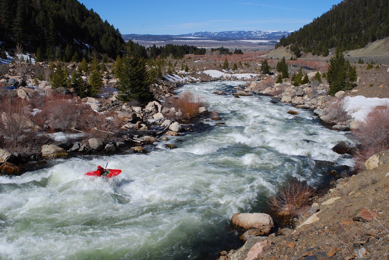
On August 17th, 1959 at 11:37 PM a major earthquake rocked the Greater Yellowstone Area. Rating a 7.5 on the Richter Scale, this quake was the largest in the documented history of Montana and took the greatest toll on human life. An entire mountainside came tumbling down on a crowded forest service campground before charging a full 400 feet up the opposite mountainside. This slide completely dammed the Madison River, eventually forming Earthquake Lake. The Army Corp of Engineers cut a new path for the river through the debris and this is now a SW Montana padling classic.
The run starts across from the Quake Lake visitors center on Montana Hwy 287. A dirt path leads down to where the lake once again becomes a river. From the moment you drift through the skeletal reamins of the forest poking up from the lake bottom, you are faced with continuous class IV boogie water requiring good read and run paddling skills. Though not overly difficult, the upper section is shallow and extremely sharp. A swim would be painful at best.
As you fly down the run, keep your eyes peeled for a big eddy on river left, just before the river bends hard to the right. You will be directly below the main part of the slide. Catch this eddy and scout the next 120 yards. This rapid, known as the S-Turn, is known for carnage and has drawn its fair share of blood. It is a definite class V at all levels but can easily be portaged on the left.
Below this drop, the river mellows quickly and you can take out wherever you like as Hwy. 287 follows this run in its' entirety. Most folks run it two or three times in a day. Enjoy!
Rapids in this Run (1)
Difficulty
Class IV-V
Length
1.5 mi
Gradient
155 ft/mi
Rapids
1
Access Points
Difficulty Classes
I Easy
II Novice
III Intermediate
IV Advanced
V Expert/Extreme
VI Unrunnable
Current Conditions
5-Day Forecast
Whitewater data from
American Whitewater
American Whitewater