2. Reregulation Dam to Hwy 70 (3 miles)
Gauge Conditions
Runnable: 300.0 – 2,000.0 CFS
Skilled, experienced boaters only!
Data from American Whitewater & USGS
Run Map
Run Time Estimate
Select put-in and take-out to estimate time.
Plan This Trip
See wind-adjusted speed maps, forecast planning, and detailed time estimates.
Sign in to generate an AI timing estimate for this run.
Whitewater timing varies with scouting, portages, and group pace. Use as a planning baseline.
Description
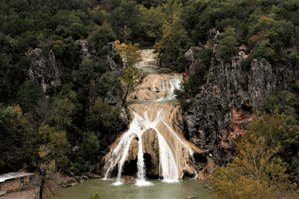
Located in extreme Southeastern Oklahoma, the Lower Mountain Fork River below the Reregulation dam is a popular summer recreation spot. At medium flows, this is an excellent river for learning and developing basic whitewater skills. Water quality in this clear, rocky stream is very good, with water temps kept at or below 70 degrees to support a healthy trout poulation.
After leaving the campground at the putin, you won't see any signs of development until you come to the old iron bridge at the takeout. On busy weekends during the day, you will most likely see plenty of rental carnage, with the Rock Garden, Chute and Presbyterian Falls areas being some really good places to "kick back and watch the show." After 4 or 5:00 though, this usually changes. All the rental boats are gone, and the "release water" often starts showing up. Beautiful scenery, solitude and much better flows is what you will often experience then.
Minimum flows in the 120 - 200 CFS range make this section of river popular with beginners and will be really bony in spots, especially through the Rock Garden. Releases that are usually scheduled late in the afternoons during the hotter months can change the character of the river quickly and dramatically. In the drier months of the year stream flows above about 120 CFS depend upon the number of hydroelectric power generators (there are two) running and the length of time they run. Generally speaking, one generator running for three hours can produce roughly 500 - 1000 CFS, slowly dropping back after the crest. This is dependent upon how much water was behind the reregulation dam prior to release. Two generators for a similar period of time can produce 2-3000 CFS.
(Generation / streamflow ratios given as a rough guide only).
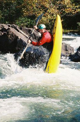
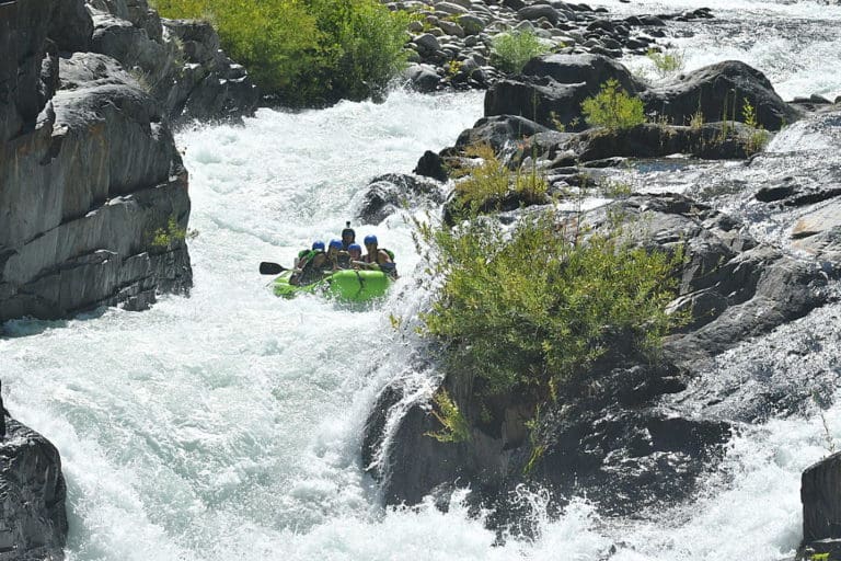
At flows of 2000+ the river exceeds the class 2+ rating and runs should not be attempted by paddlers without at least strong intermediate whitewater skills. Longer generation times will result in higher peak flows, with extended 2 generator releases easily producing flows of 4000 - 7000 CFS.
Caution!
High flow rates typical of extended two generator releases can produce nasty hydraulics, pushy water conditions and dramatically increased chances for pinned boats,(especially true for open canoes without flotation, which can easily be wrapped and broken) long swims, lost equipment, and plenty of other hazards. Routes can become difficult to find and winding up in flooded timber is possible. Class IV rating given at high levels to reflect these consequences. This is especially true in the Chute and Ledges sections just above Presbyterian Falls, the keeper hole that forms at Presbyterian Falls, and the low-lying wooded area about a half-mile upstream of the takeout that floods out at higher levels.
Normally, especially during the summer months, the river falls into the 120-300 CFS range before the releases, making it suitable for beginners in kayaks, canoes, float tubes, you name it - you will probably see it there. This is a very popular river and home to a number of liveries, and can become quite congested on weekends during the day. However, most liveries stop putting in between 3 and 5pm most days, avoiding the peak flows of the releases. Evenings usually find the river with higher flows and a much less boat traffic, making it seem like a totally different river. Intermediate to advanced boaters tend to enjoy this time the most. Two generator releases in the evenings can hold the river to levels above 1000 for several hours after the generation has stopped - sometimes until noon and beyond the next day.
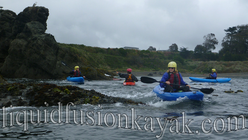
Each summer, due to the consistent flows, Swiftwater Rescue Training Classes are held here. These ACA classes instruct participants in techniques for river safety, self rescue, and rescue of other paddlers and equipment. Contact Jim Simmons for more information. (See photos below.)
Putin
From intersection of US259 & US70 in Broken Bow go East on 70 5.2 miles. There is a sign on the south side of 70 that says "Mountain Fork Park". Turn left and you will see a sign that says "Canoe Rentals". Go north on this road 3 miles to the putin which is located within the campground.
Takeout
Takeout is located at the Mountain Fork River at Hwy70 - 1.8 miles East of Mountain Fork Park Road. Cross over the iron bridge, and take then take a left on the dirt road that will parallel the north side of the road. Park directly under or near the bridge. Please don't park on the outfitter's lot on the south side of the bridge.
Camping
There are 12 improved campsites available at the putin. All 12 have concrete picnic tables, lantern posts, fire rings and water. Some of them have electricity and can accommodate most full-size RV's. Fees range from $15.00 a night for full RV sites to $8.00 a night per tent for primitive camping, which is also available here. There are no showers at the Rereg campground, but there is a vault toilet there. All campsites in this park are available only on a first come - first served basis. This campground fills up quickly on most spring, summer and fall weekends, and particularly on holidays. Also, Beaver's Bend State Park, located on the flatwater section of the river between Broken Bow Lake dam and the power plant has lots of campsites, cabins, showers, and other services available. Your camping receipt from the Rereg campground entitles you to use the showers, etc. at Beaver's Bend. There are other campgrounds available in the Broken Bow Lake area as well as primitive camping in the adjacent Ouachita National Forest.
Other Nearby Accommodations and Services
There are several outfitters in the area providing kayak and canoe rentals, and shuttles. Some have stores offering items you might need for a day on the river. There are lots of private rental cabins all around this area, too.
Broken Bow has motels, stores, gas stations, cafes & restaurants, and just about anything else you might need. If you forget or run out of something you can always make the short drive down to Broken Bow. There is also a convienience store with gas at Eagletown, a few miles east of the takeout bridge on US70 that is a little closer than Broken Bow if you need to just pick up a couple of things.
Rapids in this Run (1)
Waterfalls (1)
Hazards & Portages (1)
Caution: The following locations may require scouting or portaging. Always check current conditions.
Difficulty
Class I-II+(IV)
Length
3.2 mi
Gradient
10 ft/mi
max 45
Rapids
1
1 Hazard
Access Points
Difficulty Classes
I Easy
II Novice
III Intermediate
IV Advanced
V Expert/Extreme
VI Unrunnable
Current Conditions
5-Day Forecast
Whitewater data from
American Whitewater
American Whitewater