2. Route 311 bridge to AW Take Out
Gauge Conditions
Runnable: ? – ? CFS
Approximate reading: This gauge is 4.2 miles away on Johns Creek. Use as a general reference only.
Data from American Whitewater & USGS
Run Map
Run Time Estimate
Select put-in and take-out to estimate time.
Plan This Trip
See wind-adjusted speed maps, forecast planning, and detailed time estimates.
Sign in to generate an AI timing estimate for this run.
Whitewater timing varies with scouting, portages, and group pace. Use as a planning baseline.
Description
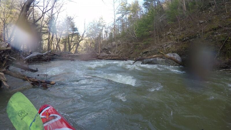
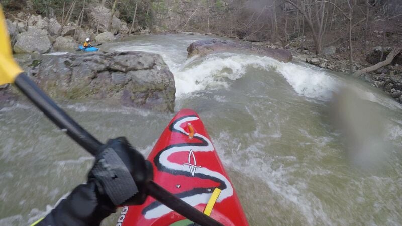
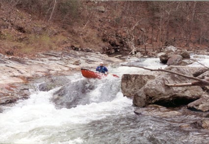
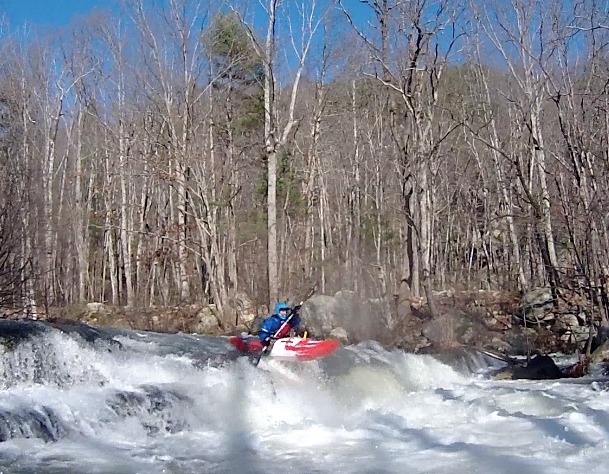
Johns Creek is one of Virginia's whitewater treasures, with a well-documented history of use. The run is solid class IV, described as comparable to the Watauga River without Hydro or Stateline Falls. You can find descriptions in several guidebooks of classic rapids like Sirius the Dog Star, Royal Flush, Coke Island, Little Heinzerling, Bambi Meets Godzilla, Blind Man's Bluff, the Separator, and Fool's Falls.
The entire run is bordered by private property and at least one riparian landowner has opposed paddling in the past, including taking legal action against paddlers. Because of this, there was very little paddling use between the late nineties and 2015 because of legal uncertainties. In the spring of 2015 the VA Marine Resources Commission issued a letter determining that Johns Creek is a navigable stream until proven otherwise. A subsequent newspaper article stated that the County Attorney would not prosecute paddlers for criminal trespass, but that does not mean that the issue is fully legally resolved.
Because of the sensitivity of Johns Creek access, paddlers should stay in their boats if reasonably safe and at all possible, and not utilize the private shores for any purpose. This effectively makes the run extremely committing and at least a grade harder, so wise and conservative paddling choices are important. For the sake of access and safety, consider delaying a trip to Johns Creek and paddling with a solid crew that knows it well. And of course be extremely respectful of all riparian landowners regardless of the situation.
American Whitewater owns the take-out for the run, and paddlers are encouraged to use it if paddling the creek. Please change clothes in the changing room in the woods, drive courteously, and be extremely respectful of the nice neighbors. Day use only please. The take-out is a grassy parking area located about a quarter mile outside of New Castle, on the right just past Givens Construction Company as you head out of town. The public put-in is on the upstream side of the bridge where 311 crosses Johns Creek several miles upstream of the take out. Don't forget to patronize the local businesses while you are in New Castle.
Check out a video of Johns Creek from the early 90's.
See Also:
_Classic Virginia Rivers,_ Ed Grove (1992 ed), p. 244.
_Virginia Whitewater_, Roger Corbett (2000 ed.), p. 301.
_Exploring Virginia's Waterways_, Ed Gertler (2022 ed.), p. 217.
_Appalachian Whitewater, Vol. II: The Central Mountains_ (1995 ed.), p. 199.
_Southeastern Whitewater_, Monte Smith (1995 ed.), p. 273.
Rapids in this Run (3)
Waterfalls (1)
Difficulty
Class III-IV(V)
Length
4.5 mi
Gradient
55 ft/mi
max 145
Rapids
3
Access Points
Difficulty Classes
I Easy
II Novice
III Intermediate
IV Advanced
V Expert/Extreme
VI Unrunnable
Current Conditions
5-Day Forecast
Whitewater data from
American Whitewater
American Whitewater