2 - Rt. 53 Bridge to Karthaus (West Branch)
Gauge Conditions
Runnable: ? – ? CFS
Approximate reading: This gauge is 6.2 miles away on Red Moshannon Creek. Use as a general reference only.
Data from American Whitewater & USGS
Run Map
Run Time Estimate
Select put-in and take-out to estimate time.
Plan This Trip
See wind-adjusted speed maps, forecast planning, and detailed time estimates.
Sign in to generate an AI timing estimate for this run.
Whitewater timing varies with scouting, portages, and group pace. Use as a planning baseline.
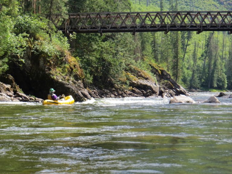
Description
Located below the race section of the Red Mo (Peale Bridge to Rt. 53 Bridge) is what is known locally as the Lower Red Mo. While most of the Class II rapids are found along the upper stretch, the scenery is hard to top on this stretch. The river begins to enter a remote canyon, lined with tall green hemlocks and pines. The entire length is polluted by Abandoned Mine Drainage (AMD), which has stained the streambed and given the waterway its "Red" nickname. Due to this drainage, the stream cannot sustain a fish population.
After about 5 miles, the Red Mo creek joins up with the big, wide West Branch of the Susquehanna River. From here, continue down about 3 miles on the West Branch on a very long, flat, straight section. The takeout is on river-right, just before the bridge in Karthaus.
Gauge
For this section to be runnable, you generally want the painted gauge on the Rt. 53 bridge abutment to show at least 0.75'.
Rapids in this Run (3)
Difficulty
Class I-II
Length
8.4 mi
Gradient
18 ft/mi
Rapids
3
Access Points
Difficulty Classes
I Easy
II Novice
III Intermediate
IV Advanced
V Expert/Extreme
VI Unrunnable
Current Conditions
5-Day Forecast
Whitewater data from
American Whitewater
American Whitewater