2 - Trout Lake to Green Truss Bridge Wild
Gauge Conditions
Runnable: 1,000.0 – 1,800.0 CFS
Data from American Whitewater & USGS
Run Map
Put-in
Take-out
Rapids/Hazards
Wild
Scenic
Run Time Estimate
Select put-in and take-out to estimate time.
Plan This Trip
See wind-adjusted speed maps, forecast planning, and detailed time estimates.
Sign in to generate an AI timing estimate for this run.
Whitewater timing varies with scouting, portages, and group pace. Use as a planning baseline.
Description
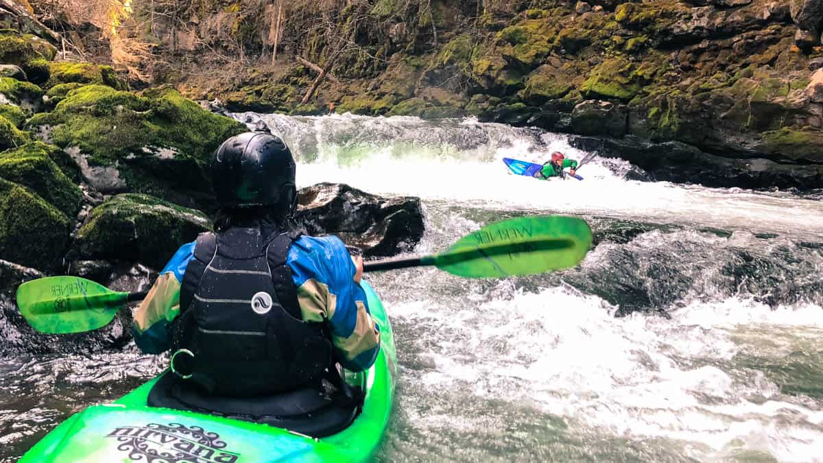
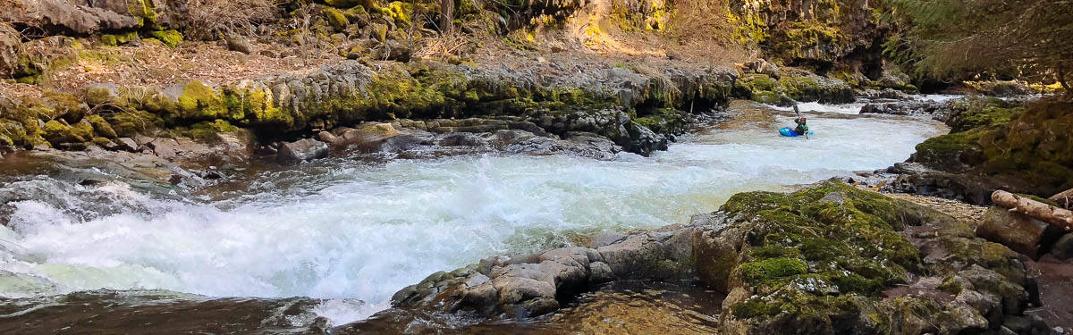
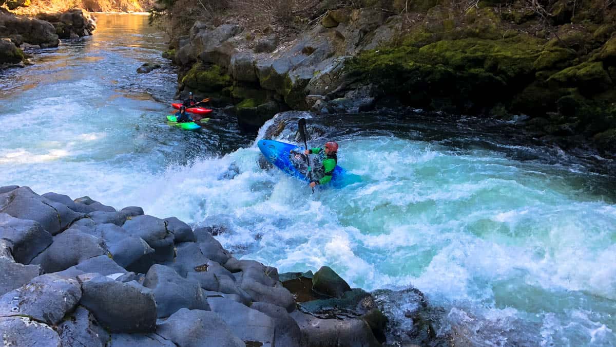
Dramatic gorge with numerous ledge drops that rate class IV-V set in the agricultural lands around Trout Lake that gives this section its name of the Farmlands run. The run is normally paddled during the snowmelt season of April to June. Lava Dam and Off Ramp are the big drops that can be portaged.
Check out the Farmlands section of the White Salmon page on Jason Rackley's site
Logistics: Follow Hwy. 14 along the Columbia River and at mile 63.6 take Alt Hwy 141 north (this turn is a couple miles to the west of the Hood River bridge across the Columbia). Continue 2.2 miles to the junction with Hwy. 141 and then follow this north towards Trout Lake.
The recommended take-out is located on private land, owned and managed by Lupine Forest LLC, where an informal kayaker trail originates at Hwy. 141 mile 17.3 across the highway from Carr Road just upstream of the Green Truss Bridge. It's 200 yards from the highway down to the river. The bank is steep but not as treacherous as the climb up the cliff band at the historic Green Truss Bridge access immediately downstream. Parking for this site is located at a DNR site a short distance down the B-700 Road which heads west from the junction of Carr Road with Hwy. 141. Please treat this site with respect and recognize that it is private propoerty. Dispersed recreation use at this site is permitted but it is a privilege and it is important that we be responsible users. The traditional access site was at the Green Truss Bridge located at Hwy. 141 mile 17.1 where the private Winegartner road turns off the highway to the river to the Green Truss Bridge. Access was up the cliff band on the downstream river right side of the bridge. It is a hazardous take-out and there have been injuries. If you do use this access please treat the site as load/unload only and do not park at the access point or block the road that provides access to the bridge.
The traditional put-in is reached by continuing up Hwy. 141 to mile 20.9 where you turn east onto Warner Road (signed for Glenwood). Follow Warner Road road 1.0 mile as it transitions to Sunnyside Road and the bridge across the river. Access may be available in the highway right-of-way but its tight and the adjoining land is all private. Parking is limited but boaters have used a couple spots on the upstream river left side of the bridge at the junction of Sunnyside Road and Stoller Road.
An alternate access is at Sidewinder, the first major rapid, at a small pullout adjacent to the river on Sunnyside Road. From Hwy. 141 mile 20.9 turn east onto Warner Road (signed for Glenwood). In 0.8 miles, before crossing the White Salmon River, turn south on Sunnyside Road and continue 0.6 mile down to the pull-out adjacent to Sidewinder Rapid. These access points are not formal public access points, likely involve private property, and paddlers are strongly encouraged to be courteous with local residents.
Rapids in this Run (4)
Difficulty
Class IV-V
Length
5.2 mi
Gradient
60 ft/mi
Rapids
4
Access Points
Difficulty Classes
I Easy
II Novice
III Intermediate
IV Advanced
V Expert/Extreme
VI Unrunnable
Current Conditions
5-Day Forecast
Whitewater data from
American Whitewater
American Whitewater