2. Tucker to Hood River Marina
Gauge Conditions
Runnable: 3.5 – 9.0 FT
This is a low, boatable flow that is actually pretty fun
Data from American Whitewater & USGS
Run Map
Run Time Estimate
Select put-in and take-out to estimate time.
Plan This Trip
See wind-adjusted speed maps, forecast planning, and detailed time estimates.
Sign in to generate an AI timing estimate for this run.
Whitewater timing varies with scouting, portages, and group pace. Use as a planning baseline.
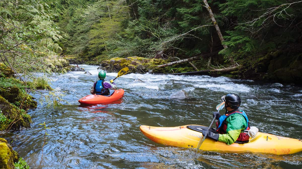
Description
A continuous class 3 run that pushes class 4 at higher flows. Fun boulder gardens at lower flows and continuous crashing holes and huge wave trains at higher flows. Powerdale Dam was removed in the summer of 2010 opening up this river for navigation and eliminating the need for a portage.
You can put in at the old dam site to skip the dam rapids which makes this stretch easier.
Logistics:
Take-out: Powerdale is the most popular take out to reduce crowding at the Museum or Marina at the confluence with the Columbia. Hood River Marina also has parking which can be reached by taking I-84 exit 64 and heading north towards the Columbia River. Before crossing the river turn into the Port Marina Park and follow the signs to the Beach which is the take-out.
Put-in: To reach the put-in head back out of the park and head south under I-84 and up towards Mt. Hood on Highway 35. In 6.8 miles turn right towards Odell. Follow the road 0.7 mile and turn right, continue another 0.4 mile and turn right again, then continue 2.3 miles down to the Tucker Bridge across the Hood River where you will find a put-in under the bridge on river right. Note that parking is very limited here. Please ask for permission if you want to park at the Country Store.
An alternative is to head a short distance upstream to Tucker Park (camping available) where you can put in on river right (a trail from the picnic area leads down to the river). Tucker Park put-in option adds two Class IV rapids to the run. When the park is closed boaters often park alongside the road, not blocking the gate, and walk boats down to the park. Recently, No Parking signs were nailed to the trees along the road where boaters usually park shuttle. When Tucker Park closes this continues to be an access issue for both boaters and anglers; we have no reports of boaters being towed or ticketed here but park at your own risk. Road scout the 1st rapid below Tucker Park and check for wood. There are two channels around an island, both runnable. Historically wood can pile up at the top or bottom of either channel. You can also put in at the far end of the park which adds a few more Class III+ rapids.
Rapids in this Run (1)
Difficulty
Class III
Length
6.1 mi
Rapids
1
Access Points
Difficulty Classes
I Easy
II Novice
III Intermediate
IV Advanced
V Expert/Extreme
VI Unrunnable
Current Conditions
5-Day Forecast
Whitewater data from
American Whitewater
American Whitewater