2.Upper, Route 1310 Bridge to Hwy. 19
Gauge Conditions
Runnable: 900.0 – 2,000.0 CFS
Data from American Whitewater & USGS
Run Map
Interactive run map
Loads as you approach this section.
Run Time Estimate
Select put-in and take-out to estimate time.
Plan This Trip
See wind-adjusted speed maps, forecast planning, and detailed time estimates.
Sign in to generate an AI timing estimate for this run.
Whitewater timing varies with scouting, portages, and group pace. Use as a planning baseline.
Description
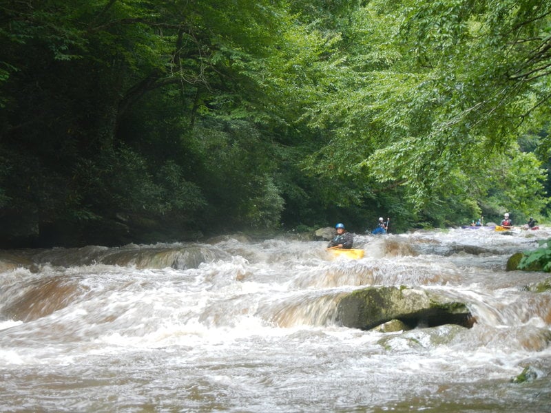
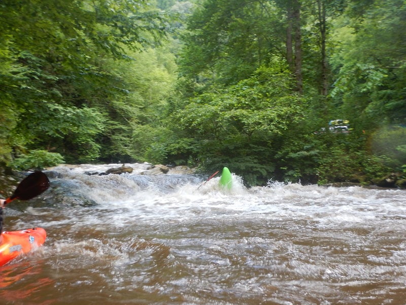
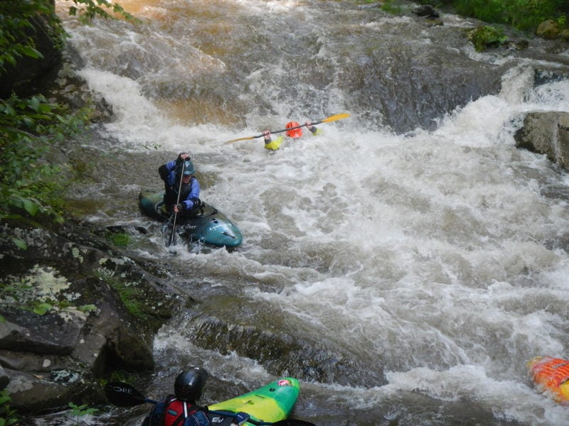
The beauty of the Nanty Gorge continues upstream and is a terrific Class III step-up run. Technical paddling is required, and there are sections of continuous whitewater. Most if not all the holes are punchable and not very sticky though, so the consequences are relatively low. Magic Carpet Ride, PB&J, Troll Hole, and some other rapids are notable.
This is a great run either at a creeky level (250 releases) or with a lot of water. (450 or rainfall)
The entire run is road scoutable. Please check for wood on your way to the put-in.
Put-in: Six bridges upstream from commercial put-in. If you start to see large Class V-looking drops and waterfalls, you've gone too far upstream and reached the Nantahala Cascades. There is a big turnout just before the bridge for shuttle and unloading boats. Access the river via the staircase downstream of the bridge, river right. Please be thoughtful when parking if it is busy. The lot can accommodate many more cars if parked side by side instead of parallel. The Forest Service has been monitoring the lot on busy days so please do your best to keep the lot clean.
There is also a new put-in (with concrete steps, ramp, etc. just below PB&J.)
Take-out: Nantahala River Launch Site just downstream of the commercial put-in.
There are periodic 'bypass' releases which provide water to run the Cascades / Upper Nantahala. The releases which occur during 'Week of Rivers' (near July 4th) and during the Nantahala Outdoor Center's Guest Appreciation Festival (GAF) will be quite busy. The remainder of the releases much less so. On all the releases the Forest service closes several parking areas which are popular put-in locations and turns them into unloading areas.
The Duke bypass flow releases can be found here.
Rapids in this Run (5)
Hazards & Portages (2)
Caution: The following locations may require scouting or portaging. Always check current conditions.
Difficulty
Class III+(IV)
Length
3.3 mi
Gradient
100 ft/mi
Rapids
5
2 Hazards
Access Points
Shuttle Info
Driving West towards Tennesee on US 19/74, turn left on Wayah Road/SR 1310. On your left, you will have the public put-in for the Nantahala. There are flush toilets, running water, and changing rooms that are available in the warmer months. You will cross your first bridge by the commercial rafting put-in. Continue on 3.1 miles, counting bridges from the commercial put-in until you have reached the gravel parking lot by the fourth bridge.
To run the one mile section, bridge to bridge, park your second vehicle before or after the third bridge. I suggesting running the next rapid after Troll Hole and the taking out at the little beach. It's easier than climbing up rocks under the 3rd bridge.
To run to the public put-in for the Nantahala, leave a vehicle in the parking lot and drive you other vehicle to the gravel lot.
Difficulty Classes
I Easy
II Novice
III Intermediate
IV Advanced
V Expert/Extreme
VI Unrunnable
Current Conditions
5-Day Forecast
Whitewater data from
American Whitewater
American Whitewater