2. US 220 to Forksville
Gauge Conditions
Runnable: 3.5 – 8.0 FT
Data from American Whitewater & USGS
Run Map
Run Time Estimate
Select put-in and take-out to estimate time.
Plan This Trip
See wind-adjusted speed maps, forecast planning, and detailed time estimates.
Sign in to generate an AI timing estimate for this run.
Whitewater timing varies with scouting, portages, and group pace. Use as a planning baseline.
Description
Kevin Colburn posted an Access Alert on 2004-03-15:
PLEASE park on the upstream side of the Route 220 bridge! A landowner on the downstream side of the bridge has politely requested that paddlers use the other side because too many people have begun parking on the downstream side. Let's maintain this good relationship with the landowner and park on the upstream side!
Robert Mac Dowell shared:
One other thing that needs mentioning is the top notch play holes as you enter the park area, just below the bridge to the cabins. These are first-class play holes, so save some energy for the last 1/2 mile.
jeff mitchell shared:
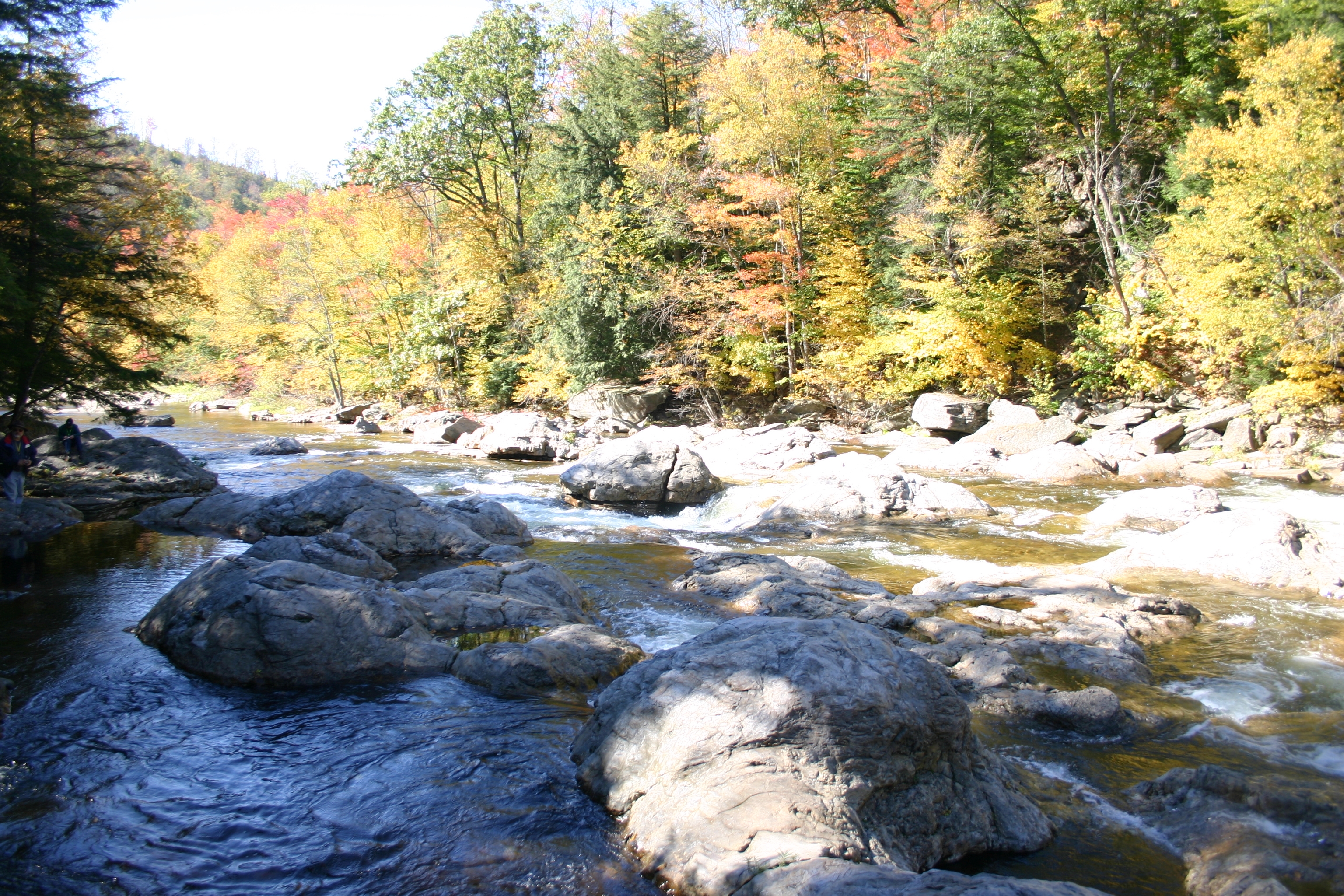
To be honest, I've never paddled the Loyalsock, but I'm very familiar with the creek. The premier whitewater section is between the U.S. 220 bridge and Forksville; there is a damn at Worlds End State Park you may be required to portage. The most famous rapids are the Haystacks, IV+ (possible V in high water) which are large Burgoon boulders around which the creek swirls and drops a couple of feet--it is a very technical rapid. It is located about 2-3 miles downstream from the 220 bridge. It's a popular swimming area in the summer.
There is also some trout fishing as you near Worlds End. There is another Class-IV rapid a few miles downstream. Most rapids are II-III+, there aren't many large pools, the creek is almost always dropping. Average gradient is 40-45 fpm, max is 60 fpm. Because there are no hydro dams on the Loyalsock, you must wait for the creek (actually the size of a small river) to rise naturally. The best times are during the spring snowmelt or isolated periods in the fall. The gauge on this website is near the mouth of the Loyalsock and is not accurate for the portion of the creek b/w 220 and Forksville. The Loyalsock is a very beautiful stream. It flows through an undeveloped, isolated gorge where there are many waterfalls, vistas, cliffs and rock formations. It has carved an 'S' shaped gorge at Worlds End about 800 feet deep. It is a place well worth your visit. I believe there are kayak competitions in or around Worlds End in early spring.
jeff mitchell also posted:
More info...
the 'Sock b/w US 220 and Forksville is generally runnable when the gauge at Loyalsockville reads 4.5 feet. Access to the creek is not as critical an issue as w/ some streams. If you want to run the Haystacks (ouch!) you'll have to put in at the US 220 bridge in Ringdale. There is private property around the bridge, but a put-in shouldn't be too difficult. If it happens to be difficult, drive .8 miles south of the bridge along 220, turn right onto Meade Rd. and park at the Loyalsock Trail parking area--this is now public land. You'll have to carry to the stream down a steep, rocky, but manageable bank to the creek. If you have no desire to run the Haystacks, https://youtu.be/m9BaXXJIv\_Q?si=gcK1fwOE9U9eRUSB, there is a 2nd access. Where 220 passes Laporte, follow 154 a few miles to Rock Run Rd., which will be on your right; this rd crosses the creek and offers a 2nd access. Worlds End is the usual take-out.
Rapids in this Run (1)
Difficulty
Class I-IV
Length
12.1 mi
Gradient
45 ft/mi
max 60
Rapids
1
Access Points
Difficulty Classes
I Easy
II Novice
III Intermediate
IV Advanced
V Expert/Extreme
VI Unrunnable
Current Conditions
5-Day Forecast
Whitewater data from
American Whitewater
American Whitewater