2. Woodruff Bridge to River Bridge (Takelma Gorge)
Gauge Conditions
Runnable: 300.0 – 1,500.0 CFS
Data from American Whitewater & USGS
Run Map
Description
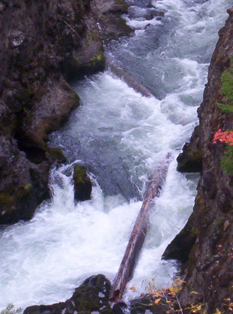
This is a short run that presents a fun challenge for experienced paddlers through the Takelma Gorge which is a solid class IV+ sequence of rapids in a dramatic bedrock gorge.
The beginning of the run starts out as flatwater before you come to the start of the gorge at Entrance. You can get out here for a more complete scout of the gorge on river left. This is important, and easy to do by utilizing the hiking trail on river left, because logs can become lodged between the bedrock walls and large boulders in a manner that requires a portage and a portage at river level is not possible in some places. The rapids in the gorge are numbered 1 through 5. Low water can create severe sieve hazards and at high water large holes develop.
Logistics:
To reach the take-out head north on Oregon State Highway 62 past Prospect. At Highway 62 mile 49.1 turn left on USFS 6210 toward River Bridge Campground. Head 0.9 mile to the river and take out at the bridge.
To reach the put-in, go back out to Highway 62 and head north. At Highway 62 mile 51.3 turn left on USFS 68 toward Woodruff Bridge. Go 1.8 miles, cross the bridge and park.
Rapids in this Run (1)
Difficulty
Class IV+
Length
4.0 mi
Gradient
38 ft/mi
Rapids
1
Access Points
Difficulty Classes
I Easy
II Novice
III Intermediate
IV Advanced
V Expert/Extreme
VI Unrunnable
Current Conditions
5-Day Forecast
Whitewater data from
American Whitewater
American Whitewater