2515 Bridge to Highway 101 at mouth
Gauge Conditions
Runnable: 400.0 – 100,000.0 CFS
Data from American Whitewater & USGS
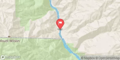
Run Map
Run Time Estimate
Select put-in and take-out to estimate time.
Plan This Trip
See wind-adjusted speed maps, forecast planning, and detailed time estimates.
Sign in to generate an AI timing estimate for this run.
Whitewater timing varies with scouting, portages, and group pace. Use as a planning baseline.
Description
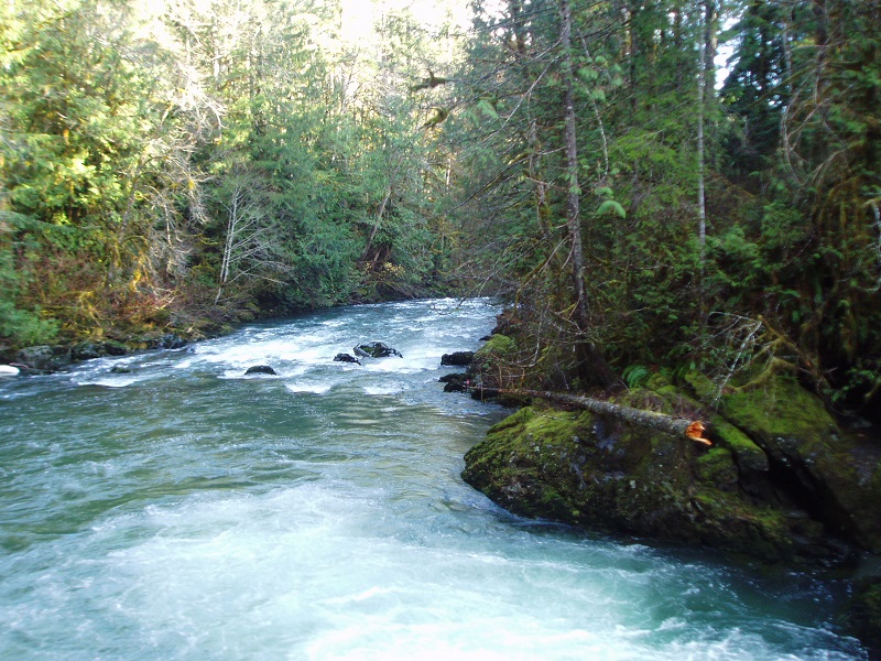
The Duckabush has some great class IV rapids, but the hike at the start of the run and the paddle out through braided channels make it a bit less appealing than other runs nearby. Despite this, it's a beautiful river and well worth checking out if you're looking for a new adventure. The season is generally begins in October when the river flows on good rain events and continues through the spring on snow melt which can extend into early July on a good snow pack year.
Approximately two miles of good intermediate rapids characterize the start of the run from the bridge. The downside however, is once you reach the gorge you need to portage up and around it for nearly a mile (Korb notes there may be some good rapids downstream of the first portage where a boulder closes off the river, but the difficulty is getting back to the river). The portage trail joins up with the Ranger Hole trail which heads down to the river.
If you want to avoid the portage and still hit the best rapids, then you can hike in from the road on the Ranger Hole Trail. This also requires about a mile hike in. Once you reach the river, scout out the rapids and work your way upstream a couple hundred yards to launch. This is the best section of rapids on the run and it's an incredibly beautiful spot.
Below this point you have about a mile of fairly continuous class IV boulder gardens separated by sections of class III rapids through scenic bedrock canyons. These are great drops that you can boat scout. Unfortunately however the run begins to taper down quickly after about a mile to class III, II, and then becomes a float out through braided channels for the last couple miles. If you put in at Ranger Hole, this lower section will be about 2/3 of the run. The river remains beautiful through this lower section until you near the end and come up to lots of homes and reinforcing walls used to stablize the banks. Beware that log jams can be a hazard in this section.
ACCESS: The take-out is at the Duckabush River bridge at Highway 101 mile 310.2. From the take-out, head north 0.2 miles to FR 2510 (Duckabush Road) which runs along river left. The standard put-in which avoids the portage around the start of the gorge is the Ranger Hole Trail (trail 824), which is 3.7 miles up Duckabush Road at the Forest Service cabin (the cabin is available for rent). It's a mile hike down to the river. An alternate upper put-in is available 6.2 miles up the road at the FR 2510 Bridge across the Duckabush. Putting in here will yield several miles of class II-III and a portage and the start of the gorge. This section can also be run independently as its own class II-III run (takeout shortly after the USGS gauge when the road is near). During the winter, snow will likely limit access to the upper put-in, but the road is plowed up to the Ranger Hole Trail. Check the current conditions report for road condition at the USFS Olympic National Forest web site.
for additional information see:
- Korb, G. 1997. A paddlers guide to the Olympic Peninsula. third edition.
- local expert: Gary Korb & Carol Volk, 4930 Geiger Road, Port Orchard, WA 98366, 206-876-6780
- Hood Canal Ranger District, South - USFS Olympic National Forest web site
Rapids in this Run (2)
Difficulty
Class IV
Length
6.6 mi
Gradient
55 ft/mi
max 90
Rapids
2
Access Points
Difficulty Classes
I Easy
II Novice
III Intermediate
IV Advanced
V Expert/Extreme
VI Unrunnable
Current Conditions
5-Day Forecast
Whitewater data from
American Whitewater
American Whitewater