3.8 Old mine trail to NF Kings confluence
Gauge Conditions
Runnable: ? – ? CFS
Approximate reading: This gauge is 16.7 miles away on Dinkey Creek. Use as a general reference only.
Data from American Whitewater & USGS
Run Map
Run Time Estimate
Select put-in and take-out to estimate time.
Plan This Trip
See wind-adjusted speed maps, forecast planning, and detailed time estimates.
Sign in to generate an AI timing estimate for this run.
Whitewater timing varies with scouting, portages, and group pace. Use as a planning baseline.
Description
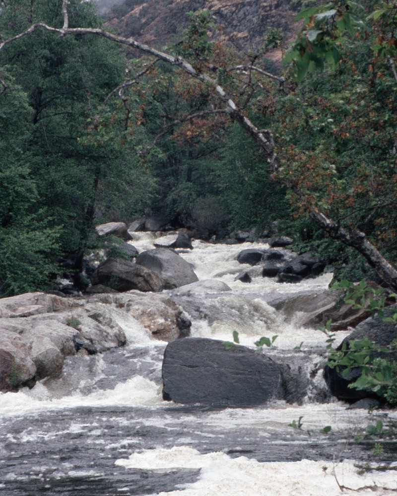
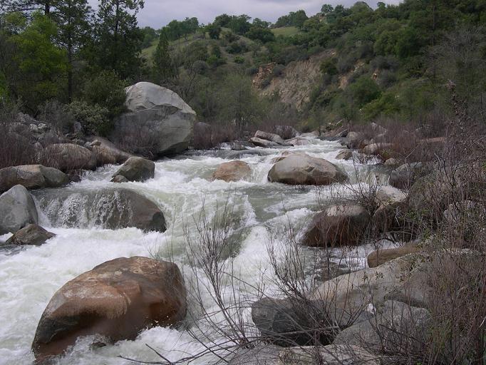
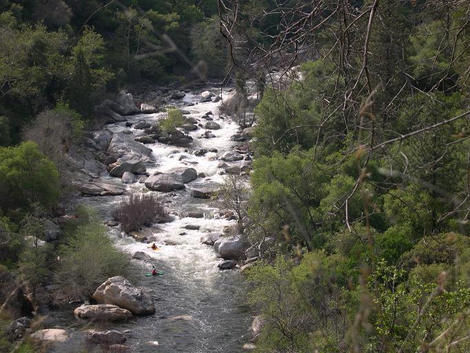
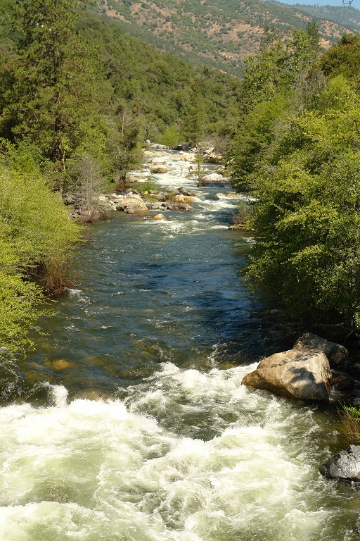
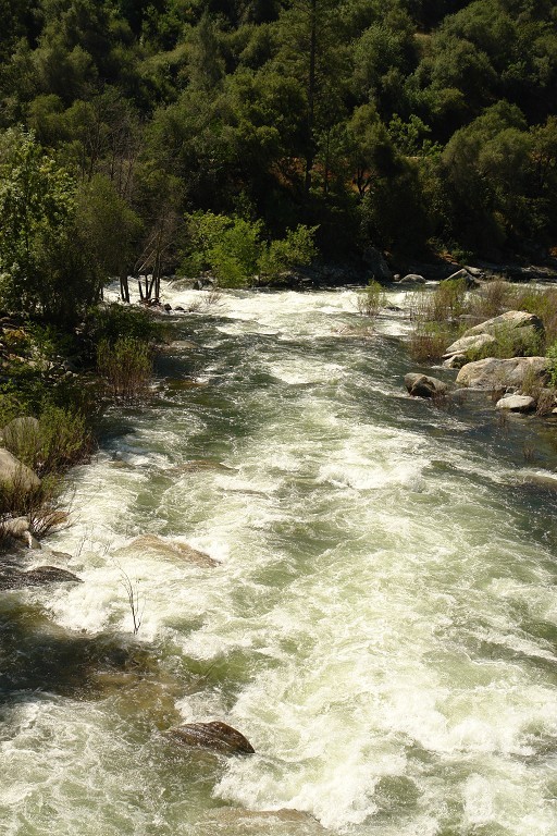
The Balch Camp section is an excellent short introduction to Dinkey Creek which is accessible year round. Boaters paddling the Dinkey Creek Waterfalls section will know the Balch Camp section as the last 1 3/4 miles of the Waterfalls reach. They may wonder why they should bother with a short section of such a famous run. This section has its own listing for several important reasons. First off, this was the first section of Dinkey Creek to be run (by Paul Martzen and Ollie Brown in 1985). For a year or two it was the only section of Dinkey to be run. Secondly, it has easy year round access, so it can be run as soon as flows come up in the winter, when other sections are inaccessible. Three, this section has a fairly wide flow range and can be run at much higher levels than the Waterfalls section. High flows in this reach and in the NF Kings immediately downstream provide a very different experience than the flows typically boated when doing the Waterfalls section.
With such easy access, boaters can take advantage of good flows during the winter. Boaters paddling Dinkey, frequently continue on down the North Fork Kings as they are similar in difficulty. Since Balch Camp is only a few minutes away from the class 3 Banzai! section of the Main Kings, expert boaters can paddle Dinkey and the NF Kings while their intermediate friends paddle Banzai!.
Season: Dinkey will typically run from midwinter, during big storms and after sufficient storms, till early June.
Character: Dinkey Creek is pool drop, but with long, technical rapids between short pools. There are a number of bedrock ledge drops but many rapids consist of finding routes through fields of medium to large boulders. The difficulty of this stretch is similar to that of the North Fork Kings, immediately downstream, though Dinkey is steeper and more technical.
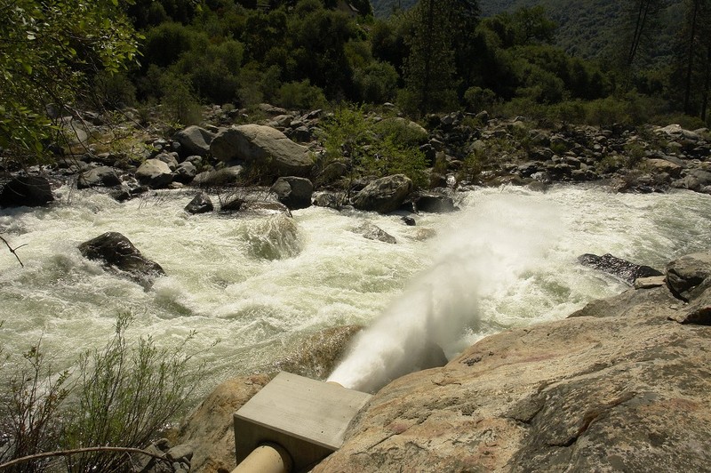
Getting There: From Fresno take freeway 180 east, to its end, jog to Belmont Avenue and continue east. Belmont will curve and become Trimmer Springs Rd. Stay on Trimmer springs road all the way around Pine Flat Reservoir. As you go around the reservoir you will pass several marinas, and cross bridges over large two inlets formed by Sycamore Creek and then Big Creek. Eventually you will reach the Kings River and you will go past the Kings River Powerhouse with its large pipe carrying most of the water from the N. Fork Kings. Continue past Kirch Flat Campground, cross a concrete bridge to the south side of the river, then cross the noisy steel Bailey Bridge back to the north side of the river. Stay on the paved road going left at this bridge. In 100 yards you will reach the canyon of the N. Fork Kings. You can leave a car at the NF and main confluence if like most you are combining Dinkey and the NF Kings. Continue 3 miles along the paved road and you will reach Balch Camp, a PG&E residential area for workers who run the nearby powerhouses and dams. There is no store here, or other public facilities. google map.
Put-in: From Balch Camp, stay on the same road, now Black Rock Rd. as it crosses the NF Kings river, but don't cross the steel bridge over Dinkey Creek. Follow Black Rock Rd. for about one mile as it goes up the Dinkey drainage. About half way up the road a big pipe crosses overhead. This pipe carries water from the NF Kings, across Dinkey, through the mountain and to the Kings River powerhouse that you passed near Kirch Flat. There is a good view of Dinkey Creek where this pipe crosses the road. At about 1 or 1.5 miles from Balch Camp, the road turns away from Dinkey and heads back to the NF Kings drainage. Park at a fairly large turnout at the turn and you will find a trail following an old road cut further upstream. google map.
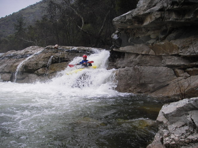
Hike this short level trail around to a clearing and junction where you will find a collection of old junk and machinery laying around. At this junction, one trail stays high and leads up to the end of the Waterfalls section. Another trail leads downwards more directly to the creek, though still heading upstream. Follow this downhill trail till just above the creek where you will find more old mining remains. From here the easiest access to the creek is to hike downstream a short distance and the trail will meet the creek next to a large sand pile. google map. Many people continue upstream a little farther to a big pool that marks the end of the waterfalls section. It is not far but it is awkward finding the best way through brush and down a steep bank to the creek. There is a very big rapid (Funky Chicken) leading into this pool. Between the pool and the sand pile put-in are some busy rapids and a small waterfall.

Alternate / short put-in: In Balch Camp, turn left over the Dinkey Creek bridge. Go straight towards a house then turn right on the first dirt road. Go through a gate (close it behind you) and park at the penstock crossing. This put-in provides a shorter introduction to this section of Dinkey.
Paul Martzen

Rapids in this Run (5)
Waterfalls (1)
Hazards & Portages (1)
Caution: The following locations may require scouting or portaging. Always check current conditions.
Difficulty
Class V
Length
1.5 mi
Gradient
130 ft/mi
Rapids
5
1 Hazard
Access Points
Shuttle Info

Difficulty Classes
I Easy
II Novice
III Intermediate
IV Advanced
V Expert/Extreme
VI Unrunnable
Current Conditions
5-Day Forecast
Whitewater data from
American Whitewater
American Whitewater