3. Averill (at McFarland Creek) access to Pateros
Gauge Conditions
Runnable: 1,000.0 – 10,000.0 CFS
Data from American Whitewater & USGS
Run Map
Run Time Estimate
Select put-in and take-out to estimate time.
Plan This Trip
See wind-adjusted speed maps, forecast planning, and detailed time estimates.
Sign in to generate an AI timing estimate for this run.
Whitewater timing varies with scouting, portages, and group pace. Use as a planning baseline.
Description
The Methow is a bigwater snow melt run with its headwaters in the peaks of the North Cascades. The river features plenty of waves and holes particularly at Black Canyon Rapids, the highlight of the run. The run can easily be broken up into two separate runs as the first half is a class II+ run from McFarland down to the Burma Road Bridge. The second half features several great class III rapids from the Burma Road Bridge down to Pateros.
_McFarland Creek Access to Burma Road Bridge, Class II+, 8.2 miles_
This section begins with several big bouncy class II rapids dispersed over the first couple miles. If you want to shorten the warm up, there are alternate access points just upstream of the town of Methow where Highway 153 crosses the river (put-in under the bridge on downstream river left). Another access point is Lightning Pine Camgpround, a private campground on river left across the river from the town of Methow where boaters sometimes camp and utilize the private launch.
Continuing past the town of Methow, which is not readily visible from the river, the Methow comes back along the highway and you will pass a great playspot for the kayakers on river right. Locals or those passing through on a road trip sometimes enjoy this as a fun park-and-play spot. Engle's Slide is a named rapid less than half a mile downstream of the play spot that is an easier class III rapid.
More fun class II rapids continue down to the Burma Road Bridge across the Methow a couple miles downstream which marks the midway point of the run and a potential access point.
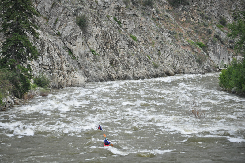
_Burma Road Bridge to Pateros, Class III(+), 8.2 miles_
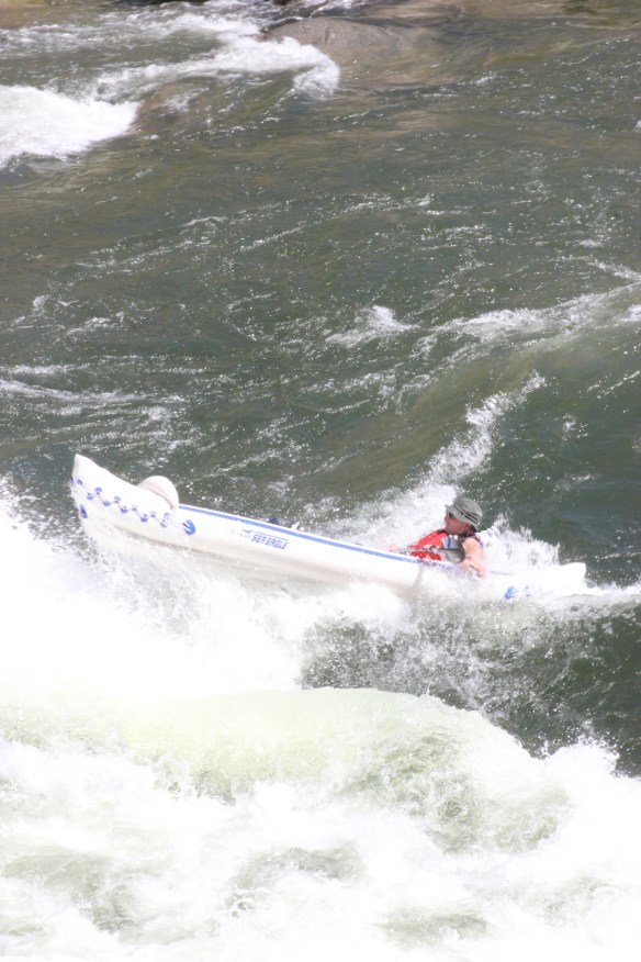
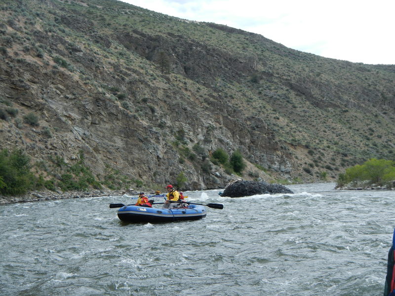
This is the classic Black Canyon section of the Methow featuring some wonderful class III action.
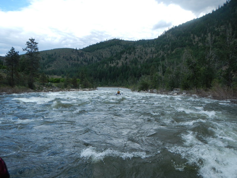
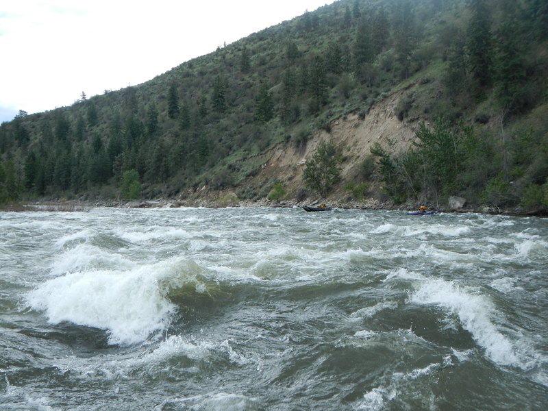
The first major rapid on this section is the class III+ Black Canyon Rapids just after you pass the confluence with Black Canyon Creek and the river takes a slight bend to the left where a high canyon wall rises up from river left. Avoid the Black Hole on river left near the start of the rapid and the next hole downstream on river right by starting center-right and then moving into the wave train down the left once you pass the Black Hole.
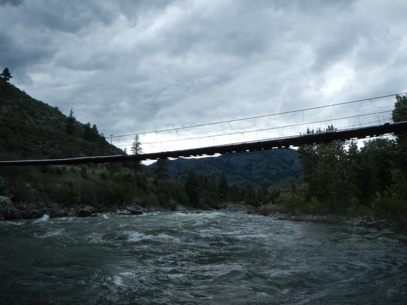
Staircase and Corner Rapids are fun class III rapids that come within the next mile and are relatively easy to read and run. Stay alert as you approach a footbridge as a big hole forms behind a boulder to the right of center just upstream of the bridge.
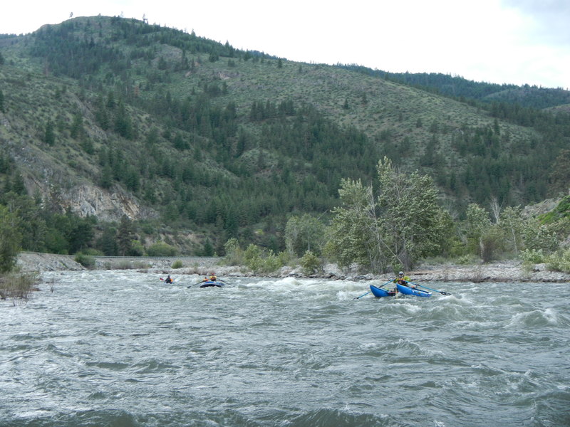
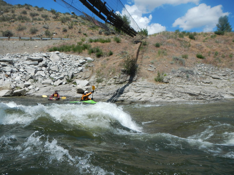
The next class III rapids are Roadside Attraction, appropriately named as you parallel the highway. Next is Bridge Rapid which comes after you pass under the next Highway 153 bridge. Both are relatively straightforward to run down the main flow.
Finally comes Meteorite, a large boulder that can form a hole at the highest flows. You will soon be at the take-out as the gradient tapers off upon nearing the Columbia River confluence.
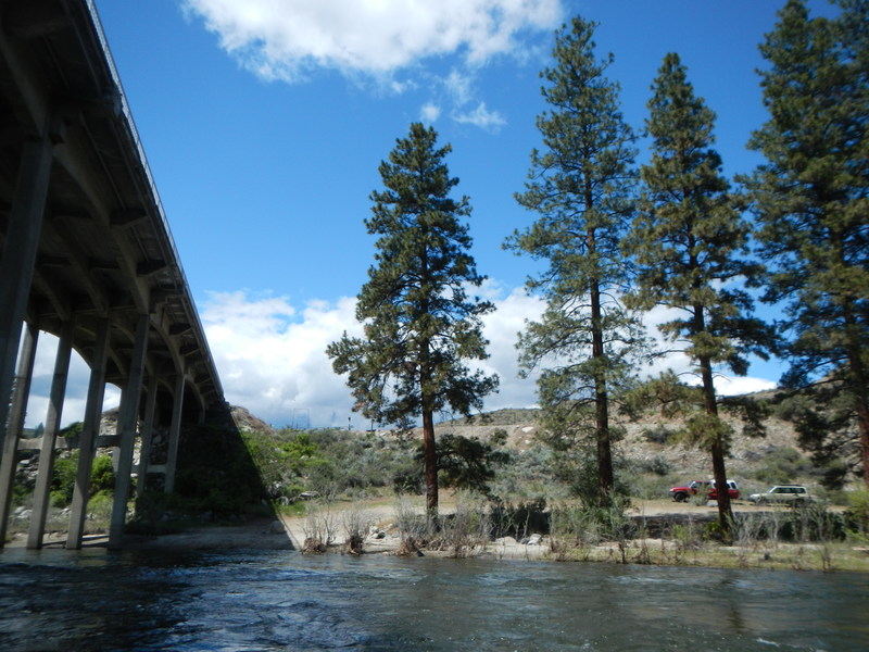
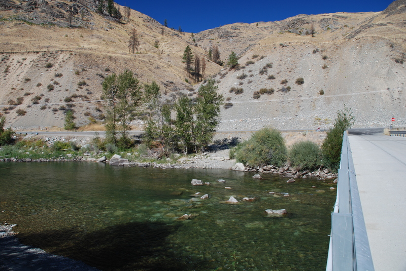
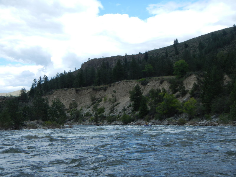
Logistics: The put-in at McFarland Creek is a convenient WDFW river access site with camp spots on the upstream river left side of the Highway 153 Bridge at mile marker 14.1 (requires a parking permit). Intermediate river access is on the downstream river right side of the bridge at Burma Road located at mile 8.4 on Highway 153; there is little to no parking here along the highway but more across the bridge. There is an easier access point about 1/2 mile downstream of the Burma Road Bridge at a formal river access site with a large parking area, bathroom, and two short trails to the river (unless you need to back a raft trailer to the water's edge or want to avoid the need for a parking pass, this is a much better access point than the Burma Road Bridge). You can scout Black Canyon Rapid on the shuttle from Highway 153 mile 6.8. A take-out is available at Highway 153 mile 1.1 (be sure to navigate to the far river right channel at the island in order to be able to paddle to shore here) or if you want restroom facilities and easy access, you can continue down to the Douglas County PUD river access site on river right at mile 0.7 on Highway 153 (does not require a parking permit).
Rapids in this Run (13)
 Rapid
Rapid
Burma Road, Upper Access
Rapid
Zahn's Access [private]
 Rapid
III
Rapid
III
Eagle's Slide
 Rapid
Rapid
Burma Road, Lower Access
Rapid
Rice Access
 Rapid
III+
Rapid
III+
Black Canyon Rapids
 Rapid
III
Rapid
III
Staircase
 Rapid
III
Rapid
III
Corner Rapids
 Rapid
II
Rapid
II
Large Hole at High Water
 Rapid
III
Rapid
III
Roadside Attraction
 Rapid
III
Rapid
III
Bridge Rapids
Rapid
Bridge 1 Access
 Rapid
II
Rapid
II
Meteorite
Playspots (1)
Difficulty
Class III
Length
17.0 mi
Gradient
24 ft/mi
Rapids
13
Access Points
Difficulty Classes
I Easy
II Novice
III Intermediate
IV Advanced
V Expert/Extreme
VI Unrunnable
Current Conditions
5-Day Forecast
Whitewater data from
American Whitewater
American Whitewater