3) Dragover
Gauge Conditions
Runnable: 3.0 – 5.0 FT
A bit high. Boatable, but things start to wash out.
Data from American Whitewater & USGS
Run Map
Run Time Estimate
Select put-in and take-out to estimate time.
Plan This Trip
See wind-adjusted speed maps, forecast planning, and detailed time estimates.
Sign in to generate an AI timing estimate for this run.
Whitewater timing varies with scouting, portages, and group pace. Use as a planning baseline.
Description
Directions to Putin:
From Pencil Bluff, AR. take Arkansas Hwy 88 east for 7 miles; turn south on county road 97 for one mile. Follow signs to campground (and take-out). County road 97 is gravel and can get really dusty when it's dry. Please obey the signs and keep your speed to a minimum through here out of consideration for the locals who live along this road.
The Dragover Campground has an access on the West Side (upstream)and one on the East Side (downstream) which the River makes a 3-mile horseshoe bend around and requires no shuttle (hence the name).
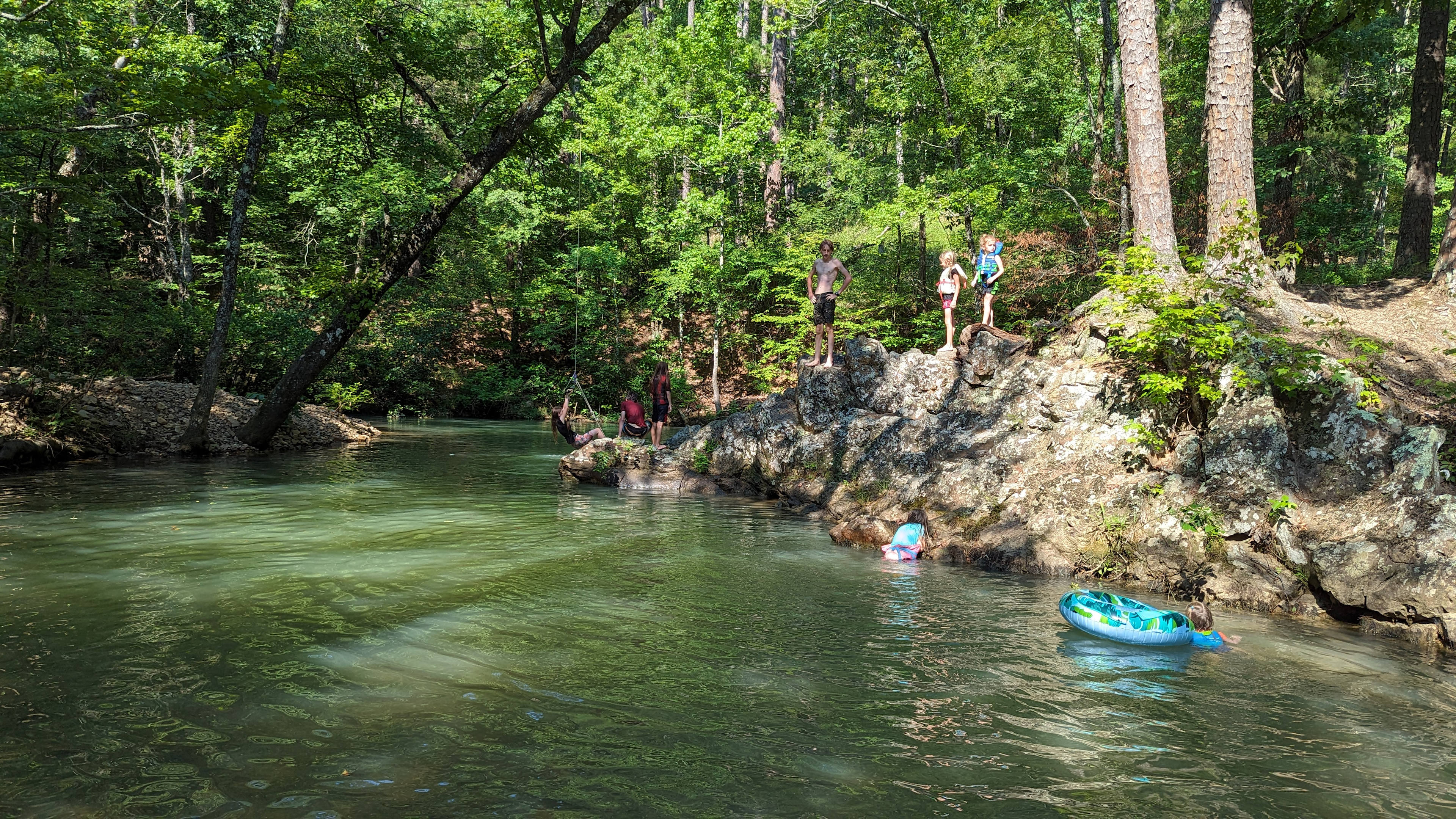
Campground has seven sites (each accomodating about 6 campers)with picnic tables, lantern posts, and fire rings. No water or electricity is provided. Campground has a handicapped accessible vault toilet. This campground is currently maintained by the Montgomery County Parks Department after being abandoned by the USFS; and no day use or camping fees are being charged at the present time. (If you see an employee of the Montgomery Parks Dept - be sure to let them know how much we appreciate their efforts in keeping this place going.) River access is provided by stairs down the bluff, (rather steep) with rollers in the middle to aid launching boats. (See photos below)
Nearby, Mount Ida has stores, gas stations, motels and cafes. The area is also well known for it's quartz crystal mines and rock shops. Some of the world's finest quartz crystal clusters and points come from around here.
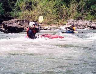
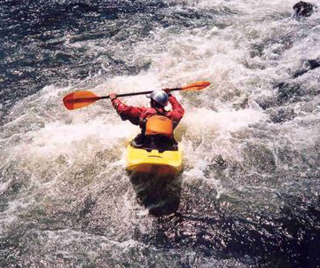
This section of the upper Ouachita is a favorite for most local paddlers, as there are more rapids and playspots in this section than on other parts of the river.The river is suitable for paddlers of any skill level and for any type of boat from small play-boat type kayaks to canoes and even rafts, at the proper flow levels. There are numerous small rapids in this stretch, with the three most notable ones listed below in the "rapids" section.
This is a very scenic river, lined with high bluffs and beautiful foliage especially in spring. It is a very popular recreation spot in spring and fall, with summer levels usually too low for enjoyable float trips.
Each spring, ACA sanctioned canoe and kayak clinics are held here by the Bayou Chapter of the Ozark Society. These clinics teach river safety and skills relating to paddling techniques appropriate to the different types of canoes and kayaks. Visit thier website for more information. Click on the links provided below the Bayou Chapter section.
You can continue downstream from the East Side to Hwy 27 on Lake Ouachita. This section is 11.5 miles @ 5 ft/mile for first few miles all in the National Forest. Depending on the level of Lake Ouachita, 1/3 - 2/3 of the trip could be on the Lake.
Can also combine with upstream sections for longer trips.
Special thanks to the members of the Arkansas Canoe Club who contributed river information and photos.
Hazards & Portages (1)
Caution: The following locations may require scouting or portaging. Always check current conditions.
Difficulty
Class I-II
Length
2.9 mi
Gradient
7 ft/mi
Rapids
0
1 Hazard
Access Points
Shuttle Info
The shuttle for this is just carrying back across the campground, so ignore the directions below.
You can use the text entry box to input your home or other starting location to get drive time, distance, and directions to this location.
Difficulty Classes
I Easy
II Novice
III Intermediate
IV Advanced
V Expert/Extreme
VI Unrunnable
Current Conditions
5-Day Forecast
Whitewater data from
American Whitewater
American Whitewater