3. Ellicott Bridge to Oxbow Reservoir (Ralston PH)
Gauge Conditions
Runnable: ? – ? CFS
Approximate reading: This gauge is 8.0 miles away on Rubicon. Use as a general reference only.
Data from American Whitewater & USGS
CDEC Flow Data California
Data from California Data Exchange Center (CDEC)
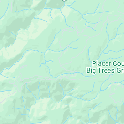
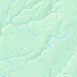
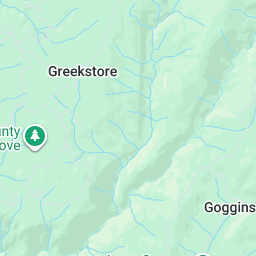
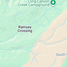
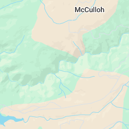
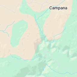
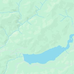
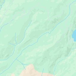
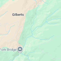
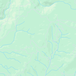
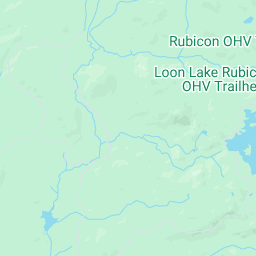
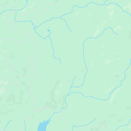
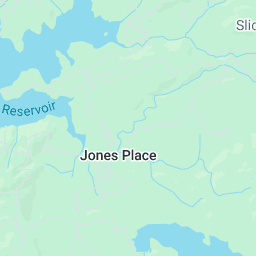
Run Map
Run Time Estimate
Select put-in and take-out to estimate time.
Plan This Trip
See wind-adjusted speed maps, forecast planning, and detailed time estimates.
Sign in to generate an AI timing estimate for this run.
Whitewater timing varies with scouting, portages, and group pace. Use as a planning baseline.
Description
Summary:
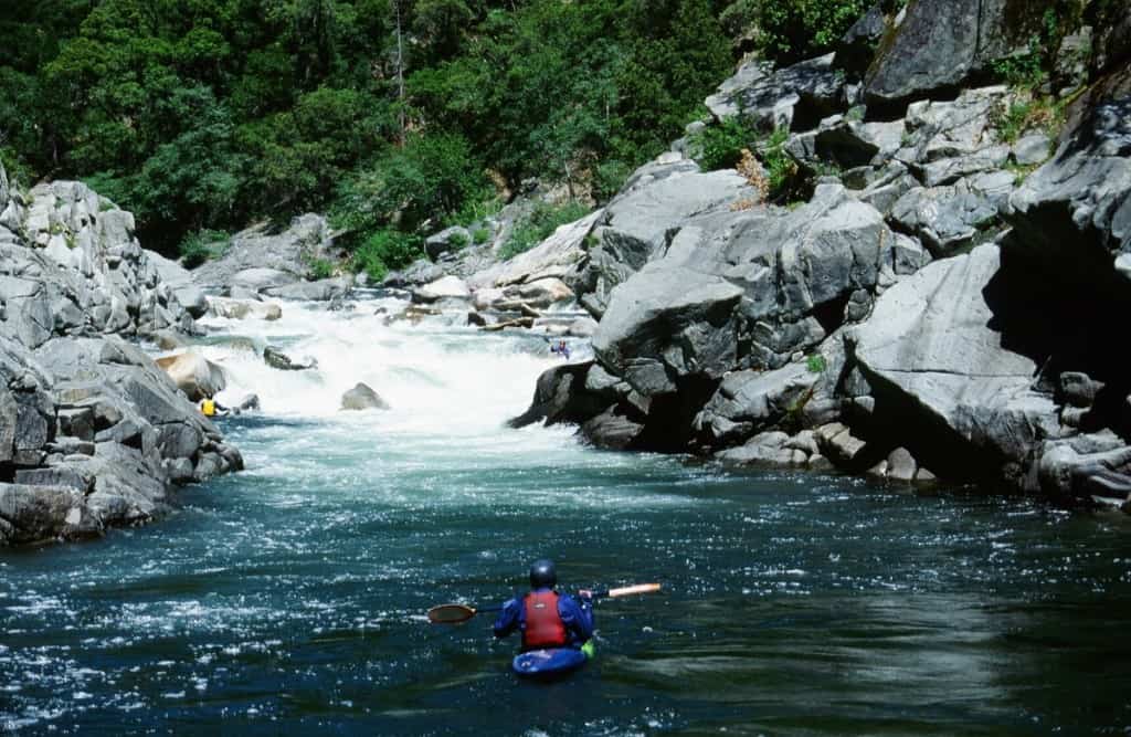
The Rubicon is a World Class Overnight Wilderness Run. It only runs in high water years when Hell Hole dam spills water (AW currently in negotiations w/ PCWA Relicensing). This doesn’t happen often so when it does, prioritize it -- it’s worth it. There is a bit of warm up but then the action doesn’t stop until the take-out, 20 miles of wilderness later.
Character:
Miles upon miles of countless IV+/V multi-move boulder gardens, interspersed with some quality bedrock. Most all of the rapids are long and continuous but most can be boat scouted and do have decent recovery pools.
If you would be comfortable leading yourself down 49-bridgeport on the S Yuba at or Middle Fork Feather for the very first time (No one showing you the lines) at similar difficulty flows, you should like the Rubicon. It is a notch easier than SF Merced.
Average gradient of 108 FPM, Max of 150 -- Surprisingly and pleasantly consistent.
A solid crew of class V boaters should budget ~6-8 hours of moving time on the water.
Flows: (see guage description for great detail)
The Rubicon seldom has boatable flows because there are several different reservoirs belonging to different projects that each take water out of the Rubicon basin and send it to the SF or MF American rivers.
As estimated at takeout:
600-1000: V-. Optimum flows for V- boaters = 800
1000-1500: V. Optimum flows for V boaters =1100
1500+: V+
Note 1: Two significant tributaries (Pilot Creek and Longs Creek) join the Rubicon ~4-5 miles upstream of the takeout and can significantly add to flow in the early season.
Note 2: There is a stick gauge up stream of the Elcotts bridge (Put-in). Find the obvious eddy from the dirt road on river right. 3.25 = ~350 cfs. 4.7 = ~950 cfs. Accretion will add to this flow (see note 1)
Hazards:
5 common portages. (all distances VERY rough estimates)
1.First island drop ~mi3 (class V sneak possible on the right)
2.Ledge hole and undercut right wall w/ class V lead in ~mi6
3.Slide hole 300m below
4.Ledge hole w/ Class V lead in ~mi8 (sneak possible on the right >900 cfs).
5.Class V Boulder jumble ~mi8.5
6.Slide hole ~mi14.
2 other holes of note: These are runable but claim their fair share of unsuspecting victims as they aren’t obvious
1.~mi 2.5. ~1/4 mile below a rapid that was likely your first scout. River narrows and bends to the left. Scout from small eddy on the left.
2.~1/4 mile above the take out. You’ll see the diversion tube coming down the hill. River bends to the left and there will be a flatish bedrock shoulder on the right.
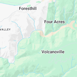
Takeout: From highway 80 in Auburn, take Auburn Ravine road to Foresthill road. After 17 miles turn onto Mosquito Ridge road and go another 12 miles to Oxbow reservoir. Driving time could be nearly an hour.
Put-in: 26.5 total miles from Take-out paved the entire length. Continue past the take out on French Meadows Road up steep switch backs. After ~14.5 miles from take out, take the only paved Fork to the right (slightly down hill and quickly crosses Long Creek). After ~2 additional miles, this road joins another major road (veer right). Continue ~10 miles to the Put-in.
Other Information Sources:
CA-Creeks: Rubicon
Placer County Water Agency
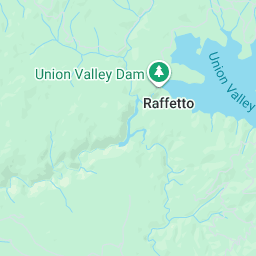
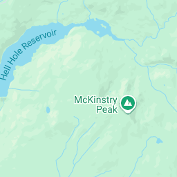
Hell Hole Reservoir- Wikipedia
Hell Hole Dam Failure photos
Sacramento Municipal Utility District (SMUD)
FishSniffer article by Dan Bachar
Upper American River Foundation
American River Watershed Group
A GUIDE TO THE BEST WHITEWATER IN THE STATE OF CALIFORNIA, HOLBEK & STANLEY, 1988
FERC Information:
Hell Hole Dam is part of Placer County Water Agency's "Middle Fork American River Project, FERC Project #2079. The FERC license for this project expires in 2013.
Project Relicensing Homepage
Licensing Process Schedule
Recreation Technical Study Reports
Draft Instream Flow Report
Rapids in this Run (3)
Difficulty
Class V
Length
21.0 mi
Gradient
110 ft/mi
max 150
Rapids
3
Access Points
Shuttle Info
hill and quickly crosses Long Creek). After ~2 additional miles, this road joins another major road (veer right). Continue ~10 miles to the Put-in.
**Other Information Sources:**
[CA-Creeks: Rubicon](http://cacreeks.com/rubicon.htm)
[Placer County Water Agency](http://www.pcwa.net/)
[Hell Hole Reservoir- Wikipedia](http://en.wikipedia.org/wiki/Hell_Hole_Reservoir)
[Hell Hole Dam Failure photos](http://cee.engr.ucdavis.edu/faculty/boulanger/geo_photo_album/Embankment%20dams/Failure%20of%20hell-hole%20dam/Hell-hole%20dam%20-%20main.html)
[Sacramento Municipal Utility District (SMUD)](http://www.smud.org/en/Pages/index.aspx)
[FishSniffer article by Dan Bachar](http://www.fishsniffer.com/dbacher/070424rubicon.html)
[Upper American River Foundation](http://www.upperamerican.com/UARF/default.aspx)
[American River Watershed Group](http://arwg.net/index.htm)
A GUIDE TO THE BEST WHITEWATER IN THE STATE OF CALIFORNIA, HOLBEK & STANLEY, 1988
**FERC Information:**
Hell Hole Dam is part of Placer County Water Agency's "Middle Fork American River Project, FERC Project #2079. The FERC license for this project expires in 2013.
[Project Relicensing Homepage](http://relicensing.pcwa.net/index.html)
[Licensing Process Schedule](http://relicensing.pcwa.net/html/whatis/relicensingschedule.php)
[Recreation Technical Study Reports](http://relicensing.pcwa.net/html/science/padreportrecreation.php)
[Draft Instream Flow Report](http://relicensing.pcwa.net/documents/DLA//Vol%203%20-%20Exhibit%20E%20-%20Environmental%20Exhibit%20and%20SD%20A,%20B,%20and%20C/2_Vol_3%20Supporting%20Document%20A%20Proposed%20Environ.%20Measures/SD-A_Proposed_Environmental_Measures/03_AQResources-Measures/InstreamFlowRes_Min_PoolMeasure.pdf)
## Permit Information
No permit needed.
## Detailed Information
**County:**Placer/ El Dorado**Zipcode:**95631**Agency:**El Dorado NF**Putin Lon:**-120.486**Putin Lat:**38.9575**Takeout Lon:**-120.726**Takeout Lat:**39.0015**USGS HUC:**18020128
**StreamTeam Status:** Not Verified
**Last Updated:** 2011-07-06 19:49:36
# Gauge Information
## Gauge Description:
There is considerable confusion about the boatable range in this reach. Given the small number of paddle trips and the lack of accurate flow information in the past, that confusion is to be expected. As flow information is provided, boaters will be able to explore the high and low ends of the boatable range. Some estimates of low, optimum and high flows were compiled in the PCWA licensing process.
Range Optimum
400 to 1200 500-700
400 to 3000 700-1,500
As of 2010 there is no online flow gauge information available for this reach. AW volunteers keep in contact with the dam operators and lobby them to report flows during spill periods. AW is working with PCWA to get real time flow information online from gauges below the dam and at Ellicotts Bridge. We also hope to get flow information for Rubicon above Ralston Afterbay. With this information boaters will be able to utilize boatable flows from rain and side streams as well as spill from Hell Hole Reservoir.
[Hell Hole daily storage](http://cdec.water.ca.gov/cgi-progs/queryDaily?HHL) is reported online. Presently, there are no gates on the spillway, so spill begins to occur when storage is above 207,500 acre/feet. Spill gets into boatable range when storage is around 208,500 acre/feet. PCWA has plans to add bladder gates in the spillway which would increase reservoir capacity to 215,000 acer/feet.
[Loon Lake Hourly Storage and Elevation](http://cdec.water.ca.gov/cgi-progs/queryF?LON) is also reported online. This reservoir will spill when storage is above 76,500 acre/feet. Spill will travel down Gerle Creek to the SF Rubicon and on to the main Rubicon above Ellicot Bridge.
The Rubicon seldom has boatable flows because there are several different reservoirs belonging to different projects that each take water out of the Rubicon basin and send it to the SF or MF American rivers.
[USGS-schematic of Rubicon & MF American](http://ca.water.usgs.gov/waterdata/Schematics2008/american.mf.basin.pdf) pdf
Flows in the upper Rubicon drainage are diverted at Rubicon Reservoir, to Buck Island Reservoir, to [Loon Lake Reservoir](http://cdec.water.ca.gov/cgi-progs/stationInfo?station_id=LON). The water is eventually sent through Robbs Peak Powerplant into the SF American drainage. Rubicon Reservoir and Buck Island Reservoir are capable of diverting up to 1,000 cfs to Loon Reservoir. The South Fork Rubicon River has a diversion dam upstream of Gerle Creek that sends flows to the Robbs Peak Powerplant. Sacramento Municipal Utility District (SMUD) operates these reservoirs. FERC project #2101.
[Upper American River Project schematic. pdf](http://hydrorelicensing.smud.org/project/stepbyst.pdf)
Hell Hole Reservoir captures any flow remaining in the Rubicon and sends most of it over to the MF American. With a capacity of 207,000 acre feet, Hell Hole is a fairly large reservoir. It not only captures Rubicon flows but also receives flows from French Meadows Reservoir on the MF American River through the French Meadows powerplant. Flows are sent back to the MF American through a tunnel to the Middle Fork Powerplant. Hell Hole is part of a [PCWA](http://www.pcwa.net/) project, FERC project #2079.
Three small tributaries below Hell Hole reservoir are also diverted. North and South forks of Long Creek are both diverted by PG&E to the Middle Fork Powerplant tunnel. It also appears that some water is diverted from the SF Rubicon into Pilot Creek to Stumpy Meadows Lake, then diverted to Georgetown Irrigation district. Up to 60 cfs can be diverted from Pilot Creek below Stumpy Meadows Lake. It is unclear how much flow can be diverted from the SF Rubicon into Pilot Creek, or if this diversion is still in operation.
Historical records are available for many locations within the Rubicon basin.
[Rubicon below Hell Hole Dam](http://waterdata.usgs.gov/ca/nwis/nwisman/?site_no=11428800&agency_cd=USGS) Spills 3 or 4 years out of 10.
[Middle Fork Powerhouse](http://waterdata.usgs.gov/ca/nwis/nwisman/?site_no=11428600&agency_cd=USGS) Receives water from Hell Hole. Maximum capacity about 950 cfs.
[French Meadows Powerplant](http://waterdata.usgs.gov/ca/nwis/nwisman/?site_no=11427200&agency_cd=USGS) delivers up to 400 cfs from MF American to Hell Hole reservoir.
[Middle Fork American below French Meadow dam](http://waterdata.usgs.gov/ca/nwis/nwisman/?site_no=11427500&agency_cd=USGS) shows how often French Meadow spills.
[South Fork Rubicon below Gerle Creek](http://waterdata.usgs.gov/ca/nwis/nwisman/?site_no=11430000&agency_cd=USGS) Diversion of up to 1,440 cfs. High flows occur seldom. They appear and dissappear so quickly that it appears very difficult to utilize them.
[Rubicon above Rubicon Reservoir](http://waterdata.usgs.gov/ca/nwis/nwisman/?site_no=11427800&agency_cd=USGS) very poor records
[Rubicon below Rubicon Reservoir](http://waterdata.usgs.gov/ca/nwis/nwisman/?site_no=11427960&agency_cd=USGS) measures minimum releases only. Spillway flows are not measured.
[Little Rubicon below Buck Island Dam](http://waterdata.usgs.gov/ca/nwis/nwisman/?site_no=11428400&agency_cd=USGS) measures minimum releases only. Spillway flows are not measured.
[Buck-Loon diversion tunnel](http://waterdata.usgs.gov/ca/nwis/nwisman/?site_no=11428300&agency_cd=USGS) Capacity approximately 1,000 cfs.
[Robbs Peak Powerhouse](http://waterdata.usgs.gov/ca/nwis/nwisman/?site_no=11429300&agency_cd=USGS) Receives all diverted flows from upper reservoirs. Maximum capacity about 1,200 cfs.
[Pilot Creek below Diversion](http://nwis.waterdata.usgs.gov/ca/nwis/peak?site_no=11433040&agency_cd=USGS&format=html) shows annual peak flows. Daily flow information is available in the USGS Annual Water Data Reports such as the [2006 report pdf](http://wdr.water.usgs.gov/wy2006/pdfs/11433040.2006.pdf) Pilot Creek can add big flows but it enters the Rubicon near the very end of this reach. Flows in this tributary can be surprisingly high compared to the SF Rubicon.
[NF Long Creek](http://nwis.waterdata.usgs.gov/ca/nwis/nwisman/?site_no=11433085&agency_cd=USGS) Daily records below the diversion for some periods only. High flows do not seem to be recorded.
[SF Long Creek](http://nwis.waterdata.usgs.gov/ca/nwis/nwisman/?site_no=11433065&agency_cd=USGS) Daily records below the diversion for some periods only. High flows do not seem to be recorded.
# Report - Reports of Rubicon Ellicott Bridge to Oxbow Reservoir (Ralston PH) and related gauges
Reports give the public a chance to report on river conditions throughout the country as well as log the history of a river.
## Reports
REACH:Rubicon
WhenRiver/GaugeSubjectLevelReporter[RubiconEllicott Bridge to Oxbow Reservoir (Ralston PH) \[CA\]](http://www.americanwhitewater.org/content/River/detail/id/271/)[Rubicon River, Low Water](http://www.americanwhitewater.org/content/Report/detail/id/2398/)n/aMatt Muir76h49m[@Rubicon Ellicott Bridge to Oxbow Reservoir (Ralston PH) \[CA\]](http://www.americanwhitewater.org/content/Gauge2/detail/id/37455/)[PCWA flow report](http://www.americanwhitewater.org/content/Report/detail/id/879877/)1044 cfsPaul Martzen4d04h49m[@Rubicon Ellicott Bridge to Oxbow Reservoir (Ralston PH) \[CA\]](http://www.americanwhitewater.org/content/Gauge2/detail/id/37455/)[PCWA flow report](http://www.americanwhitewater.org/content/Report/detail/id/879856/)980 cfsPaul Martzen7d04h49m[@Rubicon Ellicott Bridge to Oxbow Reservoir (Ralston PH) \[CA\]](http://www.americanwhitewater.org/content/Gauge2/detail/id/37455/)[PCWA flow report](http://www.americanwhitewater.org/content/Report/detail/id/879840/)1100 cfsPaul Martzen9d04h49m[@Rubicon Ellicott Bridge to Oxbow Reservoir (Ralston PH) \[CA\]](http://www.americanwhitewater.org/content/Gauge2/detail/id/37455/)[PCWA flow report](http://www.americanwhitewater.org/content/Report/detail/id/879835/)1000 cfsPaul Martzen10d04h49m[@Rubicon Ellicott Bridge to Oxbow Reservoir (Ralston PH) \[CA\]](http://www.americanwhitewater.org/content/Gauge2/detail/id/37455/)[PCWA flow report](http://www.americanwhitewater.org/content/Report/detail/id/879797/)1120 cfsPaul Martzen13d04h49m[@Rubicon Ellicott Bridge to Oxbow Reservoir (Ralston PH) \[CA\]](http://www.americanwhitewater.org/content/Gauge2/detail/id/37455/)[PCWA flow report](http://www.americanwhitewater.org/content/Report/detail/id/879767/)1880 cfsPaul Martzen14d04h49m[@Rubicon Ellicott Bridge to Oxbow Reservoir (Ralston PH) \[CA\]](http://www.americanwhitewater.org/content/Gauge2/detail/id/37455/)[PCWA flow report](http://www.americanwhitewater.org/content/Report/detail/id/879766/)1800 cfsPaul Martzen15d04h49m[@Rubicon Ellicott Bridge to Oxbow Reservoir (Ralston PH) \[CA\]](http://www.americanwhitewater.org/content/Gauge2/detail/id/37455/)[PCWA flow report](http://www.americanwhitewater.org/content/Report/detail/id/879756/)1500 cfsPaul Martzen19d04h45m[@Rubicon Ellicott Bridge to Oxbow Reservoir (Ralston PH) \[CA\]](http://www.americanwhitewater.org/content/River/detail/id/271/)[PCWA flow report](http://www.americanwhitewater.org/content/Report/detail/id/879729/)1590 cfsPaul Martzen20d04h19m[@Rubicon Ellicott Bridge to Oxbow Reservoir (Ralston PH) \[CA\]](http://www.americanwhitewater.org/content/Gauge2/detail/id/37455/)[PCWA flow report](http://www.americanwhitewater.org/content/Report/detail/id/879722/)1860 cfsPaul Martzen21d02h31m[@Rubicon Ellicott Bridge to Oxbow Reservoir (Ralston PH) \[CA\]](http://www.americanwhitewater.org/content/Gauge2/detail/id/37455/)[6/15/2011 flow report](http://www.americanwhitewater.org/content/Report/detail/id/879696/)1850 cfsPaul Martzen24d22h19m[@Rubicon Ellicott Bridge to Oxbow Reservoir (Ralston PH) \[CA\]](http://www.americanwhitewater.org/content/Gauge2/detail/id/37455/)[Flows at Ellicott](http://www.americanwhitewater.org/content/Report/detail/id/879700/)1550 cfsPaul Martzen26d01h49m[@Rubicon Ellicott Bridge to Oxbow Reservoir (Ralston PH) \[CA\]](http://www.americanwhitewater.org/content/Gauge2/detail/id/37455/)[Flows at Ellicott](http://www.americanwhitewater.org/content/Report/detail/id/879699/)1400 cfsPaul Martzen27d02h04m[@Rubicon Ellicott Bridge to Oxbow Reservoir (Ralston PH) \[CA\]](http://www.americanwhitewater.org/content/Gauge2/detail/id/37455/)[Flows at Ellicott](http://www.americanwhitewater.org/content/Report/detail/id/879698/)1200 cfsPaul Martzen27d23h19m[@Rubicon Ellicott Bridge to Oxbow Reservoir (Ralston PH) \[CA\]](http://www.americanwhitewater.org/content/Gauge2/detail/id/37455/)[PCWA flow report](http://www.americanwhitewater.org/content/Report/detail/id/879697/)200 cfsPaul Martzen55d14h02m[@Rubicon Ellicott Bridge to Oxbow Reservoir (Ralston PH) \[CA\]](http://www.americanwhitewater.org/content/Gauge2/detail/id/37455/)[Flows at Ellicott](http://www.americanwhitewater.org/content/Report/detail/id/879328/)220 cfsPaul Martzen5y32d19h24m[@Rubicon Ellicott Bridge to Oxbow Reservoir (Ralston PH)](http://www.americanwhitewater.org/content/Gauge2/detail/id/37455/)[Big Bedrock on the Rubicon](http://www.americanwhitewater.org/content/Report/detail/id/877869/)800 cfsDave Steindorf5y33d19h24m[@Rubicon Ellicott Bridge to Oxbow Reservoir (Ralston PH) \[CA\]](http://www.americanwhitewater.org/content/Gauge2/detail/id/37455/)[Account of 11/20/10](http://www.americanwhitewater.org/content/Report/detail/id/877871/)800 cfsDave Steindorf5y33d19h24m[@Rubicon Ellicott Bridge to Oxbow Reservoir (Ralston PH)](http://www.americanwhitewater.org/content/Gauge2/detail/id/37455/)[Account of 11/20/10](http://www.americanwhitewater.org/content/Report/detail/id/877870/)800 cfsDave Steindorf
## Report Table Options
[>\> next](http://www.americanwhitewater.org/content/Report/list-combo/reachid/271/gaugeids//page/2/)
## Rapid Summary
MileRapid NameClassFeatures ( [Legend](http://www.americanwhitewater.org/content/Wiki/view/id/river%3Ainfo%3Afeature_legend/))0.0[Ellicotts Bridge](http://www.americanwhitewater.org/content/StreamTeam/edit-reach/reachid/271/#rapid101247)N/A16.4[Pilot Creek Confluence](http://www.americanwhitewater.org/content/StreamTeam/edit-reach/reachid/271/#rapid101248)N/A18.0[Long Canyon Creek confluence](http://www.americanwhitewater.org/content/StreamTeam/edit-reach/reachid/271/#rapid101249)N/A18.6Foot BridgeN/A21.1[Take Out](http://www.americanwhitewater.org/content/StreamTeam/edit-reach/reachid/271/#rapid101251)N/A
## Rapid Descriptions
**Ellicotts Bridge** (Class N/A)
This is the usual put in spot. PCWA now has a flow gauge at this bridge, but it is not yet online. Boaters could also put in 8.6 river miles upstream at the dam.
**Pilot Creek Confluence** (Class N/A, Mile 16.4)
Pilot creek enters from the left and may have a good flow in the winter and early spring.
Topo maps show a trail coming a short ways from a road down to the Rubicon here. This could provide access for a short 4.7 mile boating trip from Pilot Creek to Ralston.
**Long Canyon Creek confluence** (Class N/A, Mile 18.0)
Long Canyon Creek comes in from the right and can bring increased flow, especially in the winter.
**Take Out** (Class N/A, Mile 21.1)
The road comes close to the river just upstream of a powerhouse.
## User Comments
* * *
2011-05-12 01:53:07 (55 days ago)
Paul Martzen[Details](http://www.americanwhitewater.org/content/Contact/view/contactid/904/display/detail/)
Flow Report from PCWA - May 11, 2011 Flows were fluctuating between 300 & 350 cfs at Ellicott
Bridge, but are around 220 on May 11. Flows just above Ralston Afterbay are about 550 cfs. Hell
Hole Dam is expected to spill in mid June. [Edit](http://www.americanwhitewater.org/content/Comment/edit/cid/1248096/section/river/reachid/271/notifylist//)
[Add a Comment](javascript:aw.formathelper.dialog.process(null,"/content/Comment/new/reachid/271/section/river/notifylist//.dialog");)


[](http://maps.google.com/maps?ll=38.9795,-120.606&spn=0.43854,0.911617&t=u&z=11&key=ABQIAAAASb3njmhNhm7jGeLlI5QwDBTrflnRaa8ylooHUce5JikbfkbJ8BSJuWjWwqLdGN-qP4Z6FuzBOZg-Dg&mapclient=jsapi&oi=map_misc&ct=api_logo "Click to see this area on Google Maps")
Map © USGS - [Terms of Use](http://www.google.com/intl/en_us/help/terms_maps.html)


2 mi
5 km
Topo
USGS Aerial
Map
Satellite
## Directions Description:
We have no additional detail on this route. Use the map below to calculate how to arrive to the main town from your zipcode.
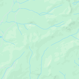
## Map & Directions
**Presets:**
WARNING! Directions are approximated from information that AW collects. They may not necessarily reflect the reality and may direct the user on roads that do not exist or are closed. Shorter routes may also exist.
**Walking directions are in beta.**
Use caution – This route may be missing sidewalks or pedestrian paths.
Unknown road
32.5 mi (about 1 hour 19 mins)
[1](javascript:void(0)).Head **southeast**11.2 mi[2](javascript:void(0)).Turn left toward **11 Pines Rd**6.8 mi[3](javascript:void(0)).Turn right onto **11 Pines Rd**7.6 mi[4](javascript:void(0)).Turn left to stay on **11 Pines Rd**
Destination will be on the left
6.9 mi
11 Pines Rd
.
Map data ©2011 Google


[](http://maps.google.com/maps?ll=38.991,-120.605993&spn=0.211609,0.310707&z=12&key=ABQIAAAASb3njmhNhm7jGeLlI5QwDBTrflnRaa8ylooHUce5JikbfkbJ8BSJuWjWwqLdGN-qP4Z6FuzBOZg-Dg&mapclient=jsapi&oi=map_misc&ct=api_logo "Click to see this area on Google Maps")
Map data ©2011 Google - [Terms of Use](http://www.google.com/intl/en_us/help/terms_maps.html)


2 mi
2 km
Map
Satellite
[Weather Forecast](http://www.accuweather.com/index-forecast.asp?partner=netweather&traveler=0&zipcode=95631) \| [Weather Maps](http://www.accuweather.com/maps-satellite.asp?partner=netweather) \| [Weather Radar](http://www.accuweather.com/index-radar.asp?partner=netweather&traveler=0&zipcode=95631) \| [Hurricane Center](http://hurricane.accuweather.com/hurricane/index.asp)
# News
[](http://www.americanwhitewater.org/content/News/display/type/reach/subtype/271/.rss) River Alert
[](http://www.americanwhitewater.org/content/News/display/type/state/subtype/USA-CAL/.rss) State News
[](http://www.americanwhitewater.org/content/News/display/type/reachlink/subtype/271/.rss) River Links
# Photo\#877597
[](http://www.americanwhitewater.org/content/Photo/detail/photoid/877597/)
[Detail](http://www.americanwhitewater.org/content/Photo/detail/photoid/877597/) [Trip Report](http://www.americanwhitewater.org/content/Report/detail/id/877870/) [Edit](http://www.americanwhitewater.org/content/Photo/common-edit/id/877597/) [Remove](http://www.americanwhitewater.org/content/Photo/remove/id/877597/)@Rubicon Ellicott Bridge to Oxbow Reservoir (Ralston PH), (2.07MB .jpeg)
# Water in the Rubicon, Coming Soon
[](http://www.americanwhitewater.org/content/Photo/detail/photoid/877594/)
[Detail](http://www.americanwhitewater.org/content/Photo/detail/photoid/877594/) [Trip Report](http://www.americanwhitewater.org/content/Report/detail/id/877867/) [Edit](http://www.americanwhitewater.org/content/Photo/common-edit/id/877594/) [Remove](http://www.americanwhitewater.org/content/Photo/remove/id/877594/) Water in the Rubicon, Coming Soon @Rubicon Ellicott Bridge to Oxbow Reservoir (Ralston PH), (1.15MB .jpeg)
# Big Bedrock on the Rubicon
[](http://www.americanwhitewater.org/content/Photo/detail/photoid/877596/)
[Detail](http://www.americanwhitewater.org/content/Photo/detail/photoid/877596/) [Trip Report](http://www.americanwhitewater.org/content/Report/detail/id/877869/) [Edit](http://www.americanwhitewater.org/content/Photo/common-edit/id/877596/) [Remove](http://www.americanwhitewater.org/content/Photo/remove/id/877596/) Big Bedrock on the Rubicon @Rubicon Ellicott Bridge to Oxbow Reservoir (Ralston PH), (1.15MB .jpeg)
# Photo\#877598
[](http://www.americanwhitewater.org/content/Photo/detail/photoid/877598/)
[Detail](http://www.americanwhitewater.org/content/Photo/detail/photoid/877598/) [Trip Report](http://www.americanwhitewater.org/content/Report/detail/id/877871/) [Edit](http://www.americanwhitewater.org/content/Photo/common-edit/id/877598/) [Remove](http://www.americanwhitewater.org/content/Photo/remove/id/877598/)@Rubicon Ellicott Bridge to Oxbow Reservoir (Ralston PH), CA(1.25MB .jpeg)
# Rubicon River, Low Water
[](http://www.americanwhitewater.org/content/Photo/detail/photoid/247/)
[Detail](http://www.americanwhitewater.org/content/Photo/detail/photoid/247/) [Trip Report](http://www.americanwhitewater.org/content/Report/detail/id/2398/) [Edit](http://www.americanwhitewater.org/content/Photo/common-edit/id/247/) [Remove](http://www.americanwhitewater.org/content/Photo/remove/id/247/) Rubicon River, Low Water @Rubicon Ellicott Bridge to Oxbow Reservoir (Ralston PH), CA(25.61KB .jpeg)
# Sticky Falls, Rubicon River
[](http://www.americanwhitewater.org/content/Photo/detail/photoid/246/)
[Detail](http://www.americanwhitewater.org/content/Photo/detail/photoid/246/) [Trip Report](http://www.americanwhitewater.org/content/Report/detail/id/2398/) [Edit](http://www.americanwhitewater.org/content/Photo/common-edit/id/246/) [Remove](http://www.americanwhitewater.org/content/Photo/remove/id/246/) Sticky Falls, Rubicon River @Rubicon Ellicott Bridge to Oxbow Reservoir (Ralston PH), CA(26.35KB .jpeg)
# Credits and History
Volunteer paddlers bring you this information by running the river and keeping the information up-to-date, or by incorporating the comments you leave for them. StreamTeam river editors are responsible for maintaining accurate and up-to-date river information and Regional StreamTeam members provide editorial oversight. If you notice something wrong with a river description leave a comment or notify the river editor. If you notice that a river has gone a while without an update and you want to maintain it, send a message to the Regional StreamTeam member.
## Credits
Streamteam regional editor
Dave Steindorf
4 Baroni Drive
Chico, CA 95928
[Send Message](http://www.americanwhitewater.org/content/Contact/message/contactid/10031/)
[Details](http://www.americanwhitewater.org/content/Contact/profile/contactid/10031/)
E-mail: [dave@americanwhitewater.org](mailto:dave@americanwhitewater.org)
Phone: 530-343-1871

Dave Steindorf has been an active river advocate in California since 1997. As the primary negotiator for American Whitewater, Dave has gained a reputation as a consensus builder. He has been able to gain the respect of Agencies, NGO's, and Licensees while successfully achieving the goals of his constituents. He was a signatory to the Rock Creek Cresta Settlement agreement, along with past AW Board President Kevin Lewis, and AW Conservation Director John Gangemi. This agreement provide for the first whitewater releases in California. He has since worked diligently to organize and sustain the releases on the North Fork Feather River.
Dave has a diverse range of recreational, professional and educational experiences that make him uniquely suited for his role at AW. Dave has more than 8 years of experience working on FERC Relicensing. Dave is somewhat of an anomaly, in that he has not only worked in an advocacy role but also as a consultant for several Utilities in the West. During that time he has had a role in 12 recreational flow studies as well as studies on angling and flat-water boating. Dave is also able to draw on his vast experience in a variety of recreational pursuits including having worked professionally in the areas of Paddling, Angling, Cycling, and Outdoor Retail. In addition to this breadth of experience Dave also has a degree in Economics and a Masters in Education.
Dave was introduced to rivers at age 7, when his father put a fly rod into his hands. Learning to kayak later on was a natural progression from his childhood love of rivers. Dave's passion for river conservation issues inspired him to make a video, "More than Plumbing", which won an award for best amateur video at the 2000 National Paddling film festival.
Dave strongly believes that flowing rivers are an undervalued resource not only in this country, but also around the world. He feels that education is the key to river conservation. "Most of our progress on the North Fork Feather has been due to our ability to educate the other NGO's, agencies, and PG&E to the value of whitewater boating. However, the best way to improve people's notions about whitewater is to get them on the river. Couch Potatoes make lousy river advocates."
Streamteam regional editor
Thomas O'Keefe
3537 NE 87th St.
Seattle, WA 98115
[Send Message](http://www.americanwhitewater.org/content/Contact/message/contactid/580/)
[Details](http://www.americanwhitewater.org/content/Contact/profile/contactid/580/)
E-mail: [okeefe@americanwhitewater.org](mailto:okeefe@americanwhitewater.org)
Phone: 425-417-9012
Tom first got his start paddling and playing in the water during early childhood canoe trips to the Adirondacks in upstate New York. After a brief diversion as a competitive swimmer and water polo player through high school and college, Tom came back to paddling and began his first serious whitewater while living in Japan and shortly thereafter became a full-fledged fanatic with the University of Wisconsin Hoofers. Tom has traveled across the country and around the globe in search of great rivers and most recently completed a final descent of the Yangtze River through the Three Gorges, before the gates were closed on the world's largest dam. Tom has been a volunteer with American Whitewater for more than a decade and a Regional Coordinator in the Pacific Northwest for the past several years. Tom received his undergraduate degree at Cornell University before completing his graduate work in aquatic ecology at the University of Wisconsin where he received his PhD. In recent years Tom has worked at the University of Washington where his research projects have focused on the dynamics of nutrients returning salmon bring to river ecosystems and the structural development of riparian forests along large floodplain rivers. Tom has experience working with resource agencies including the National Park Service and Forest Service as many of his research projects have been conducted on public land. Tom has also taught courses in aquatic ecology, including watershed ecology and management, both at the university level and for youth programs. Bringing a wealth of experience to the organization, Tom contributes skills in river and fisheries ecology, teaching and outreach, grant writing, multimedia, web development, and inspiring local volunteers to help build American Whitewater's stewardship program. He is based in Seattle, WA and works closely with volunteers throughout the Pacific Northwest region on projects in Coastal WA/OR, the Columbia River watershed, Puget Sound, Fraser River watershed, coastal BC, and Alaska. In addition Tom covers project work in the Upper Midwest. And when the water's up, Tom still finds time to play on the water.
Streamteam regional editor
Paul Martzen
Fresno, CA 93728
[Send Message](http://www.americanwhitewater.org/content/Contact/message/contactid/904/)
[Details](http://www.americanwhitewater.org/content/Contact/profile/contactid/904/)
Phone: 559-441-1383

I developed a love of rivers by innertubing the Kings River in the Sanger, Reedley and Kingsburg area of California, starting around 1970. In 1982, I became a whitewater kayaker and soon explored more and more of the rivers and creeks around the Fresno area. I continue to enjoy exploring new rivers and seeing new aspects of familiar rivers. I feel a responsibility to protect our rivers and to share with others my appreciation for the good that we gain from wild rivers.
## History
DateCommentEditor[2002-02-11 06:13:36](http://www.americanwhitewater.org/content/River/detail/id/271/revision/1190065/)[2011-07-06 19:49:36](http://www.americanwhitewater.org/content/River/detail/id/271/revision/1200332/)added rapidsChris Tulley[2010-06-11 06:19:52](http://www.americanwhitewater.org/content/River/detail/id/271/revision/1197800/)Added flow links, adjusted put in & take outPaul Martzen[2010-11-22 18:59:50](http://www.americanwhitewater.org/content/River/detail/id/271/revision/1198743/)Gauge links and Relicensing linksPaul Martzen[2010-06-11 21:15:20](http://www.americanwhitewater.org/content/River/detail/id/271/revision/1197804/)minor updatesPaul Martzen[2010-11-22 19:25:33](http://www.americanwhitewater.org/content/River/detail/id/271/revision/1198744/)Paul Martzen[2010-06-11 08:22:53](http://www.americanwhitewater.org/content/River/detail/id/271/revision/1197801/)Fixing incorrect infoPaul Martzen[2010-12-10 06:14:23](http://www.americanwhitewater.org/content/River/detail/id/271/revision/1199019/)added rapidsPaul Martzen
# River Networking Tool - Rubicon (Ellicott Bridge to Oxbow Reservoir (Ralston PH))
TitleNameCity
# Volunteer Opportunities / Activities
## [StreamTeam](http://www.americanwhitewater.org/content/Directory/view/listing/sk-271/)
Volunteer activities centered on this river are listed above. If you see that there is no StreamTeam members for this river, you can join by clicking the link above. You can also add yourself to any other project groups associated with this river.
# General Nonmember Message
# Associated News
[](http://www.americanwhitewater.org/content/River/detail/id/271/revision/-999/printlayout/1/rev/-1/.mobile) Ellicott Bridge to Oxbow Reservoir (Ralston PH), Rubicon California, US (mobile)
Difficulty Classes
I Easy
II Novice
III Intermediate
IV Advanced
V Expert/Extreme
VI Unrunnable
Permit Required
No permit needed.
Current Conditions
5-Day Forecast
Whitewater data from
American Whitewater
American Whitewater