3- Factory Shoals
Gauge Conditions
Runnable: ? – ? CFS
Approximate reading: This gauge is 3.5 miles away on Alcovy. Use as a general reference only.
Data from American Whitewater & USGS
Run Map
Description
This run is located within Factory Shoals Park, a county-operated venue 10 miles south of Covington, GA, just off state highway 36. They charge a few bucks for park use during peak periods (warm months). Address: 450 Newton Factory Bridge Rd, Covington, GA 30014
This run has a visual gauge located on the bridge just past the entrance of the park on Newton Factory Bridge Rd.
Before you do the first run on this one, it's a good idea to scout the river trail from the bottom up to the bridge and note any new wood or other strainers. Also if it is your first time, you will want to see what you are getting into on the lower half mile; it gets a bit hairy.
The put-in is in the campground on the north side of Factory Bridge Road. Just drive thru the campground until you see water, then find a good parking place. If the campground is closed, go across the bridge to the parking area immediately left at the other end. Follow the riverside trail upstream about 100 yards to the first ledge and slide on in. There is some private property that is well marked that you will not want to trepass on.
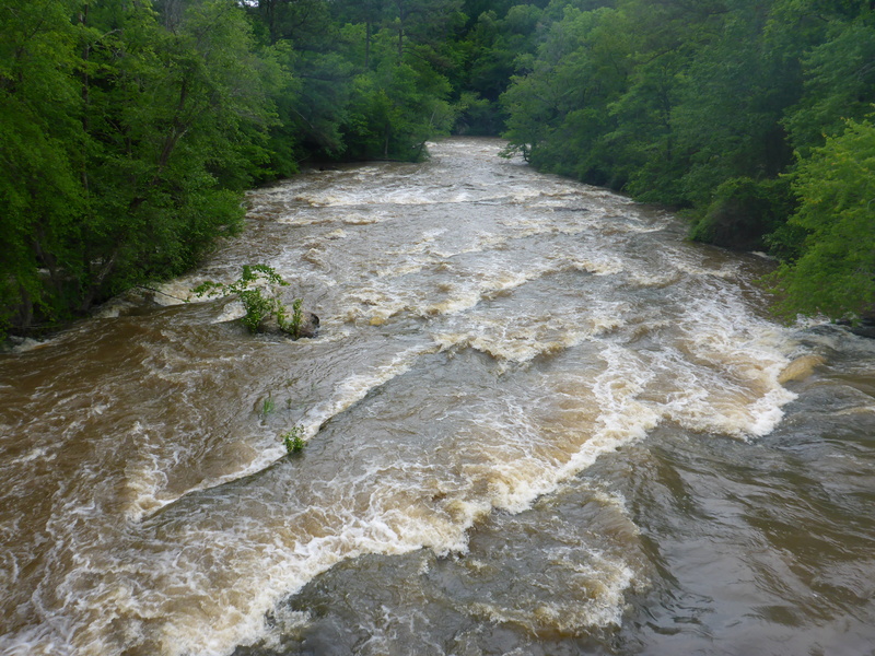
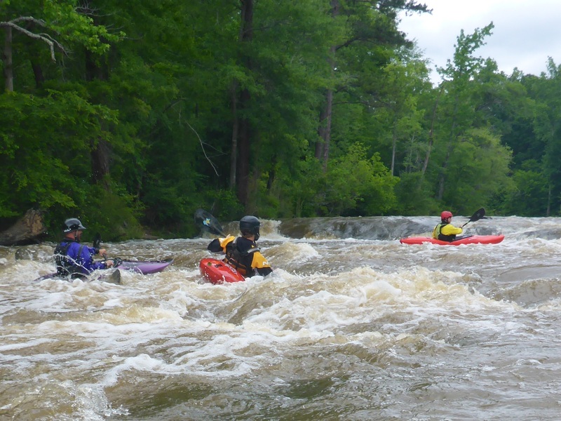
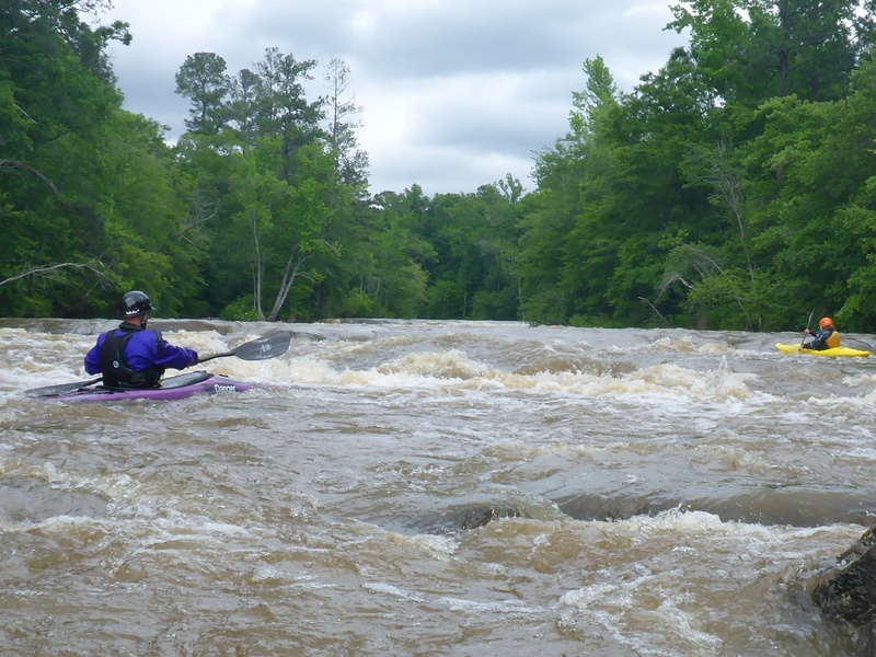
The rapids start a quarter mile around the bend from the campground putin. Above the bridge, rapids are class I-II; several ledges with some surfing potential at some levels. Below the bridge is an island with a variety of routes dependent on water levels.
The gradient increases the further you travel below the bridge. Ledges begin to get more complicated and currents pick up and get more pushy.
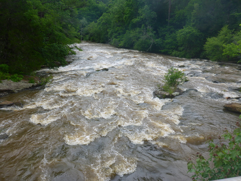
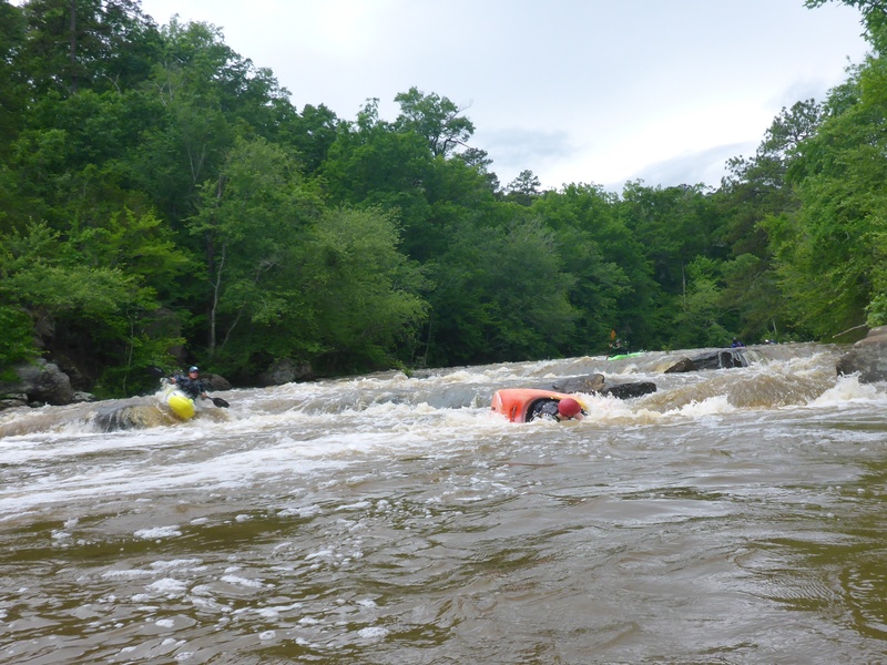
A half mile below the bridge, a hundred yards of flatwater pool gives you a chance to catch your breath. Access at this point is good on both sides if you want to pull out; below the pool things are going to jump up to class III. There are a couple of difficult ledges to work down before you line up for the last drop. You can spot the little midstream island from this point that marks the final ledge; as you get closer you will notice the distinct horizon line just beyond the island.
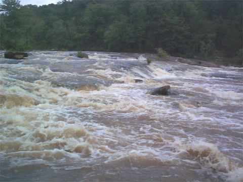
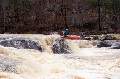
The last drop is about 9 foot vertical in 40 foot horizontal, and looks bigger from below (see photos). It features a slide into a mildly undercut boulder on river right, a central flume, and a boof into a pool in midriver. Pass the midriver island on the right side. The protruding boulders 8' off the right bank of the island form a gunsight pointing towards the drop spot for the flume; to hit the boof, eddy behind the last boulder, ferry a few feet to river left, turn and go for it.
On river left are more options depending on water level; there is a nasty big boiling undercut up against the river left bank at the very bottom. You can pull out and portage back up the trail on river right for additional runs.
After this rapid the rest of the river is buried beneath a reservior, Lake Jackson.
Standard take-out is the beach on river right at the base of the last rapid. A hundred-yard uphill hustle gets you to the 'Big Bend' picnic area on the back side of Factory Shoals Park. Due to the overall shortness and excellent accessibility of this reach, multiple runs in a day can be had with some creative shuttling.
Directions from Covington
Take Highway 36 south about ten miles. Watch for Newton Factory Bridge Road on your left just past Red Oak church. (If approaching from the south, it is the 3rd right from the intersection with GA 212, just past the FFA campground) Turn in and drive down to the river. You will pass the park entrance on your right; the campground road is across the street, sort of. The visual stick gauge is found on the piling under the southwest corner of the bridge. The take out is accessed by entering the park and going all the way through to the "Big Bend" parking lot. Hike down to the river and scout, especially if this is your first time.
Rapids in this Run (3)
Difficulty
Class III
Length
1.3 mi
Gradient
33 ft/mi
max 80
Rapids
3
Access Points
Difficulty Classes
I Easy
II Novice
III Intermediate
IV Advanced
V Expert/Extreme
VI Unrunnable
Current Conditions
5-Day Forecast
Whitewater data from
American Whitewater
American Whitewater