3. Great Falls (Fish Ladder)
Gauge Conditions
Runnable: 3.5 – 4.7 FT
Big and fast. 2nd and 3rd slides deserve extra respect. good level for Bitch Monkey and it's rowdy in the Back Canyon. Experienced, solid boaters only
Data from American Whitewater & USGS
Run Map
Run Time Estimate
Select put-in and take-out to estimate time.
Plan This Trip
See wind-adjusted speed maps, forecast planning, and detailed time estimates.
Sign in to generate an AI timing estimate for this run.
Whitewater timing varies with scouting, portages, and group pace. Use as a planning baseline.
Description
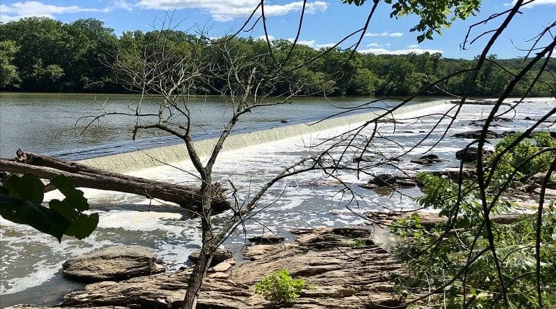
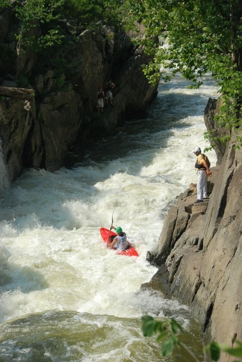
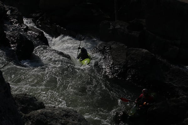
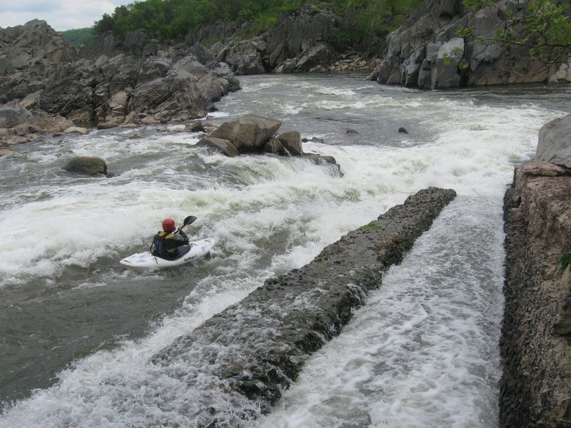
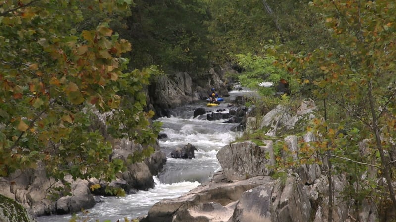
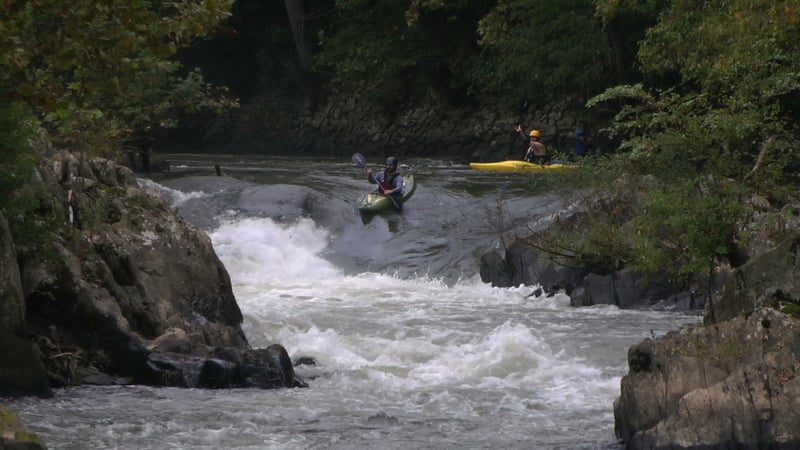
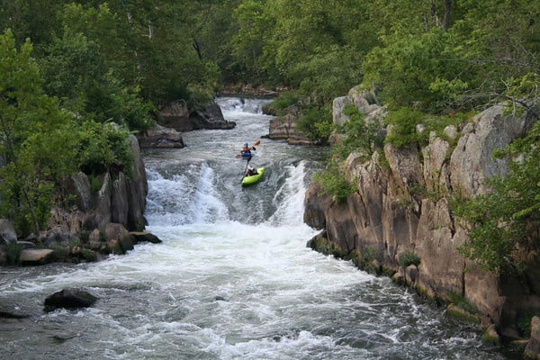
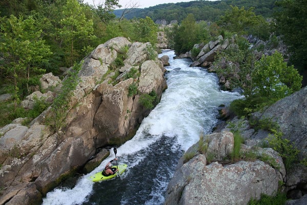
The Fish Ladder is the river left side channel of Great Falls along the C&O Canal towpath on the Maryland side. It is the largest of a network of small parallel channels that form Olmstead Island, carrying perhaps 10- 20 % of the total flow of the Potomac River. It was often thought to be easier than Great Falls proper, but still deserves a solid class V rating due to the difficulty of the crux and the nasty conditions of the riverbed, which shifts frequently. This channel was altered in 1892 By the Army Corps of Enginners and has been deteriorating ever since, leaving sharp rocks, chunky 'Cheese Grater' concrete, steel beams, rebar, railings from a washed out bridge and other hazards than can seriously injure an upside down boater, and tear holes in a plastic kayak. The name fishladder primarily applies to the far river left channel where the concrete slides define the crux on the run. The smaller Tight Quarters, Bridge Channel, and Olmstead channel break off to the right before the 1st slide. The 'Back Canyon' is the narrow box canyon that splits off to the right just before the footbridge, with small rock islands and the 'Bitch Monkey" drop separating them.
Paddling the Fish Ladder, you are also in full view of the Park visitors, and history has proven that folks will dial 911 if they see anything other than clean lines, so don't screw up! The hazards are unfortunate but on the correct line at the correct water levels its great fun and probably won't damage your boat. All of the rapids, with the exception of the last slide, can be pre-scouted from the trail network along the C&O Canal Towpath and the footbridge leading to the Great Falls overlook. This channel collects wood like the NSA collects phone records..... so be sure to look first. Logjams move annually, and several riverbed changes have occured in recent years. most notably the 3rd Slide kicking harder towards The Bitch Monkey, and new rocks in the pinch of the Back Canyon.
To learn more about the history of the Fish Ladder, read this description on the C&O Canal website.
Related reaches: Great Falls (Center Lines), Great Falls (MD Lines), and Great Falls (VA Lines).
Waterfalls (4)
Playspots (2)
Hazards & Portages (7)
Caution: The following locations may require scouting or portaging. Always check current conditions.
Difficulty
Class IV-V(V+)
Length
0.4 mi
Gradient
100 ft/mi
max 200
Rapids
0
5 Hazards
2 Portages
Access Points
Shuttle Info
Most people park at Great Falls (MD) to run the falls. There is a $5 fee per vehicle to enter the park, or you can buy an annual pass for $20. The MD pass is honored on the VA side and vice versa. You can get directions by typing the address of the Great Falls Tavern Visitor Center into Google Maps or Mapquest:
11710 MacArthur Blvd.
Potomac, MD 20854
No shuttle is necessary. When you finish running the Falls, continue downriver and take out at Sandy Beach. Then walk back to your car via the towpath.
Difficulty Classes
I Easy
II Novice
III Intermediate
IV Advanced
V Expert/Extreme
VI Unrunnable
Permit Required
Running Great Falls is legal but you should be experienced and knowledgeable about the river your entering. Great Falls is a Highly visible rapid and your lines will be curiously critiqued by the other park visitors. Unfortunately, It is not legal to put in above the Falls on the Virginia side.
Current Conditions
5-Day Forecast
Whitewater data from
American Whitewater
American Whitewater