3 - Green Truss Bridge to BZ Corners Wild
Gauge Conditions
Runnable: ? – ? CFS
Approximate reading: This gauge is 11.1 miles away on White Salmon. Use as a general reference only.
Data from American Whitewater & USGS
Run Map
Put-in
Take-out
Rapids/Hazards
Wild
Scenic
Run Time Estimate
Select put-in and take-out to estimate time.
Plan This Trip
See wind-adjusted speed maps, forecast planning, and detailed time estimates.
Sign in to generate an AI timing estimate for this run.
Whitewater timing varies with scouting, portages, and group pace. Use as a planning baseline.
Description
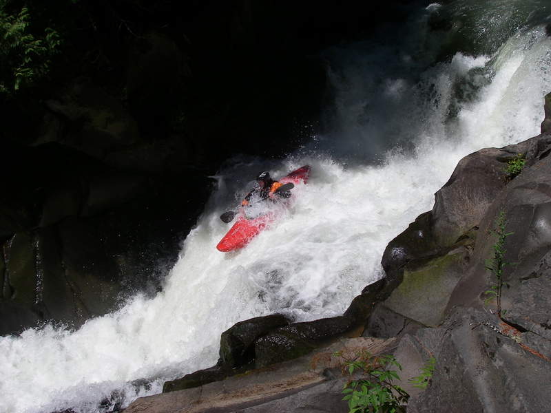
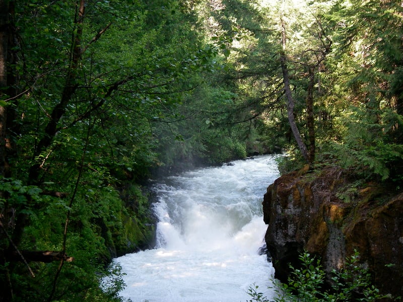
This run is characterized by big drops and an impressive canyon that can be enjoyed nearly every day of the year. Expert paddlers flock here in the warm summer months as other creeks become too low and this run is known as one of the nation's Classic Summertime Class V Runs. With the exception of Zigzag Canyon most of the drops on this run can be easily scouted or portaged.
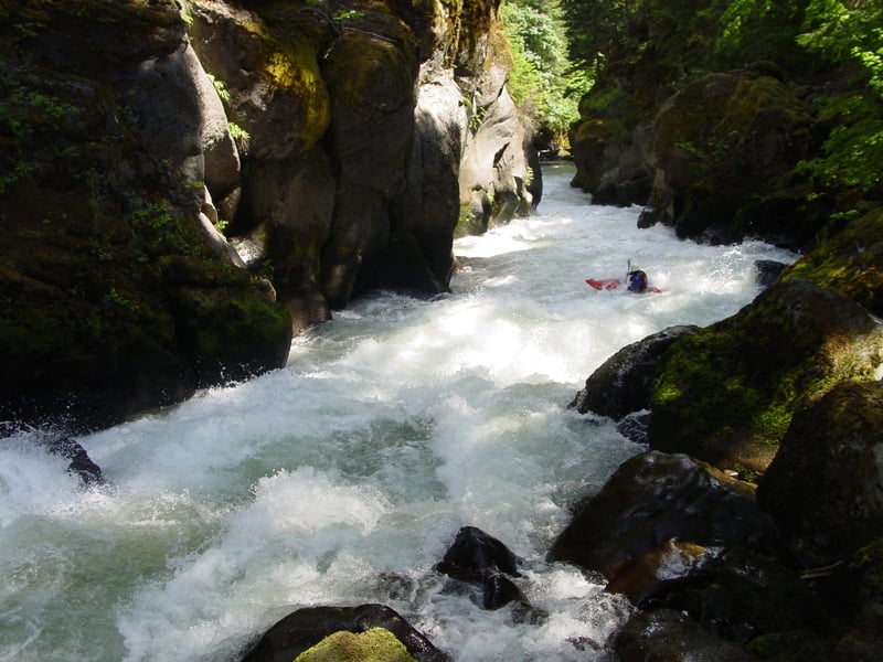
If you're out for a summer run on the Green Truss the day begins with a hot sweaty climb down into the gorge. Within a few minutes you'll be bouncing off downstream enjoying the cool waters of the White Salmon. The run begins with several fun warm-up rapids before you come to Meatball which is the first significant drop on the run. A large boulder blocks your view downstream so grab an eddy on the left to scout the landing zone. A clean run puts you in the pool above Bob's Falls.
Bob's Falls is a fun ledge drop with a meaty hole at its base. It's a good idea to set safety on this one and if it's your first time down you'll want to scout from river left. There is another fun ledge drop below Bob's and you'll soon be at the pool above Big Brother.
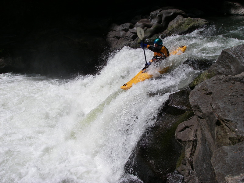
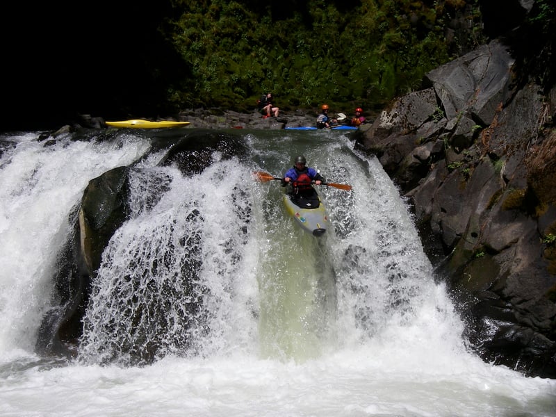
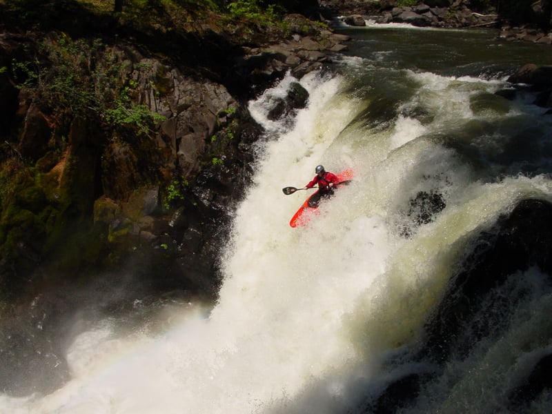
Big Brother is a 30-foot waterfall with a small lead-in drop of no more than 2 feet which is not vertical, followed by an approximately 27-foot vertical falls. The falls is fairly shallow on the river left two-thirds of the drop, with a majority of the water going over the right one-third, and then into a big hydraulic at the base of the falls with runout that flows into a cave. Running the falls requires hitting a line to thread the needle between the cave on river right and the shallow landing zone on river left. Although this drop is routinely run many choose to portage this rapid on river left. You can climb down the rock face to the pool at the base of Big Brother if you want to run Little Brother or you can continue hiking down to the base of Little Brother. Little Brother (aka The Faucet) is a great waterfall and those who portage Big Brother will likely want to consider this drop.
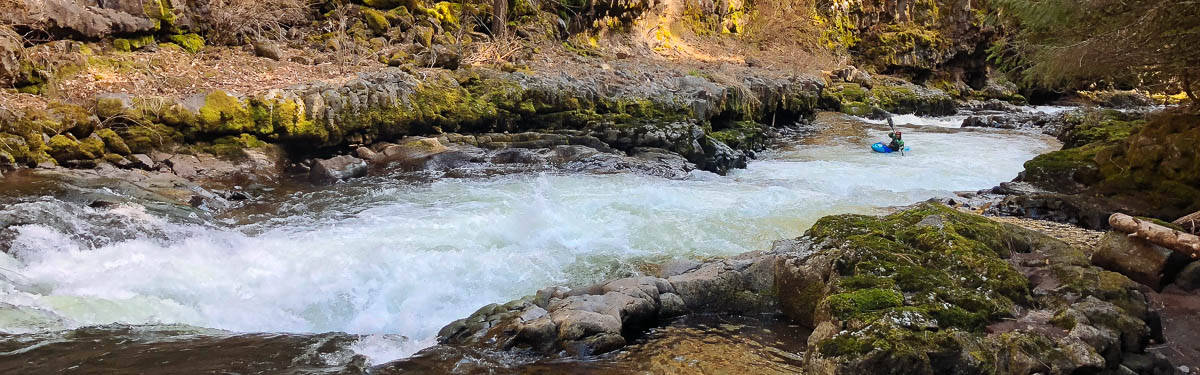
Next up is Double Drop which consists of a pair of ledge drops with a meaty hole at the base. It's easy to scout or portage this drop on the left. The drop itself is fairly straightforward--just hit the center and hang on for the ride. If you can keep your boat straight you should punch out at the bottom but if you head off course be prepared for a potentially wild ride in the bottom hole.
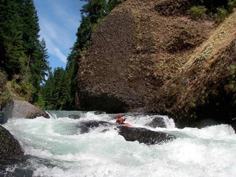
After Double Drop the pace eases up significantly and you can take the time to enjoy the canyon. Springs pour into the river and water beautiful hanging gardens that carpet the canyon walls. As you approach Cheesegrater things start to pick up again. It's time to get ready for the crux rapids of the Green Truss run. While the big drops that characterize the first third of the run can be easily scouted and portaged you must be prepared to run Zigzag Canyon.
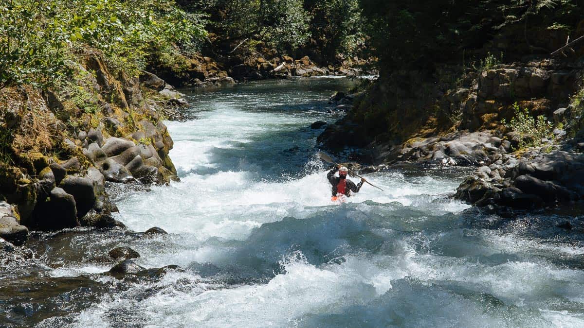
Zigzag conists of two long rapids, Upper Zigzag and Lower Zigzag both of which are approximately 200 yards long and require you to run a challenging gauntlet of ledges and holes. They are the type of rapids where it's difficult to offer any assistance so you're pretty much on your own until you get to the recovery pool at the bottom. You can scout Upper Zigzag from river right. Stay away from the wall along river left and plan out your course to get to the pool that's visible at the bottom of the drop. Once you make your way safely to the pool at the base of Upper Zigzag grab the eddy on river left and hop out for a scout of Lower Zigzag. To run Lower Zigzag you need to negotiate the ledge and hole at the top and then work your way over to the clean line down left of center.
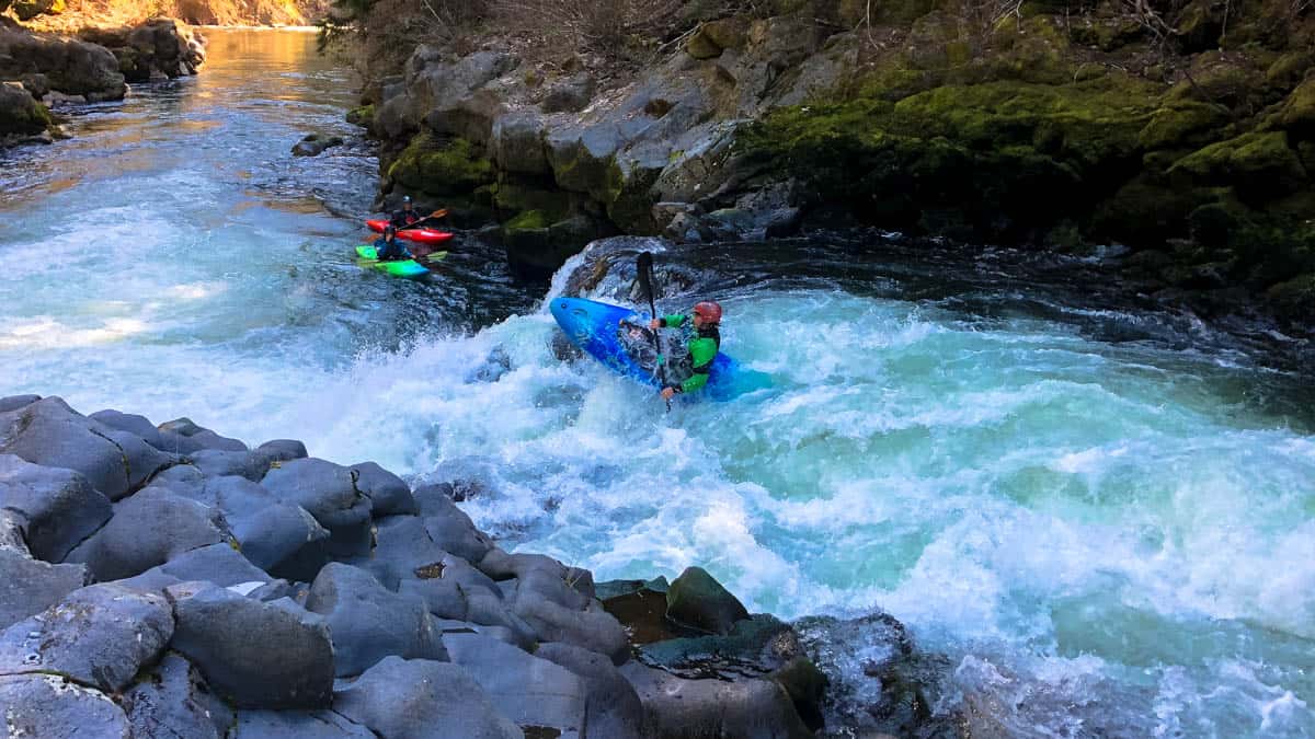
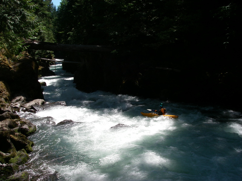
Once you make it through Lower Zigzag you can celebrate a successful trip through the most challenging drops of the run and enjoy the remaining rapids. This section is also known as the Oreletta run, the name of the family that owns property on river right that paddlers have used for access to the class IV rapids downstream of Zigzag Canyon. There are several fun drops packed into this section which are now being run by commercial rafts at lower flows. This section finishes up with the Flume before you come to BZ Falls which is probably the most challenging drop on the run. Most folks pull out on river right to portage. You can work your way down the class III entrance to BZ Falls or just pull out above this for the safe portage around the falls. Make sure you know where it is as you would not want to unintentionally float into BZ Falls.
After the portage of BZ Falls you can hop onto the boardwalk on river right or seal launch into the pool below. Continue downsteam to run Maytag which is the first drop on the BZ run. From here your choice is to use the primary take-out which requires a hike up out of the gorge on a good trail but that often requires you to fight against the commercial traffic headed down into the gorge. Alternatively you can just continue on downstream for another 7 miles to enjoy the fun class III rapids and finish off with a run of Husum Falls.
Logistics
Follow Hwy. 14 along the Columbia River and at mile 63.6 take Alt Hwy 141 north (this turn is a couple miles to the west of the Hood River bridge across the Columbia). Continue 2.2 miles to the junction with Hwy. 141 and then follow this north across the river at Husum Falls (located at Hwy. 141 mile 8.8). To reach the primary take-out continue north to the Forest Service launch site (American Whitewater lead an effort to acquire this site from private ownership with the help of the Trust for Public Land) at Hwy. 141 mile 12.8 in the town of BZ (just north of the turn-off for Glenwood Rd.).
The recommended put-in is located on private land, owned and managed by Lupine Forest LLC, where an informal kayaker trail originates at Hwy. 141 mile 17.3 across the highway from Carr Road just upstream of the Green Truss Bridge. It's 200 yards from the highway down to the river. The bank is steep but not as treacherous as the climb down the cliff band at the historic Green Truss Bridge access immediately downstream. Parking for this site is located at a DNR site a short distance down the B-700 Road which heads west from the junction of Carr Road with Hwy. 141. Please treat this site with respect and recognize that it is private property. Dispersed recreation use at this site is permitted but it is a privilege and it is important that we be responsible users. The traditional access site was at the Green Truss Bridge located at Hwy. 141 mile 17.1 where the private Winegartner road turns off the highway to the river to the Green Truss Bridge. Access was down the cliff band on the downstream river right side of the bridge. It is a hazardous put-in and there have been injuries. If you do use this access please treat the site as load/unload only and do not park at the access point or block the road that provides access to the bridge.
Additional Information
- Green Truss page on Jason Rackley's site
- Double Trouble on Jason Rackley's site
- Critical Mass for Carnage on Jason Rackley's site
- Additional information in: Bennett, J. and T. Bennett. 1997. A guide to the whitewater rivers of Washington, second edition. Swiftwater Publishing. Portland, OR.
Rapids in this Run (14)
Waterfalls (2)
Difficulty
Class V
Length
5.3 mi
Gradient
132 ft/mi
Rapids
14
Access Points
Difficulty Classes
I Easy
II Novice
III Intermediate
IV Advanced
V Expert/Extreme
VI Unrunnable
Current Conditions
5-Day Forecast
Whitewater data from
American Whitewater
American Whitewater