3. Lower Ash
Gauge Conditions
Runnable: 4.5 – 7.0 FT
Data from American Whitewater & USGS
Run Map
Run Time Estimate
Select put-in and take-out to estimate time.
Plan This Trip
See wind-adjusted speed maps, forecast planning, and detailed time estimates.
Sign in to generate an AI timing estimate for this run.
Whitewater timing varies with scouting, portages, and group pace. Use as a planning baseline.
Description
### Technical info
```
Put in elevation........430'
Take out elevation......239'
Total drop..............191'
Average drop/mile.......55'
Distance................3.5 miles
River width average.....85'
River water quality.....Poor to fair, water clarity fair.
Scenery.................poor in spots, a few factories along the way.
```
## Directions
### Put in
From Keene NH take NH route 10 south for approximately 13 miles. Take a right onto NH route 119. About 2 miles to the put in just upstream and river right from the Ashuelot covered bridge.
From Interstate 91 in Vermont take exit 2 onto route 9 into downtown Brattleboro. Take a right then follow the signs to NH 119. Follow NH 119 approximately 8 miles to the put in.
### Take out
From the put in take NH 119 west 3.5 miles into downtown Hinsdale. Look for a small dirt parking area next to the river. The new owner of the warehouse at the take-out in Hinsdale is friendly to paddlers, but requests that we park head-in by the picknick table, so as not to block a truck backing into a dock at the rear of the building.
### Description
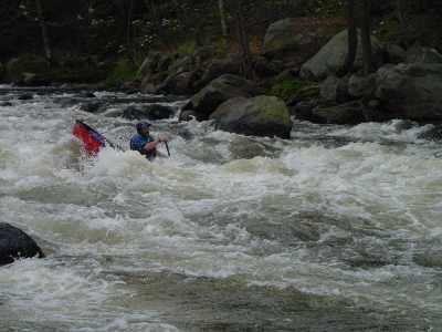
The river is broken up into three sections. Each section is seperated by a dam which must be portaged. The upper section is a nice warmup class II. The second gets a little more difficult... up to class III. The last section is the toughest...class III-IV depending on water level. The McGoldrick Dam was removed by the NH Department of Environmental Services in 2002 thereby eliminating one portage on the lower section.
Only two portages left since the other dams have either been washed out or removed. The first portage is between the Class II and III section. The second between the III and IV.
This river holds water very well since it is at the bottom of a huge watershed, it is usually one of the last rivers in New England to be running during the spring.
Video of the Ash at 5.3: http://www.youtube.com/watch?v=jsZIArarLlo&feature=colike
Rapids in this Run (3)
Difficulty
Class II-IV
Length
3.7 mi
Gradient
55 ft/mi
max 80
Rapids
3
Access Points
Difficulty Classes
I Easy
II Novice
III Intermediate
IV Advanced
V Expert/Extreme
VI Unrunnable
Current Conditions
5-Day Forecast
Whitewater data from
American Whitewater
American Whitewater