3. Lower - Base of Cullasaja Falls to Peeks Creek Bridge
No sufficiently local live gauge linked. 1 automated match was excluded because locality could not be verified. Difficulty and route details are not current water conditions.
Run Map
Run Time Estimate
Select put-in and take-out to estimate time.
Plan This Trip
See wind-adjusted speed maps, forecast planning, and detailed time estimates.
Sign in to generate an AI timing estimate for this run.
Whitewater timing varies with scouting, portages, and group pace. Use as a planning baseline.
Description
Gauge Description:
Its been scrapped down as low as 3.6, but most like to see a bit over 4.0 to pad things out.
4.6 has been stated as the optiomal level. Pads things out and covers some bad undercuts.
Its been run up to some pretty stupid levels.
The gauge is located at the SR 1620 bridge, near Vanhook Wayside Park and the take-out for the Upper Cullasaja.
There is also a gauge on the RT 1678 (Peeks Creek Road) take-out Bridge. One foot here is close to 4ft on the USGS
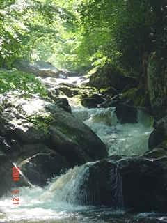
RIVER DESCRIPTION
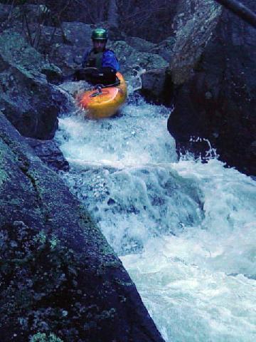
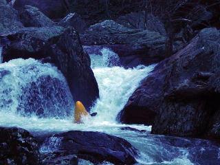
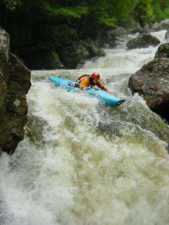
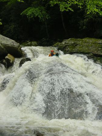
Some of the bigger drops are:
Double Drop
Eclipse
Next time
and Whale Tail.
More Info:
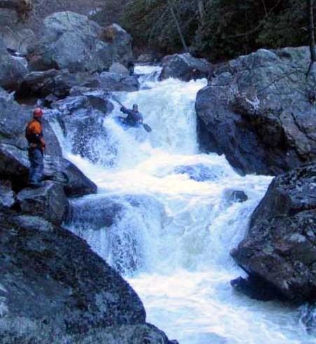
Just getting to the put-in of the Lower Cullasaja is a major workout.
First thing to do is park at the wide spot in the road that is the overlook for Cullasaja Falls. You'll be standing on the side of Highway 64 dodging cars, trucks and tourists. Carefully unload your creek boats (don't even think about a playboat on this one) and set them in a place where they won't get run over by passing vehicles, or slide 200 feet down the cliff to the base of the falls.
Get all of your gear together, and gingerly start your way down the trail to the base of the falls. Its only about a 60 degree slope. With a boat on your shoulder that qualifies as a cliff. Just picture the hike into Tallulah - sans stairs.
Someone always slips on the way down and loses a grip on thier boat. My advice is to quickly get behind the downhill side of a tree when this happens. A fifty pound boat doing about 60 miles an hour bouncing out of control down a hill can do quite a bit of damage. Another thing to be aware of working your way down the hill to the put-in is that most of those vines are poison ivey. Be careful what you grab onto.
With any luck you and your boating friends have made it to the base of the falls!! Check the first three drops for badly placed logs before you put on. Once you have made sure everything is good to go, get your skirt on the boat, get focused and peel out. Its about 4 strokes to the first class 5 drop.
From the put-in to the drop known as Whale Tail the river does not let up.
Below Whale Tale the river calms down to class IV for a little while, then class III+ boogie to the Peeks Creek Bridge.
The take-out is the bridge at SR 1678, Peeks Creek Road.
AFWS Current Rainfall Data for Macon County.
Check the Highlands gauge, 1824.
Gradients from Topo map
From the Lake Sequoyah
to Buck Creek:
1st 0.5 mi: 200 ft.
next mile: 120 ft.
next mile: 60 ft.
next mile: 120 ft.
next mile: 300 ft.
next mile: 60 ft.
next mile: 140 ft.
_See also:_ Other sections of the Cullasaja:
0\. Above the lakes (Class IV-V+) 1\. Upper (Lake Sequoyah to below Cosmic Crunch) (Class ) 2\. Middle (Below Cosmic Crunch to Above Cullasaja Falls) (Class IV(V+)) 4\. Peeks Creek Rd (NC-1678) to Peaceful Cove Rd (NC-1677) (Class II(III)) 5\. Peaceful Cove Rd (NC-1677) to Fulton Rd (NC-1668) (Class I-II)
Rapids in this Run (3)
Waterfalls (2)
Hazards & Portages (3)
Caution: The following locations may require scouting or portaging. Always check current conditions.
Difficulty
Class IV-V(V+)
Length
1.1 mi
Gradient
184 ft/mi
max 300
Rapids
3
3 Hazards
Access Points
Difficulty Classes
I Easy
II Novice
III Intermediate
IV Advanced
V Expert/Extreme
VI Unrunnable
Current Conditions
5-Day Forecast
Whitewater data from
American Whitewater
American Whitewater