3) MD.34 to Potomac River
Gauge Conditions
Runnable: 2.4 – 7.0 FT
Data from American Whitewater & USGS
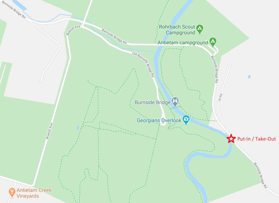
Run Map
Run Time Estimate
Select put-in and take-out to estimate time.
Plan This Trip
See wind-adjusted speed maps, forecast planning, and detailed time estimates.
Sign in to generate an AI timing estimate for this run.
Whitewater timing varies with scouting, portages, and group pace. Use as a planning baseline.
Description
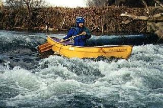
Antietam Creek is a great Class I-II run through beautiful natural scenery and the historic Antietam civil war battlefield park.
located southeast of Hagerstown, MD.
Putin at the Rt. 34 bridge (downstream side; river left) between Keedysville and Sharpsburg.
Takeout on the Potomac River at the C&O Canal camprgound located just upstream of the creek's confluence with the river.
An excellent website for the creek is maintained by Antietam Creek Canoe Co..
Description:
This section is primarily characterized by Class I-II water with rapids created by dam ruins and sharp, tight turns on this narrow creek. Spring-fed, it holds water longer than other small streams in the area and is the last to freeze and first to thaw. Practiced novice boaters should be able to handle the rapids but watch out for downed trees, which can pose serious hazards on this tree-lined run.
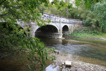
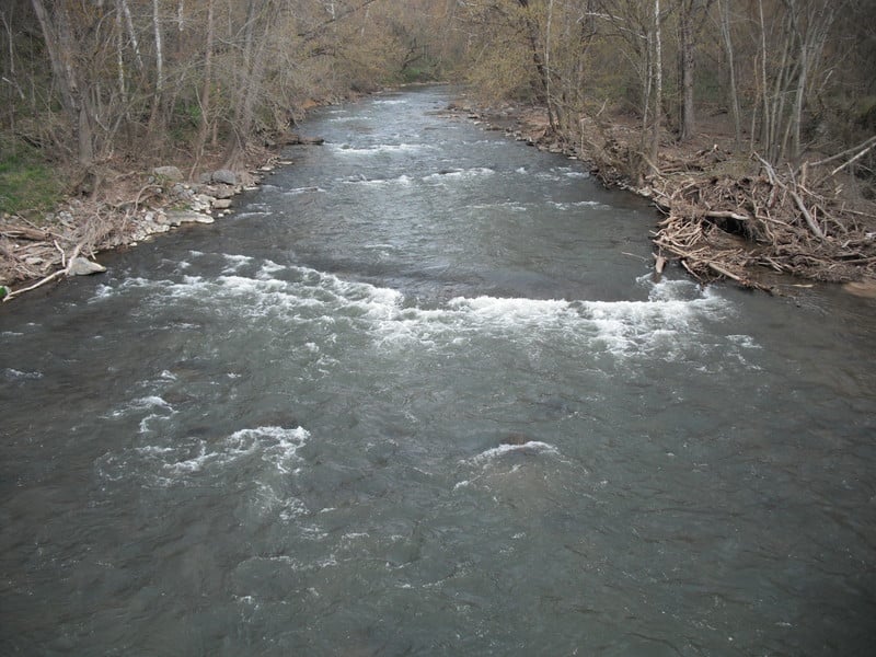
Landing at the historic Burnside Bridge at the Antietam battlefield is prohibited by the National Park Service. Below the bridge is an intact dam/weir that provides a two foot drop and bump. It is best run a little left of center. About 50 yards below the dam there is a landing on river left if you'd like to visit the battlefield site. The long middle part of the run consists of Class I moving water: shoals, eddys, small chutes and occasional strainers. Near the end of the run the gradient picks up as you approach the Potomac River.
The last rapid - Furnace Rapids - is a long Class II that can be scouted on the left. Immediately below is a bridge where an old but now closed takeout point was located. Continue down the Potomac River and paddle upstream to the takeout.
Shorter or longer trips can be made on this creek, but some of the bridge crossings other than at Rt 34 and at the C&O Canal park have historic preservation and/or landowner access issues.
Difficulty
Class I-II
Length
5.8 mi
Gradient
7 ft/mi
Rapids
4
Access Points
Difficulty Classes
I Easy
II Novice
III Intermediate
IV Advanced
V Expert/Extreme
VI Unrunnable
Current Conditions
5-Day Forecast
Whitewater data from
American Whitewater
American Whitewater