3. Middle Rd. (VA Route 628) to US Route 11
Gauge Conditions
Data from American Whitewater & USGS
Run Map
Run Time Estimate
Select put-in and take-out to estimate time.
Plan This Trip
See wind-adjusted speed maps, forecast planning, and detailed time estimates.
Sign in to generate an AI timing estimate for this run.
Whitewater timing varies with scouting, portages, and group pace. Use as a planning baseline.
Description
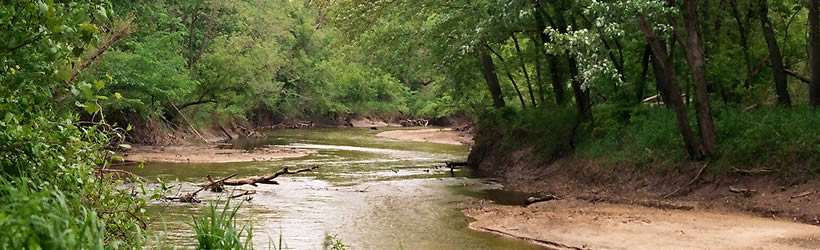
Cedar Creek is a classic VA novice trip with some mild Class II rapids scattered along its length. The Lower Cedar Creek reach is somewhat more interesting than the upper two reaches, as it has slightly bigger rapids and some scenic features such as caves and a waterfall or two.
This is the usual run that includes most of what's interesting on Cedar Creek. It is a 10.6 mile run from the Middle Rd bridge to US 11. There are some travertine outcrops just upstream from the Middle Rd. bridge that can be explored by easily paddling a short distance upstream. Keep in mind that although this is a pretty mellow river, the 10.6 mile run from Middle Rd bridge to US 11 can seem a long way to go, so give yourself plenty of daylight.
The takeout at Rt. 11 provides ample parking (this has changed) and a chance to check some differing RC gauges as described in the flow link.
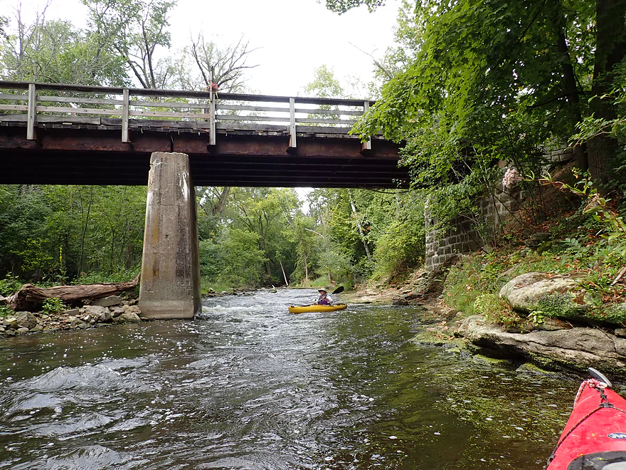
There is a low water bridge about a mile above Rt. 11 that creates a Class II rapid and which can be run right. The best rapids on the river are located here and right below.
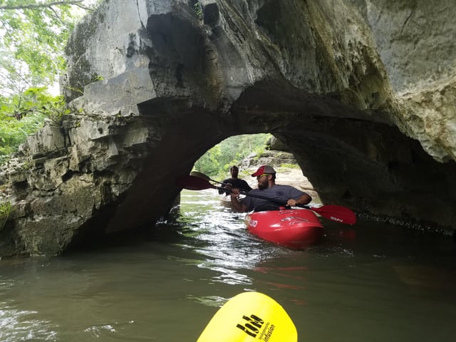
On a recent trip there was an incredible profusion of Virginia Bluebells. There are also a series of scenic cliffs that dominate most of river left and sometimes on the right. These cliffs are full of caves, including short one that you can paddle through.
See Also:
_Classic Virginia Rivers,_ Ed Grove (1992 ed), p. 144.
_Virginia Whitewater_, Roger Corbett (2000 ed.), p. 79.
_Exploring Virginia's Waterways_, Ed Gertler (2022 ed.), p. 25.
Rapids in this Run (2)
Hazards & Portages (1)
Caution: The following locations may require scouting or portaging. Always check current conditions.
Difficulty
Class II
Length
11.0 mi
Gradient
11 ft/mi
Rapids
2
1 Hazard
Access Points
Difficulty Classes
I Easy
II Novice
III Intermediate
IV Advanced
V Expert/Extreme
VI Unrunnable
Current Conditions
5-Day Forecast
Whitewater data from
American Whitewater
American Whitewater