3) North Woodstock–Woodstock
Gauge Conditions
Runnable: 350.0 – 2,000.0 CFS
Too low to scratchy low
Data from American Whitewater & USGS
Run Map
Description
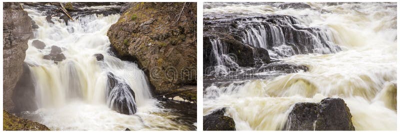
Class II river good for novice and intermediate paddlers. The two most difficult sections are right at the begining and at the take out. Both can be easily avoided by portaging.
### Technical info
```
Put in elevation........718'
Take out elevation......605'
Total drop..............113'
Average drop/mile.......27'
Distance................4.25 miles
1st mile drop...........38'
2nd mile drop...........30'
3rd mile drop...........12'
4th mile drop...........20'
River width average.....40'
River geology...........small granite boulders and lots of ledge
River water quality.....Good, clarity good.
Scenery.................Good, but highway, homes, and a race track can be heard
but are usually just out of sight.
Wildlife................Deer, Moose, lots of hawks.
```
## Directions
### Put in
From Rte Interstate 93, take exit 32 in North Woodstock. Take a right at the end of the exit ramp (from north and southbound ramps) and head west to traffic light about 1/4 mile
Left on NH route 3 South 1/4 mile to Woodstock fire station, left to parking behind station.
### Take out
Continue south on NH route 3 from the put in.
1/4 mile take a left on NH route 175
Continue on NH route 175 for approximately 4 miles passing the exit 31 highway access. About a 1/3 mile after passing over the river look for 'Death Valley Road' on the right which is a short dirt road directly across the street from the 'other' Woodstock Fire station.
Another alternative way to get to the take out is to head back to Interstate 93 from the put in then head south
Take exit 31 and take a right then an immediate left on NH route 175 then continue as above.
## Campgrounds
The following is a list of campgrounds more suited for tents and small campers, there are a variety of private campgrounds that cater especially to RV's, they are not listed here but can be found in any national campground directory.
Hancock: National Forest campground on the East Branch of the Pemi in Lincoln open year round, 4 miles east of Lincoln exit 32 off of I93 on route 112 (Kancamaugus highway).
Russell Pond: National Forest campground open May to Columbus day, located on a high elevation lake in Woodstock, take exit 31 off of I93, head east on Tripoli road toward Waterville Valley, take a left at the sign for Russell Pond campground, 2 miles to the top of the hill.
Tripoli road: Primitive roadside camping with no facilities, open May to Columbus day, take exit 31 off of I93, head east on Tripoli road toward Waterville Valley, just after the left for Russell pond campground there is a forest service trailer, stop here and pay for your camping permit.
Osceola campground: National forest campground located in Waterville Valley, open May to Columbus day, great views of surronding mountains, take exit 31 off of I93, head east on Tripoli road (dirt) 8 miles toward Waterville Valley, look for the campground sign on your left, this one is rather far from the rivers.
Campton campground: National forest campground located in Campton/Thornton, open May to Columbus day, take exit 28 off of I93, head east on NH 49 toward Waterville Valley, 3 miles to sign, group camping on the right individual sites located on the left.
Branch Brook: Private campground located on the Pemigewasset river in Campton, open May to Columbus day, take exit 28 off of I93, head east on NH 49, 3/4 of a mile to the campground on the right.
Flow Info:
USGS gage located just above the ledges section behind the firestation. This section can and does rise and fall rapidly due to the steep upper watershed. High water is usually found in late April and early May. Medium water mid May through early June. Low water through the Summer sometimes high enough to run especially after a rain event. Forecast
Too low to scratchy low......350cfs - 500cfs
Low..........................500cfs - 850cfs
Medium.......................850cfs - 1500cfs
High.........................>1500cfs
Estimated chance (%) of finding the river runnable.
Month............% chance.................comment
```
January ............ 0%....frozen. February.............0%....frozen.March................5%....Usually frozen. April...............75%....Best chance mid to late April May ................85%....Runnable most of the monthJune.................45%July.................40% August...............35%....A thunderstorm could bring it up September...........45%....Tropical storms and their remains October........Â
....60%November............70%....Fall rains, dormant treesDecember............45%....River starts freezing about Christmas
```
Be aware this is averaged out over several years. The % chance refers to the probability of finding the river running on any given day. For instance a 35% probability for August means on average you can only expect 10 days of water. One year there could be 20 days in August with water, other years none. Spring levels are usually higher than fall levels. The river rises and falls rapidly because of the steep watershed. An occasional summer storm could bring the river up for a day. People often run this stretch lower than the recommended minimum flows with some wading in the shllows.
Rapids in this Run (4)
Hazards & Portages (1)
Caution: The following locations may require scouting or portaging. Always check current conditions.
Difficulty
Class II
Length
4.4 mi
Gradient
27 ft/mi
max 38
Rapids
4
1 Hazard
Access Points
Difficulty Classes
I Easy
II Novice
III Intermediate
IV Advanced
V Expert/Extreme
VI Unrunnable
Current Conditions
5-Day Forecast
Whitewater data from
American Whitewater
American Whitewater