3. Paola Access to Moccasin Creek Wild
Gauge Conditions
Runnable: ? – ? CFS
Approximate reading: This gauge is 18.3 miles away on Flathead. Use as a general reference only.
Data from American Whitewater & USGS
Run Map
Put-in
Take-out
Rapids/Hazards
Wild
Recreational
Run Time Estimate
Select put-in and take-out to estimate time.
Plan This Trip
See wind-adjusted speed maps, forecast planning, and detailed time estimates.
Sign in to generate an AI timing estimate for this run.
Whitewater timing varies with scouting, portages, and group pace. Use as a planning baseline.
Description
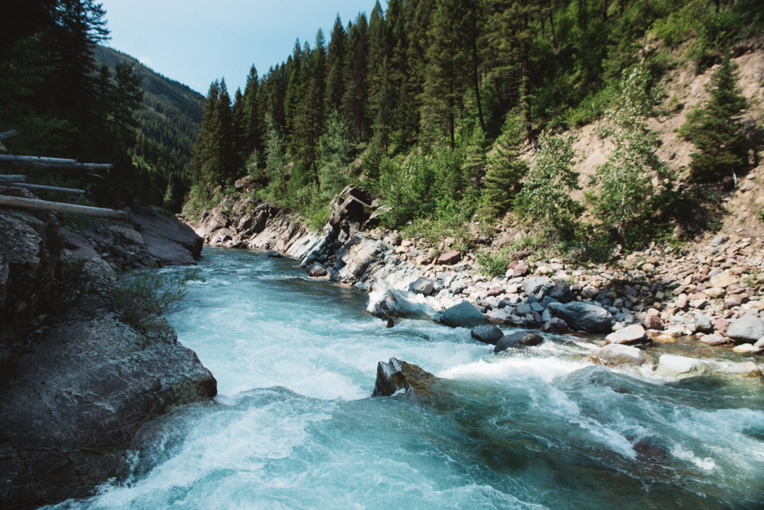
This section of the Middle Fork Flathead combines two distinct reaches that together, or in combination with upstream or downstream sections, make for a rewarding overnight trip. Boaters should be aware that this reach has some private land and a few homes along river left. A current land ownership map is helpful to ensure you camp only on public land. Dispersed camping is permitted on Forest Service land on river left. Glacier National Park on river right does not issue camping permits for river floaters but there are some gravel bars on river right that are within the active channel.
The first distinct reach is 11.6 miles from Paola to Cascadilla where the river flows through a scenic corridor of forested slopes and gravel bars. Some good camping options are available between Muir Creek and Coal Creek. Brown’s Hole Rapid provides the most notable whitewater in this section, though it is not a significant factor at low summer flows. Overall this stretch is mellower compared to the more sustained rapids found upstream or farther downstream, making it a pleasant run for those looking to soak in the scenery without committing to continuous technical paddling.
Below Cascadilla, the river continues another 6.4 miles to Mocassin Creek. About 1.5 miles downstream of Cascadilla, the river leaves the highway and enters the Nyack Flats, a broad valley of braided channels and wide gravel bars. Here paddlers find open vistas, shifting channels, and at times logjams to navigate. The views across the valley into Glacier National Park are especially striking. Large cobble bars provide excellent opportunities for riverside camping.
Take-out logistics are important to consider. Cascadilla is the standard and most straightforward access point, and it works well as the end of a day trip or short overnight from Paola and is a suitable access for larger rafts. While this segment continues 6.4 miles farther to Mocassin Creek, that access is far from ideal—it requires paddling or lining boats up Deerlick Creek, something manageable in kayaks or at low flows but a real hassle in larger craft. For most groups with rafts, Cascadilla is the practical endpoint unless you plan to continue farther downstream.
As with all stretches of the Middle Fork Flathead, this is a designated Wild and Scenic River and deserves the highest level of care. Clean, drain, and dry your gear to prevent the spread of invasive species, and practice Leave No Trace ethics when camping on the gravel bars.
Rapids in this Run (3)

Difficulty
Class II-III
Length
18.0 mi
Rapids
3
Access Points
Difficulty Classes
I Easy
II Novice
III Intermediate
IV Advanced
V Expert/Extreme
VI Unrunnable
Current Conditions
5-Day Forecast
Whitewater data from
American Whitewater
American Whitewater