3. Pontook
Gauge Conditions
Runnable: 0.0 – 749.0 CFS
Data from American Whitewater & USGS
Run Map
Run Time Estimate
Select put-in and take-out to estimate time.
Plan This Trip
See wind-adjusted speed maps, forecast planning, and detailed time estimates.
Sign in to generate an AI timing estimate for this run.
Whitewater timing varies with scouting, portages, and group pace. Use as a planning baseline.
Description
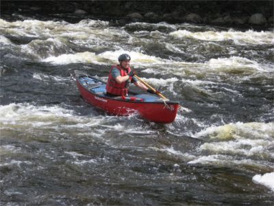
A nice class II in the north woods of NH. Good place to see moose.
### Technical info
```
Put in elevation........1154'
Take out elevation......1100'
Total drop..............54'
Average drop/mile.......23'
Distance................2.4 miles
River width average.....75'
River geology...........Small to medium granite boulders
River water quality.....Good, clarity fair to good.
Scenery.................Good mountain and forest scenery.
Wildlife................Deer, Moose, Merganzers, Blue herons, Bald eagles.
```
Check out the Androscoggin River Watershed Council for more information on this river.
Summer Recreational Releases
The Pontook releases every weekend from Memorial day weekend
through two weekends following Labor Day.
Releases start at 10 am and conclude at 4pm
https://brookfieldprod.blob.core.windows.net/files/63711695406-2020%20Pontook%20Dam%20Release%20Schedule%20SafeWaters%20(003).pdf
Pontook\
Flow Info
## Directions
## Erroll NH...Gateway town
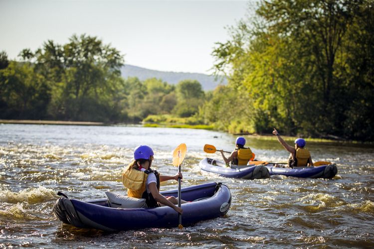
Errol NH located in northern NH close to the Maine border offers a wide range boating opportunities all summer long. This area offers some of the most remote regions in the eastern US. Wildlife is plentiful and may include Moose, bear, Loons, Bald Eagles etc. In addition Lake Umbagog located just north of Errol is a federally protected National Wildlife Refuge.
The Errol rapid located on the east side of Errol is a short class II section good for training and novices. Saco Bound (Northern Waters) has set up a small outfit here on the western shore with a campground, paddling school, and small boating shop. Water is controlled by a hydro dam just upstream from the campground and runs through this section every summer day. This section is onlabout 1/3 of a mile long and boaters usually carry back upstream and run it several times a day.
The Pontook section of the Androscoggin is about 15 miles south of Errol on route 16. This section offers a longer and more interesting class II run. Pontook dam releases most weekends.
Starting in late June and ending in late August, the Magalloway and Rapid rivers offer more challenging boating.
The Magalloway located 20 miles north of Errol in Wilson Mills Maine, offers class III and V boating on the upper stretch. Releases are on weekends starting in late June through the second week in July. The Rapid then has four release weekends until the middle of August then once again the Magalloway finishes up the month of August with weekend releases.
The Rapid River offers class IV boating in a remote setting. The Rapid can only be reached via a maze of logging roads just outside of Upton Maine about 10 miles east of Errol.
Campgrounds / Lodging /Rafting
· Errol Motel, Main St, Errol, NH 03579, (603-482-3256)
· Northern Waters (Saco Bound), Kayaking school, camping, excursions, paddling shop.
Phone: 603.447.2177
· Magalloway River Inn, Route 16, Errol, NH 03579, (603-482-9883)
· Aziscohos Valley Camping Area, Route 16 Wilson Mills Maine (207-486-3271)
· Mollidgewock State Park Campground, Route 16 Errol, NH Phone: 603-482-3373 Reservations: 603-271-3628
· Lakewood Camps: 207.243.2959
· Log Haven Campground: 603.482.3294
· Umbagog Outfitters P.O. Box 268 Errol, NH 03579
phone: 603-356-3292
Food
· The Northern Exposure: Main St Errol, NH, 03579, (603) 482-3852
· Errol Cream Barrel & Chuck Wagon 482-3258
Main Street, Errol NH 03579
Rapids in this Run (2)
Hazards & Portages (1)
Caution: The following locations may require scouting or portaging. Always check current conditions.
Difficulty
Class II
Length
2.5 mi
Gradient
23 ft/mi
max 35
Rapids
2
1 Hazard
Access Points
Difficulty Classes
I Easy
II Novice
III Intermediate
IV Advanced
V Expert/Extreme
VI Unrunnable
Current Conditions
5-Day Forecast
Whitewater data from
American Whitewater
American Whitewater