3. Rockville to Jenkinsburg Bridge (Cheat River)
Gauge Conditions
Data from American Whitewater & USGS
Run Map
Description
Run Description
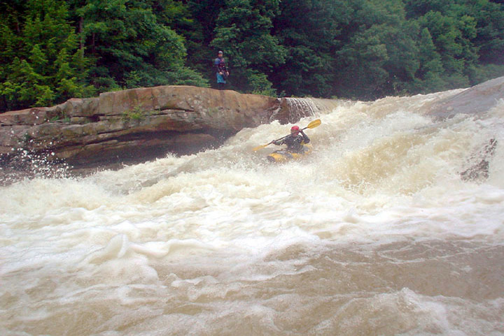
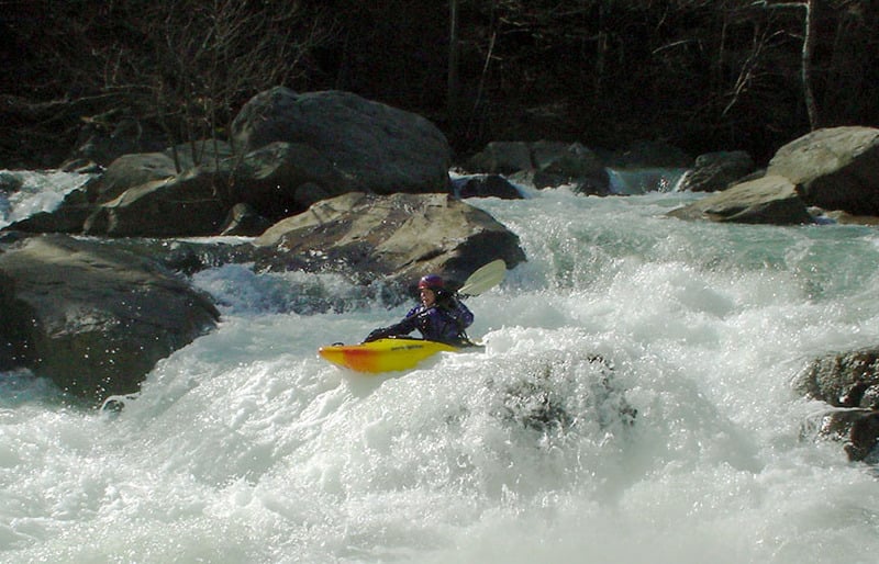
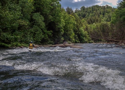
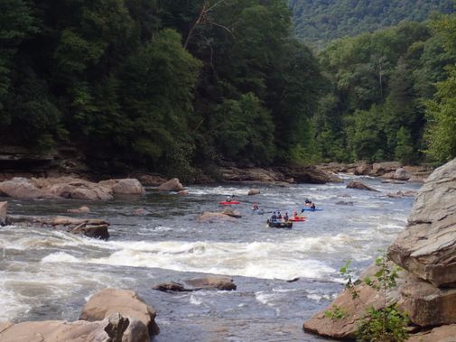
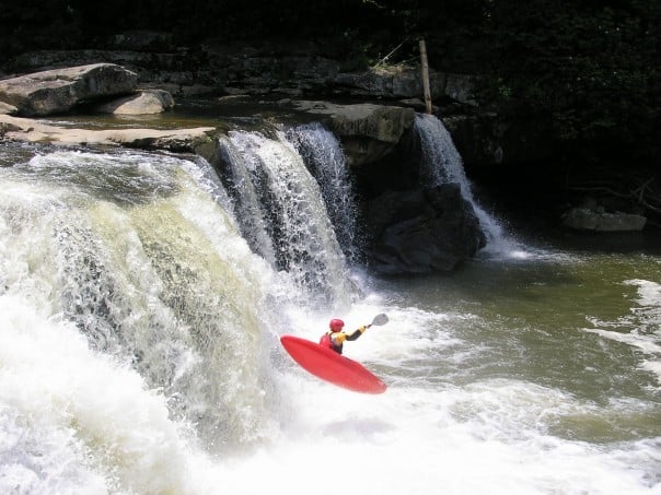
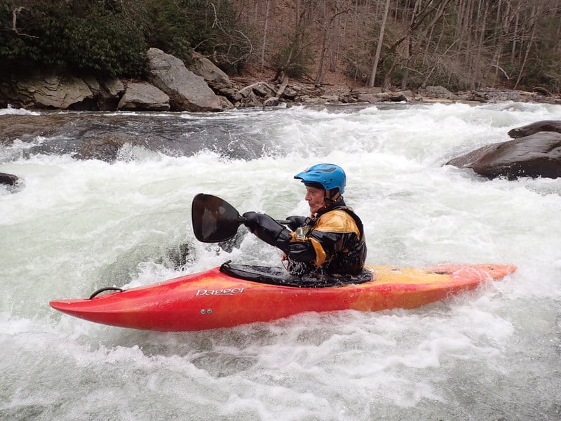
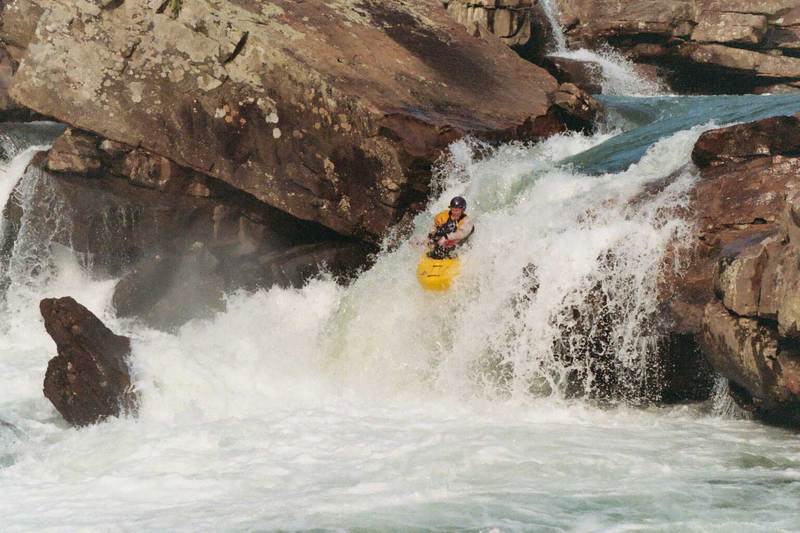
The Big Sandy is becoming more popular every year as the jewel of the Cheat River watershed, the largest undammed watershed east of the Mississippi. The run includes two waterfalls--Wonder Falls and the more challenging Big Splat--along with several technical class IV rapids. Big Splat is an AW Standard Rated Rapid with a difficulty of 5.1 when the Rockville Gauge reads 6.1.
At higher water levels (> 6' at Rockville), it's often fun to run the Upper Big Sandy or the Little Sandy before the Lower. This gives a longer run including good play and scenery, and it gives those who don't want to tackle the Lower a good opportunity to enjoy the Sandy without fear. You'll find a nice surfing wave at the Rockville putin, and a great view of the beautiful Sovern Run Falls.
For a Go Pro helmet cam video of Wonder Falls, Zoom Flume, Little Splat, and Big Splat, go to http://www.youtube.com/watch?v=nRcwW2Bs-rU
Keel Hauler Rating - 31
Logistics
For those coming from the West, there is now a better road that goes South to Rockville from Morgantown Road. Turn under I-68 at Laurel Run and follow to the NEW put-in parking lot. See the Keel-haulers' map.
From the East or South, you can still head south from Bruceton Mills(I-68) or north from Albright on WV 26 to Valley Point (just about 6 miles from either direction). Look for the turn-off to Hudson Road (WV 15), take it west for 4.8 miles, and turn right down towards the river. Continue another couple miles (bear left at the next fork) to the bridge across the river. This access ends with a mile of rutty, muddy road to the Rockville Bridge and parking is limited on busy weekends. Those who don't have good 4WD often carry or drag their boats down to the bridge. To reach the takeout, head back up to Hudson Road and continue 2.3 miles west down to the Cheat River at Jenkinsburg.
High Water Info
Here's Bob Gedekoh's description of alternate high-water lines on the Sandy:
> Here are some 'High Water' Sandy Tips
>
> If you are nervous about the approach rapid to the falls it is possible to run it on river right if the river is above 6.3 or so. Scout this line first if you dont know it. At the bottom you will drop over a five- or six-foot ledge. When the river is above 6.8 most folks go this way.
>
> Actually the recycle at the bottom of Wonder Falls can get nasty if you miss the boof at levels greater than 6.6. _(Editor's note: some swear that the recycle gets nasty at 6.5.)_ At 7 feet you really need to be on line and make the boof correctly... or risk a dangerous thrashing in the recycle at the base of the falls. When the river goes above 7.1 or 7.2 there is another completely different way to run the falls on river left... not far from shore. But don't try it any lower than 7.1 or you will piton. Even at 7.2 you need to paddle off the lip fast and keep your nose up to use that river left line. I have run this river left line as high as 8 feet.
>
> Another high-water line opens up at Zoom Flume at 6.5 on river left. It is a slide into and over an eight foot ledge. If you try this make sure you don't get pushed into the pin spot about five feet to your right at the brink of the ledge. The recycle at the bottom of this ledge gets nasty at about 7.3 and will recycle you if you don't clear it. This recycle is hard to escape. So if the Sandy is above 7.4 or so, consider going back to the usual Zoom Flume line (which is explosive), or scout the center and try to find another route.
>
> When the river goes above 6.7 or so it becomes very hard to portage Big Splat on the right because you can't get back into your boat on the launch ledge. An alternate high-water Splat portage is available on river left.
>
> At 7.5 and higher, there is a nasty hole at the bottom of the first rapid below Big Splat. I got caught in it a couple of weeks ago at eight feet and had to abandon ship. The worst part of that experience was that I had to be rescued by the son of a keelhauler. Oh, the shame of it!!!!
>
> The Big Sandy above seven feet can be fun, but it is serious business. If you attempt it, make sure you are with a strong group.
>
> Note: The mileages given for the rapids, described below, are pretty much guesswork. We'll nail that down with a GPS thingie...someday.
Rapids in this Run (4)
Waterfalls (1)
Hazards & Portages (3)
Caution: The following locations may require scouting or portaging. Always check current conditions.

Difficulty
Class IV-V
Length
5.1 mi
Gradient
79 ft/mi
max 110
Rapids
4
3 Hazards
Access Points
Shuttle Info
Logistics:
For those coming from the West, there is now a better road that goes South to Rockville from Morgantown Road. Turn under I-68 at Laurel Run and follow to the NEW put-in parking lot. [See the Keel-haulers' map.](http://www.keelhauler.org/khcc/cheat3.jpg)
From the East or South, you can still head south from Bruceton Mills (I-68) or north from Albright on WV 26 to Valley Point (just about 6 miles from either direction). Look for the turn-off to Hudson Road (WV 15), take it west for 4.8 miles, and turn right down towards the river. Continue another couple miles (bear left at the next fork) to the bridge across the river. This access ends with a mile of rutty, muddy road to the Rockville Bridge and parking is limited on busy weekends. Those who don't have good 4WD often carry or drag their boats down to the bridge. To reach the takeout, head back up to Hudson Road and continue 2.3 miles west down to the Cheat River at Jenkinsburg.
Charlie Walbridge pointed out on 2005-05-04:
"Mountain Streams and Trails, the new owner of the Jenkinsburg Access, asks that private paddlers running the Cheat and Big Sandy use the Upper Parking Lot during Cheat Fest Weekend. The Lower Parking Lot must be kept clear for outfitter trucks and buses. Vehicles parked there make maneuvering these big rigs difficult or impossible. _(This is good advice for any high-traffic weekend.)_
"So please park right and give a big THANK YOU to any MS&T employees you see on or off the river!"
Another option if you don't want to torture your car's suspension is to call Glenn Miller (304-379-3404), whose shuttle service is reasonably priced and very convenient. Show up on time, and whatever you do, don't stand him up! Glenn is a famously nice guy, and he and his service deserve respect.
Difficulty Classes
I Easy
II Novice
III Intermediate
IV Advanced
V Expert/Extreme
VI Unrunnable
Current Conditions
5-Day Forecast
Whitewater data from
American Whitewater
American Whitewater