3 - Tallassee Shoals to Ben Burton Park
Gauge Conditions
Runnable: 200.0 – 4,000.0 CFS
Suitable for novice paddlers
Data from American Whitewater & USGS
Run Map
Run Time Estimate
Select put-in and take-out to estimate time.
Plan This Trip
See wind-adjusted speed maps, forecast planning, and detailed time estimates.
Sign in to generate an AI timing estimate for this run.
Whitewater timing varies with scouting, portages, and group pace. Use as a planning baseline.
Description
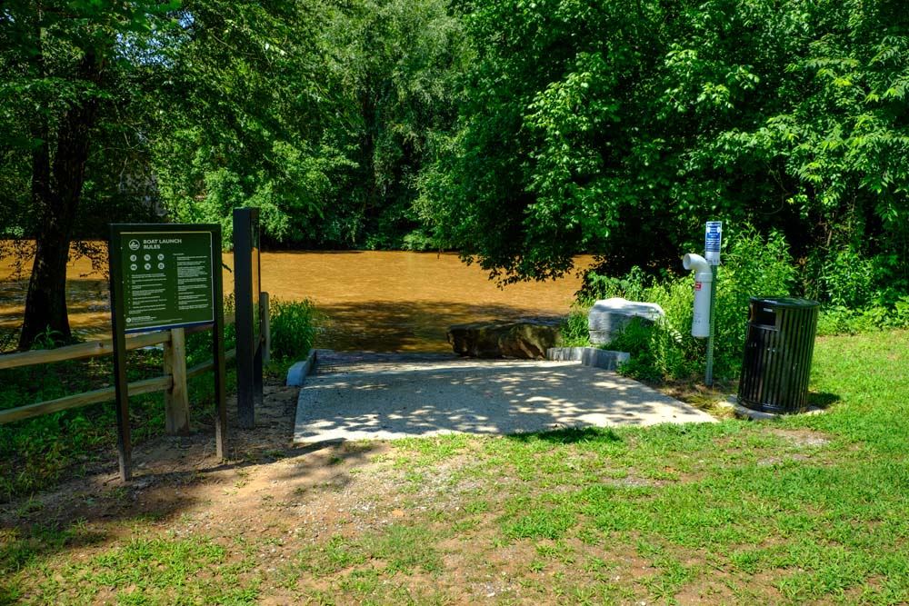
A 25 foot tall dam resides on this section 1/2 mile below the hwy 330 bridge. The dam is dangerous and the portage on river right traverses difficult terrain. Thus it is suggested to park at an access easement at the end of Big Bear Road (look for a 3-4 car parking area) and hike down to the river and then upstream a bit, putting in at the base of the dam (there is a link to Google Map directions on the Access tab). As of 2021 the dam operator is in the process of constructing a portage trail on river right.
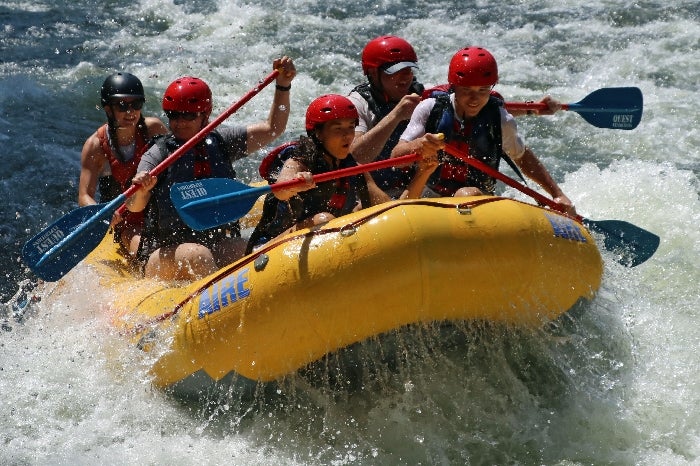
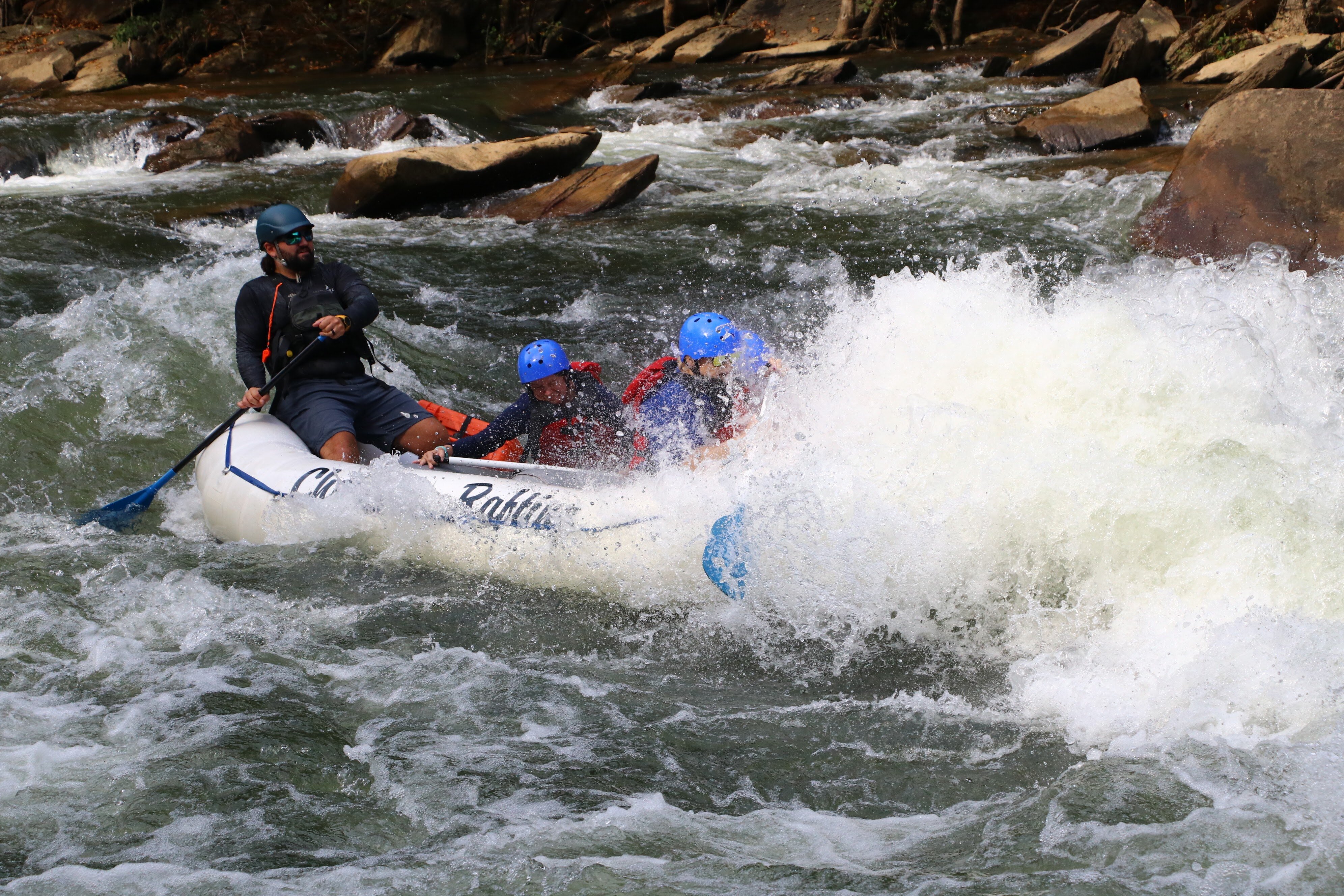
Tallassee Shoals rapid starts at the base of the dam, gently dropping 20 feet over 0.4 miles. Because water is diverted for hydropower, the shoals is a knuckle dragger until levels exceed 1100 cfs. Above 1300 cfs Tallassee Shoals is a mini-Ocoee, with multiple waves and holes that can be surfed. A river right trail allows doing laps on this section though do be conscientious of property owners. When flows exceed 2,400 cfs the shoals become class IV due to many large hydraulics.
The next 6 miles is a relaxing class I float. Do keep an eye out for two pipes that cross the river. Depending on the level the pipes may be difficult to get over. The gradient picks up at the end, marking the beginning of Ben Burton Shoals, a fast class III. The remnants of a dam at Ben Burton make for hazards so helmet is suggested. There is a county-maintained access point on river left.
More about the flows at Tallassee Shoals:
Up to 850 cfs can be diverted for hydropower. The dam operator is required to maintain a year round minimum flow of 70 cfs through the shoals and 138 cfs in May, for aquatic habitat. At these low flows, much of the shoals is not runnable but they can be walked or waded. Starting at around 1100 cfs on the Arcade gauge enough water is spilling over the dam and down the shoals to make the shoals mostly runnable. Above 1300 cfs a variety of fun play holes and waves start to form. Some of the features are small but great for spins and low angle cartwheels. The best wave is about 2/3rds the way down the shoals but is challenging to get back to from the side eddies. Keep an eye out for a retentive play hole which comes in at various levels on river right at the bottom of the shoals. At 5000 cfs and up there are numerous large waves to surf but most are caught on the fly.
Rapids in this Run (3)
Hazards & Portages (3)
Caution: The following locations may require scouting or portaging. Always check current conditions.
Difficulty
Class I-III
Length
7.5 mi
Gradient
10 ft/mi
max 40
Rapids
3
2 Hazards
1 Portage
Access Points
Shuttle Info
A 25 foot tall dam resides on this section 1/2 mile below the hwy 330 bridge. The dam is dangerous and the portage on river right traverses difficult terrain. Thus it is suggested to park at an access easement at the end of Big Bear Road and hike down to the river. If the flow is below 900 cfs, then hike or scrape your way down the shoals about 100 yards. The flow from the bypass returns to the main channel at this point.
The takeout is at county-maintained access point river left.
[Link to shuttle route on Google Maps](https://goo.gl/maps/hHv2PTL3MqQ2)
Difficulty Classes
I Easy
II Novice
III Intermediate
IV Advanced
V Expert/Extreme
VI Unrunnable
Current Conditions
5-Day Forecast
Whitewater data from
American Whitewater
American Whitewater