3 - Taylor River to Concrete Bridge Wild
Gauge Conditions
Runnable: 1,000.0 – 3,000.0 CFS
The gauge is about a mile below the concrete bridge (the last takeout for this run). There are several large tributaries, including the Pratt River, so what yo
Data from American Whitewater & USGS
Run Map
Put-in
Take-out
Rapids/Hazards
Wild
Scenic
Run Time Estimate
Select put-in and take-out to estimate time.
Plan This Trip
See wind-adjusted speed maps, forecast planning, and detailed time estimates.
Sign in to generate an AI timing estimate for this run.
Whitewater timing varies with scouting, portages, and group pace. Use as a planning baseline.
Description
SEASON: November rains and spring snowmelt. A consistent performer on weeknights late April through early June.
FUN FACT: One of the most scenic river trips easily accessible as a day trip from the Seattle area.
LOGISTICS: To reach the river take exit 34 off I-90 and head north on 468th Ave. past the truck stop. The Middle Fork Road (FR 56) turns off to the right in 0.5 miles. Continue up this road to mile 5 and the Granite Creek Access (aka Concrete Bridge), which is on the downstream river left side of the bridge. This site is the traditional division between the Upper and Middle runs, but many paddlers looking to spend more time on the Upper Middle's best rapids will continue upstream to Russian Butte View access which serves as an alternate take-out. This site is at mile 8 on DNR land just before you reach the Forest Service boundary at a point where the river comes up along the road, and a short distance downstream of the Pratt River confluence. This access can also be used as a put-in for those who want to start their trip here and then continue down on the easier first section of the Middle-Middle, taking out above First Island Drop (this run is known as "The Mupper" - make sure to scout the takeout, as the access below First Island Drop is full of trees).
For the put-in, you can continue up to mile 10.2 and a site known as Riverbend where the river runs up along the road at an unimproved camp site. This alternative puts you in downstream of Rainy Creek Rapid. For those interested in the full run, continue up to mile 11.3 and a small pull-out along the river known as Bridge View just before the turn into the Middle Fork Trailhead. The Forest Service has asked paddlers to use this site instead of parking at the trailhead and scrambling under the foot bridge. The Bridge View access is suitable for either rafts or kayaks. If you want to put in a couple miles higher and enjoy the incredible backdrop provided as you paddle past Mt. Garfield this is also an option (it also adds one more fun rapid at the Taylor River confluence). Continue up the Middle Fork Road road to mile 12 where you will cross the Taylor River and within 100 yards the Middle Fork Road continues by turning off to the right where it heads up a short hill (it's easy to miss this turnoff as the spur road, which looks like the main road and continues straight, comes to a gated dead end). From this point on the road is in poor condition but accessible by car. At mile 14.8 on this road you will see a pull-out marked by large rocks and a trail that leads into the river about 100 yards. This is a relatively new river access following purchase of this property by the Cascade Land Conservancy and transfer of the land to the Forest Service in 2006.
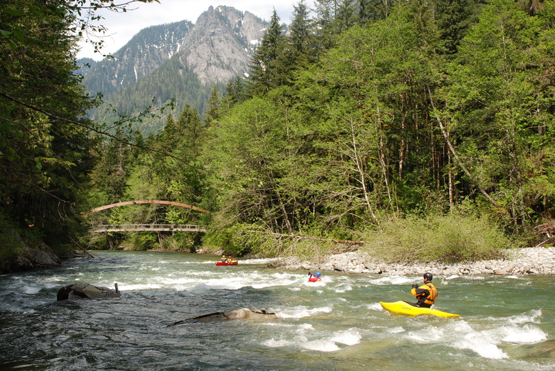
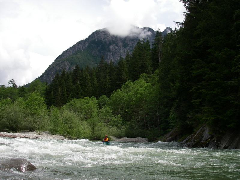
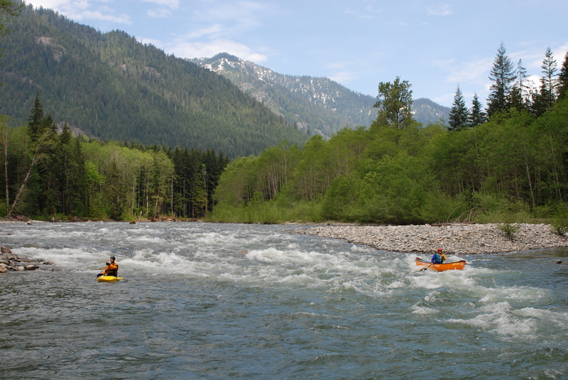
DESCRIPTION: This is a fun little run with beautiful mountain views. The rapids are not particularly difficult, but there are a lot of them and the current is always moving.
There are a couple of rapids that go right into headwalls. At higher flows, you can run these rapids far right and avoid the headwalls altogether. If you run the main wavetrain, avoid the instinct to try to paddle right at the bottom to avoid the headwall, as you will just get stuck in a huge eddy line and flip like I always do!
The action starts to taper off a bit once you pass the Pratt River confluence but many continue on downstream to Concrete Bridge. You can also extend the run even further by continuing on the first part of the Middle-Middle and taking out below First Island Drop at the old DNR Mine Creek Campground. This adds 3 great class III rapids, as well as some long, sweeping class II+ rapids, and the takeout is no harder than the one at the Concrete Bridge.
_with contributions from David Elliott_
Difficulty
Class II
Length
8.0 mi
Rapids
5
Access Points
Difficulty Classes
I Easy
II Novice
III Intermediate
IV Advanced
V Expert/Extreme
VI Unrunnable
Current Conditions
5-Day Forecast
Whitewater data from
American Whitewater
American Whitewater