3. Taylorville Section
Gauge Conditions
Runnable: ? – ? CFS
Approximate reading: This gauge is 5.1 miles away on Beaver. Use as a general reference only.
Data from American Whitewater & USGS
Run Map
Description
## River Guide Video
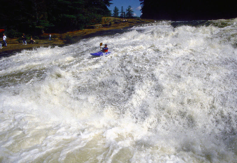
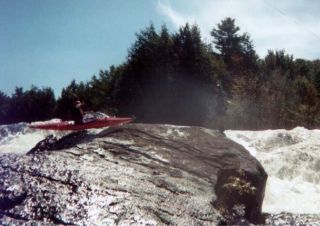
Releasing on weekends in September, this is the easiest of the three Beaver sections. This one-mile stretch offers an introduction to creeking. It's easy to shuttle up and run it two, three, or (pushing it!) four times in a release day.
Also see the Moshier Section (Class IV-V), which runs on Labor Day weekend, the Eagle Section (Class V-V+), which runs on a similar schedule to the Taylorville Section, and the Raquette River, Stone Valley Section.
Posted by Chris Koll:
The releases are a product of negotiations by American Whitewater that resulted in a series of 11 whitewater releases during a typical year spread over three challenging sections of Beaver River whitewater. The sections are dry except for release days when Orion Power allows water to spill back into the natural river bed creating whitewater runs ranging from class 3 to class 5.
The runs are typically short--varying in length from one to four miles--and on most release days water is scheduled on two different parts of the river. Boaters can easily paddle one section of the Beaver in the morning and then catch a second section in the afternoon.
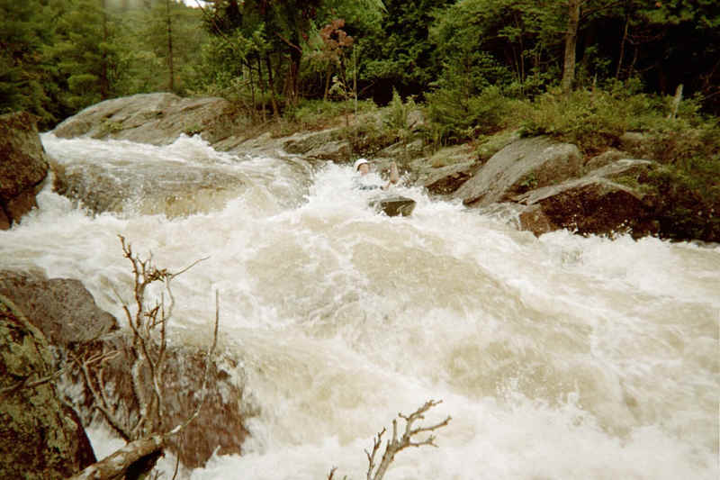
The whitewater sections include the Taylorville run, a 1.5-mile stretch that features six class 3-4 drops. While some of the drops appear intimidating--particularly a steep 30-foot slide--the rapids are fairly straightforward and are appropriate for strong intermediate paddlers looking for an introduction to steep creeking.
The Moshier section is the jewel of the river, a 4-mile run that includes two runnable waterfalls, a number of easy class-3 rapids, and concludes with a long, technical class-5 rapid composed of four discernible drops. The section is appropriate for experts or strong intermediates with judicious scouting and/or portaging.
The Eagle section is short and demanding. Only a mile in length, the run starts off with four class 5 drops where the river drops the equivalent of 475 fpm. Eagle is a demanding expert run.
Questions regarding the Beaver can be directed to Chris Koll by email or by calling 315-652-8397.
And now for something completely different: Click here, here, and here for Karl Gesslein's view of the Beaver. (Clicking will open up a new browser window.) If you like that, check out some more drawings here.
Tug Hill - Old Forge Area Reaches
Beaver (1. Moshier)Beaver (2. Eagle) Beaver (3. Taylorville)
Black (1.) Black (2.) Black (3.)
Black (4.) Black (5.) Black, S. Branch
Cincinnati Creek Crystal Creek Deer River (Section 1)
Deer River (Section 2) Fish Creek, E. Branch Independence River (1. Upper)
Independence River (2. Main) Indian (S.Br. Moose trib.) Little Black Creek
Little Woodhull CreekMad River Mill Creek
Mohawk (1.) Moose (1. Middle) Moose (2. Lower)
Moose (3. Bottom)Moose, Middle Branch Moose, S. Branch (1.)
Moose, S. Branch (2.) Negro Brook Otter Creek
Roaring Brook (Brokeback Gorge) West Canada Creek (1.) West Canada Creek (2. Ohio Gorge)
West Canada Creek, S. BranchWoodhull Creek (Upper) Woodhull Creek (Middle)
Woodhull Creek (Miracle Mile)
Google Map of New York Whitewater
New York Whitewater Paddlers Facebook Group
Rapids in this Run (4)
Difficulty
Class III-IV
Length
0.7 mi
Rapids
4
Access Points
Shuttle Info
**Directions** (see the [stylized Beaver map](http://www.americanwhitewater.org/content/Photo/detail/photoid/8721/) or the [Google Map](http://maps.google.com/maps?f=q&hl=en&q=victor,+ny+to+43.93+N,+75.31W&ie=UTF8&z=15&ll=43.934309,-75.309048&spn=0.013042,0.029268&om=1)): The Beaver River originates from Stillwater Reservoir in the western section of the Adirondack Park northeast of the village of Lowville. The area is undeveloped and camping is available throughout the area.
Most boaters will reach the Beaver via Interstate 81 north of Syracuse, NY.
Exit I-81 at Adams Center and take NY 177 east to West Lowville.
At that point, take NY 12 to Lowville.
In Lowville, take NY 812 north toward Croghan.
Immediately before 812 crosses the Beaver River, turn right onto Belfort Road and proceed to Belfort, NY.
In Belfort, the road will "T" immediately in front of the Belfort Inn.
Turn right and travel 100 yards before turning right onto a road that leads to the Taylorville powerhouse.
Just before the Taylorville powerhouse, a dirt access road leads upstream to the Taylorville Reservoir and the put-in.
Terrific campsites are available at the Soft Maple Campground (315/346-1756), centrally located between the Taylorville and Eagle runs. Boaters also often crash at the Moshier put-in. However, camping at the Taylorville put-in is no longer permitted after reports of public nudity and midnight low-water descents of the drops at Taylorville were brought to the attention of Orion.
Difficulty Classes
I Easy
II Novice
III Intermediate
IV Advanced
V Expert/Extreme
VI Unrunnable
Current Conditions
5-Day Forecast
Whitewater data from
American Whitewater
American Whitewater