3.) Valatie to Colombiaville
Gauge Conditions
Runnable: 3.0 – 9.0 FT
Drops become run-able around 3ft, big water waves develope around 6.5 feet and are present as the water rises higher
Data from American Whitewater & USGS
Run Map
Description
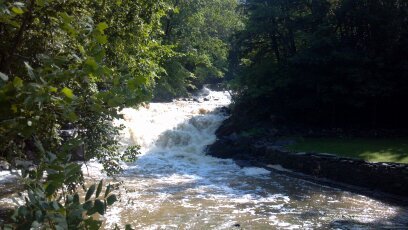
The lower section of Kinderhook Creek as it falls over carved shale into the Hudson is quite steep with regular flow. This section starts in the town of Valatie, (meaning "Little Falls"), drops over a hundred feet in Stuyvasent (originally Glencadia meaning "creek region of simple pleasurees") and continues to the Rt. 9 Bridge in Columbiaville. However, due to numerous large drops it is not run in it's entirity. Usually river running is done on the upper section, and from Rossman Rd to Stockport.
Those visiting this area should also be sure to check out Claverack Creek, Stony Kill, and the Upper Kinderhook Creek.
Park and Huck \- There are many large drops for park and huck; a combination of original formations, capped with mill dams. In order they are:
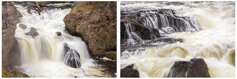
Beaver Mill (Valatie) Falls: Class IV, ~25 ft - A fun park and huck with great access runnable with normal flows. Keeping your bow up is mandatory to avoid a pin between the two lines. Put in below or portage on river right under the bridge. There is also a river left side of the drop which opens up at higher water, however care should be taken to avoid rebar and safety should be set at the bottom hole which can be very retentive at certain levels.
Upper Stuyvasent Falls: Class V, ~65ft - A no joke double drop, starting with a winding left turn which lauches onto a shelf before riding a tongue for a clean drop. Portage on river left.
Lower Stuyvasent Falls: Class V+, ~60 ft - An untouched drop with many options as dicey as the next. Portage river left.
Rossman Falls: Class IV+: ~40ft - \*Unrun\* Pick your spot and go. Be sure to check your landing first!
Hidden Gem Falls: Class V: A jumbled cascade falling about 50 ft with 3 distinct steps, this drop is acutally on a tributary to Kinderhook Creek and is visible from theshuttle route near the confluence with Claverack Creek. Be wary of the last drop and be sure to land far to the right.
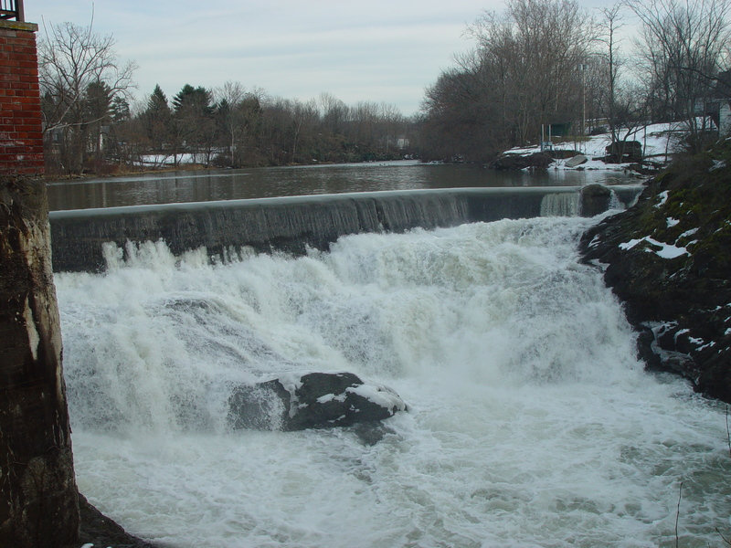
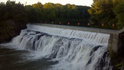
There is also a Class II dam above Beaver Mill Falls which can be attained and then reached on river left. About 8ft tall it is a steep slide that drops into a 2 foot drop.
River Running:
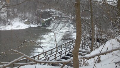
All the stretches between the dams are class I-III and are best run starting at 4ft. The best section being from Rossman Rd bridge to the Rt. 9 bridge in Columbiaville. Put in on river left by the bridge and take out on river right at the fisherman's trail. The last rapid goes over a rock slide which can be scouted from the bridge, below the slide the river is affected by the tidal shifts of the Hudson. Playspots in the lower half will be affected by the changing tide. At high water this section is filled with surfing waves and at times a few very high quality waves at the takeout.
Other Local Runs:
Kinderhook Creek Section 1
Kinderhook Creek Section 2
Kinderhook Creek Section 3
Stony Kill
Claverack Creek
Roeliff Jensen Kill
Capital Region Area Reaches
Basic Creek Batten Kill Claverack Creek
Cobleskill Creek Fox Creek Hannacrois Creek
Hoosic Hudson (Lock 2) Kinderhook Creek (1.)
Kinderhook Creek (2.) Kinderhook Creek (3.) Kline Kill
Normans Kill (1.) Normans Kill (2.) North Chuctanunda Creek
Mohawk (Upper Cohoes Wave) Mohawk (Cohoes Wave) Poesten Kill (0.)
Poesten Kill (1.) Poesten Kill (2.) Quacken Kill
Schoharie Creek Stony Kill Wyant's Kill
Catskills Area Reaches
Basic CreekBatavia Kill Bear Kill
Beaver Kill (Delaware Trib)Beaver Kill (Hudson Trib) Beer Kill
Beer Kill, W. BranchBowery Creek Bush Kill
Callicoon Creek, E. BranchCallicoon Creek, N. Branch Catskill Creek (1.)
Catskill Creek (2.)Catskill Creek (4.) Claverack Creek
Coxing KillDelaware Delaware, E. Branch
Delaware, W. BranchLittle Delaware Dry Brook
East KillEsopus Creek (1) Esopus Creek (2)
Esopus Creek (3)Esopus Creek (4) Esopus Creek (5)
Hannacrois CreekKaaterskill Creek (1.) Kaaterskill Creek (2.)
Kinderhook Creek (3.)Kiskatom Creek Mombaccus Creek
Mill BrookNeversink (1.) Neversink, E. Branch
Neversink, W. BranchPeters Kill Platte Kill
Plattekill CreekPotic Creek Roeliff Jansen Kill (1)
Roeliff Jansen Kill (2)Rochester Creek Rondout Creek (1)
Rondout Creek (2)Rondout Creek (3) Sandburg Creek
Saw Kill (1)Saw Kill (2) Saw Kill (3)
Schoharie Creek (1.)Schoharie Creek (2.) Shingle Kill Creek
Squirmer CreekStony Clove Creek Ten Mile Creek
Thorp CreekTremper Kill Wallkill
West KillWoodland Creek Vly Creek
Google Map of New York Whitewater
New York Whitewater Paddlers Facebook Group
Rapids in this Run (1)
Waterfalls (5)
Hazards & Portages (3)
Caution: The following locations may require scouting or portaging. Always check current conditions.
Difficulty
Class I-II(V+)
Length
11.2 mi
Rapids
1
1 Hazard
2 Portages
Access Points
Difficulty Classes
I Easy
II Novice
III Intermediate
IV Advanced
V Expert/Extreme
VI Unrunnable
Current Conditions
5-Day Forecast
Whitewater data from
American Whitewater
American Whitewater