4: Cobbs Bridge Rd. to N. Horseshoe Bridge Rd.
Gauge Conditions
Runnable: 2.0 – 10.0 FT
Upper limit for best boatability uncertain. Please help your fellow boaters with a comment or report.
Data from American Whitewater & USGS
Run Map
Description
The Chauga is a flatwater run with a few punctuated whitewater rapids. This is especially true if you put in at the Cobbs Bridge access point. At Cobbs Bridge the river makes a wide sweeping turn over several class-II slides. Below this point there are two additional class-II rapids. One is an unnamed slide in the first mile of river and the second drop is Powerline Rapid somewhere around the 3-mile point. Powerline could contain trees and strainers on the left but there are numerous lines over this small slide. The rest of the upper run is flat with a few class-I riffles.
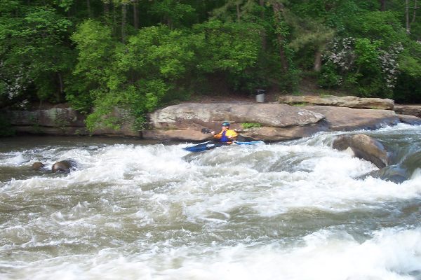
The best boating option for whitewater is to put in at the Hwy 76 bridge and boat down through Chau Ram Park. You can take out in the Park by hiking up the river right bank. The only exciting class II-III section of whitewater is in the park. After Hwy 76 the river starts dropping over some small boulder fields producing easy class-II rapids.
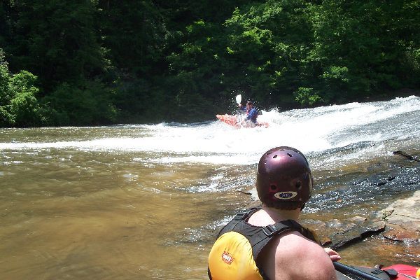
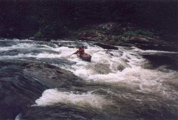
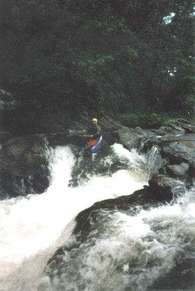
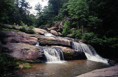
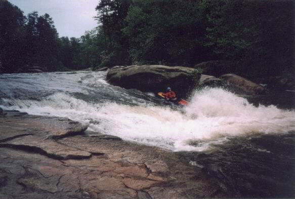
The two biggest rapids are soon to follow. Pumphouse Rapid (class III) is an obvious horizon line with an exposed rock island in the center of the river. Boaters have two options at this drop and will wither go left down a series of small slides or plunge off the right drop. The right drop requires a quick turn to avoid an undercut ledge. If you are looking to get the most bang for your buck you can easily carry back up the middle or left bank and run this rapid again. The pumphouse is immediately downstream on the left. Ramsey Creek confluences with the Chauga below the pumphouse on the left. The cascades on Ramsey Creek are probably class IV-V rapids during flood conditions. The bottom drop appears to be a simple vertical waterfall but the top drop has some dangerous undercuts and a sieve.
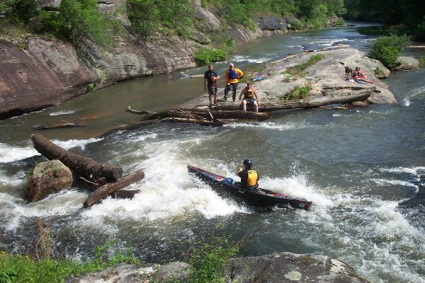
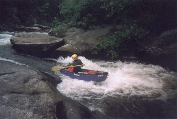
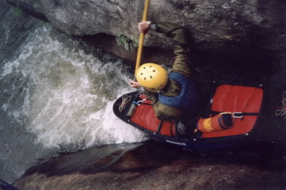
At this point the river falls over a couple more class II riffles before reaching Suicide Slide or Can Opener (Class III). This rapid also has a large rock inland with about 90% of the river flowing around the right side down a slide. The right side slide, which is known either as Suicide Slide or Can Opener, is a solid class- III rapid with a very real possibility of injury. Boaters can choose to go left of the can-opener rock, but in doing so they must be careful of the undercut island rock. Alternatively they can ride the slide down the right side and hopefully miss the can-opener rock. Don't worry about misinterpreting what rock is the can opener--it is obvious.
An alternate line down the left crack side of the island is a possibility, but at low flow it could be ill-advised in some boats. The first drop is a tight slide with a knife-blade rock at the bottom. The real danger here is the second drop, because the bottom of the second drop can pinch-pin boats.
There is a good trail on river right back to the Chau Ram Park parking lot. Many boaters might wish to put in and takeout from this parking lot. Just carry up to Pumphouse Rapid and boat down the Suicide Slide. Run each rapid several times and then carry back to the cars.
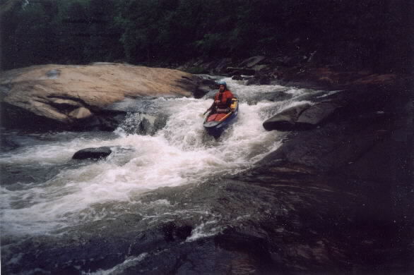
The final drop in the park is a small class-II ledge that is best run on river right.
After this the river goes flat for another two miles with barely a class-II riffle. The takeout bridge has an access point on river right.
ONE IMPORTANT FINAL NOTE.
CHAU RAM PARK IS CLOSED FOR THE WINTER AND YOU CANNOT PARK YOUR CARS HERE.
I apologize for using the Monty Smith names for rapids on this river. I know he renames things but could not find an old guidebook for the real names of the rapids.
Rapids in this Run (6)
Waterfalls (1)
Playspots (1)
Hazards & Portages (3)
Caution: The following locations may require scouting or portaging. Always check current conditions.
Difficulty
Class I-II(III)
Length
7.1 mi
Gradient
20 ft/mi
max 40
Rapids
6
3 Hazards
Access Points
Difficulty Classes
I Easy
II Novice
III Intermediate
IV Advanced
V Expert/Extreme
VI Unrunnable
Current Conditions
5-Day Forecast
Whitewater data from
American Whitewater
American Whitewater