4 - Concrete Bridge to Tanner (Middle-Middle) Wild
Gauge Conditions
Runnable: 1,000.0 – 5,000.0 CFS
The gauge is located just below Cable Car rapid, and is therefore a pretty good indication of what you will have on this run.
Data from American Whitewater & USGS
Run Map
Put-in
Take-out
Rapids/Hazards
Wild
Scenic
Run Time Estimate
Select put-in and take-out to estimate time.
Plan This Trip
See wind-adjusted speed maps, forecast planning, and detailed time estimates.
Sign in to generate an AI timing estimate for this run.
Whitewater timing varies with scouting, portages, and group pace. Use as a planning baseline.
Description
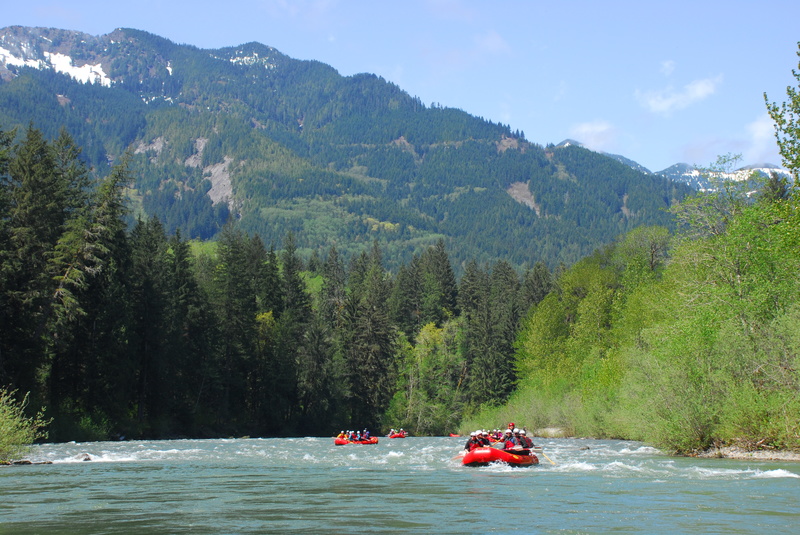
The Middle Fork Snoqualmie, particularly the section known as the 'Middle-Middle,' offers the most accessible intermediate whitewater for the greater Seattle area. The season typically begins with the November rains and runs through the spring snowmelt, lasting until June in most years. It's a popular after-work run, especially on weeknights in April and May. While it's often easy to find others to shuttle with, the river is also well-suited for a simple bike shuttle.
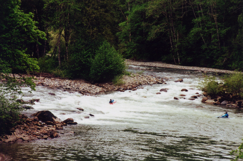
The traditional run on the Middle-Middle starts at Concrete Bridge (aka Granite Creek Access) and flows through shallow boulder fields, offering Class II rapids. Much of this section is visible from the road during the drive to the put-in. At lower flows below 2000 cfs, many will skip this first section, but it remains runnable. The current pace continues with one clean Class III- rapid at Cable Car before reaching Mine Creek Rapid, which has mellowed since the island washed away.
Many paddlers opt to start their trip at Mine Creek, especially when flows are lower or when a quicker run is preferred. A fun play spot can be found immediately downstream from the pool at the put-in, a popular spot for those waiting for their crew to get ready.
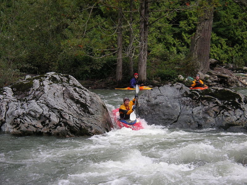
Downstream of Mine Creek, the river flows through Class II boulder gardens until you reach A-Frame Drop, recognized by the A-frame house high above the river. The gradient increases slightly through more boulder gardens and fun class II rapids as you near House Rocks, which is preceded by a long straight section with a bend to the right at Right Angle Drop. House Rocks is a sequence of three distinct segments that flow together, with a couple of large boulders near the center. Though it’s not much more difficult than the preceding Class III drops, the length and sequence of moves needed to avoid holes make it a Class IV. At lower flows the rapid could be considered a sequence of class III+ rapids. At higher flows, the rapid becomes a freight train of monster waves and powerful hydraulics, but there are sneak lines along the edges for those who prefer them. Boat scouting is necessary, as the land along the river's left and right banks is privately owned.
After House Rocks, the run begins to taper off with Class II boulder gardens and one more Class III at Second Island Drop. As the density of homes increases significantly on the left bank, you’re nearing the take-out. Look for the powerlines crossing the river and take out at the access corridor, a King County right-of-way that is a formal public access point. Be aware of the private property on either side of this corridor.
Access:
Take-Out: Most boaters meet at the take-out. To get there, take exit 32 off I-90 and head north for 0.6 miles. At the T-junction, turn right onto North Bend Way and continue for 0.7 miles. Just past where the river runs near the road, turn left onto SE Tanner Road. Follow this road for 0.5 miles to a parking area for river access. The powerlines crossing the road and leading to the river mark the access corridor. A green gate maintained by the county prevents you from driving directly to the river, requiring a short 50-yard hike.
Put-In: To get back to the put-in, head back to North Bend Way, travel 0.2 miles past the boat/RV storage facility, and turn left onto SE 140th. Follow this road for 1.1 miles to the left-hand turnoff for Middle Fork Road. Take Middle Fork Road for 3.5 miles to Island Drop (also known as the old Mine Creek Campground), where a bend in the river meets the road. This is a good put-in that avoids the upstream section, which some prefer to skip when flows are below 2,000 cfs. If you have more time or the water level is higher, you can continue up to mile 5, where the concrete bridge crosses the river. A put-in is available on the downstream left side of the bridge.
Difficulty
Class II-III+(IV)
Length
7.0 mi
Gradient
43 ft/mi
Rapids
8
Access Points
Difficulty Classes
I Easy
II Novice
III Intermediate
IV Advanced
V Expert/Extreme
VI Unrunnable
Current Conditions
5-Day Forecast
Whitewater data from
American Whitewater
American Whitewater