4. Cussed Hollow to FR 9039 (Middle)
Gauge Conditions
Runnable: 700.0 – 2,000.0 CFS
Data from American Whitewater & USGS
Run Map
Description
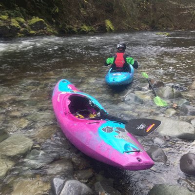
This is a great run for IKs and kayaks, and it's an excellent run for self-supported overnight trips. The first 4 miles are utterly gorgeous with class III whitewater and one or two class IV's depending on flow.
You can boat scout everything until Big Creek Gorge – when you see a big gravel bar on the left and a headwall on the right curving hard left, land on the cobbles and scout left. Big Creek Gorge has a tricky entrance that throws boats into the right wall, then a crux consisting of several large boulders with tight slots that can catch logs. It deserves a class IV rating even at low flows and is probably class V at higher flows. Kayaks can run this in sections and portage left as needed, though portaging is more difficult when the left side rock bar is under water. Those who know ahead of time that they don't want to run it (and can recognize it in time) can land early on the right and climb up to the Lewis River Trail, then drop back down to the river below the rapid. Rafts will have a significantly harder portage, so pack light and leave lots of time.
Below Big Creek Gorge, the rapids calm down significantly. You may want to combine this with the 4.5 mile run down to the Eagle Cliffs Park at the head of the reservoir. There are several nice rapids and great views of waterfalls.
Logistics: The take-out for this run is at the FR 9039 bridge which is accessed by going to FR 90 mile 20.6, turning on FR 9039 and heading 0.6 mile down this unpaved road to a bridge across the river and a trailhead downstream river left; it's a little easier to get out on river right. An advantage of using this trailhead as your take-out is you can do a bike shuttle on the trail that follows river right for a multi-sport adventure.
Many just continue on downstream to the next run (which is a short addition) and take-out at the Eagle Cliff Park Recreation Area at the head of Swift Reservoir. This recreation site, maintained by PacifiCorp with bathroom, parking, and picnic area, is located is 45 miles east of Interstate 5 on Highway 530. It is at mile 15.9 on FR 90.
The put-in is at FR 90 mile 28.5 where FR 90 crosses the Lewis River. Access is available through a campsite upstream from the bridge on river right. The parking area on the downstream river left side has been designated 'no parking' in 2020. Mind the parking signs in this area, they are ticketing. You can shuttle on the road along river left or mountain bike the trail on river right.


Difficulty
Class III-IV
Length
8.3 mi
Gradient
39 ft/mi
Rapids
5
Access Points
Difficulty Classes
I Easy
II Novice
III Intermediate
IV Advanced
V Expert/Extreme
VI Unrunnable
Current Conditions
5-Day Forecast
Whitewater data from
American Whitewater
American Whitewater