4. Grants Pass to Grave Creek
Gauge Conditions
Runnable: 1,000.0 – 3,000.0 CFS
Best boatable levels uncertain. Help us out! Add a comment or 'report'.
Data from American Whitewater & USGS
Run Map
Run Time Estimate
Select put-in and take-out to estimate time.
Plan This Trip
See wind-adjusted speed maps, forecast planning, and detailed time estimates.
Sign in to generate an AI timing estimate for this run.
Whitewater timing varies with scouting, portages, and group pace. Use as a planning baseline.
Description
_Grants Pass to Hog Creek_
This 19-mile stretch begins in Grants Pass, where the river flows through town. This section is more open and a less scenic as it passes by riverside development and agricultural land for the first few miles. Jet boat tours that run down to Hellgate Canyon run their trips through this section.
_Hog Creek to Graves Creek_
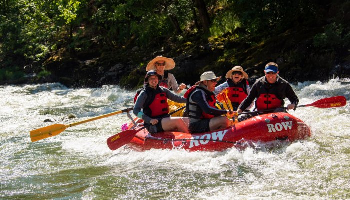
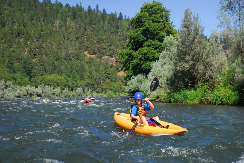
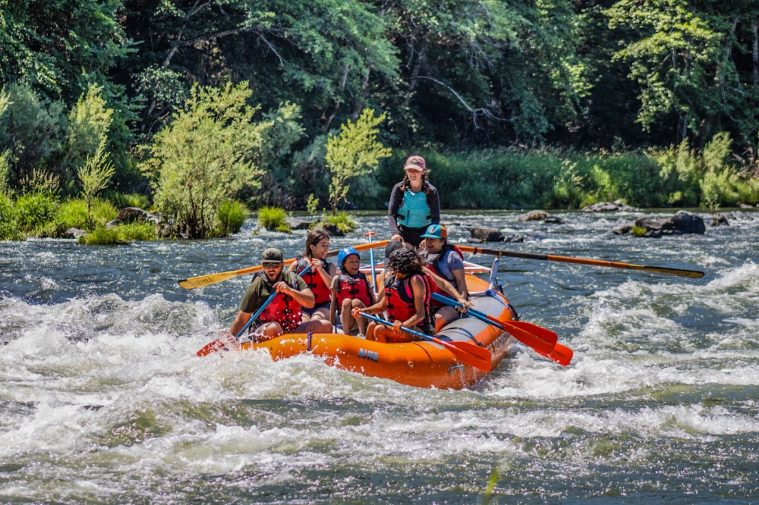
This 14.5-mile section of the Rogue offers great options for a day trip with some fun rapids, nice beaches, rock ledges for jumping into the river, and even a riverside restaurant where you can grab a cold drink or a full meal. With several nice river camps along the way, you could enjoy a fun overnight trip on this stretch or add it as an extra day for multi-day trips continuing downstream. This segment is also an exceptional instructional reach. With warm water, consistent flows through the summer, and plenty of good features to practice on there is hardly a better place to learn to kayak in the entire Pacific Northwest.
This section begins at the Hog Creek Boat Ramp which can be a bustle of activity on summer weekends with guided trips, experienced paddlers, young people of questionable experience out on a party float, and the occasional fleet of jet boats bringing tourists down for a look at Hellgate Canyon.
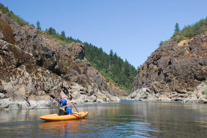
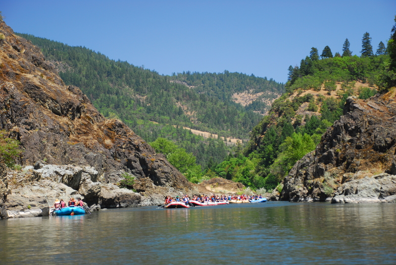
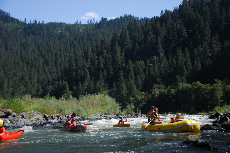
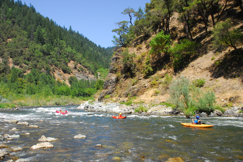
The current is swift at the put-in as the river heads into Hog Creek Rapid, an easy riffle just before the entrance to Hellgate Canyon. The walls rise up dramatically before you as you enter Hellgate Canyon and if it looks familiar, you may recognize it as the site of the jump scene from Butch Cassidy and the Sundance Kid. The canyon is short so take time to enjoy it. You will find some ledges that are good fun for jumping into the river. For many years the canyon was considered as a dam site but the river is now fully protected from hydropower development under the Wild and Scenic Rivers Act.
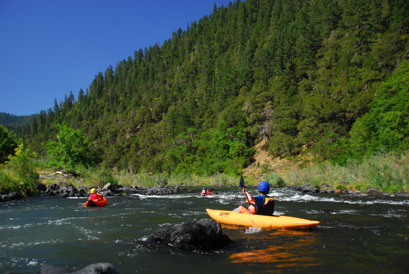
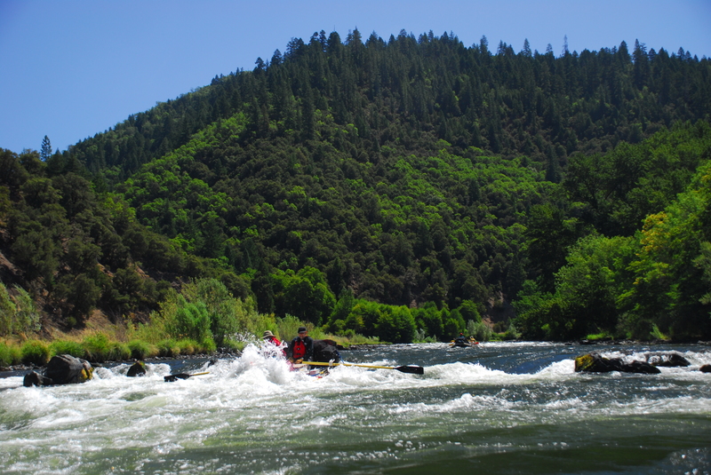
Leaving the canyon, you will arrive at class II+ Dunn Rapid where the river goes through a series of waves and small holes making it one of the more challenging rapids on this stretch. More fun but easy class II whitewater continues on down to the Hellgate Bridge.
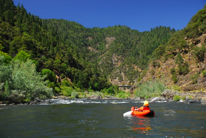
As you pass Indian Mary, you will encounter an easy class II rapid and a short distance downstream you will enter the Taylor Creek Gorge. While not as dramatic as Hellgate Canyon, the bedrock walls that rise up from either side of the river offer more fun platforms for leaping into the river.
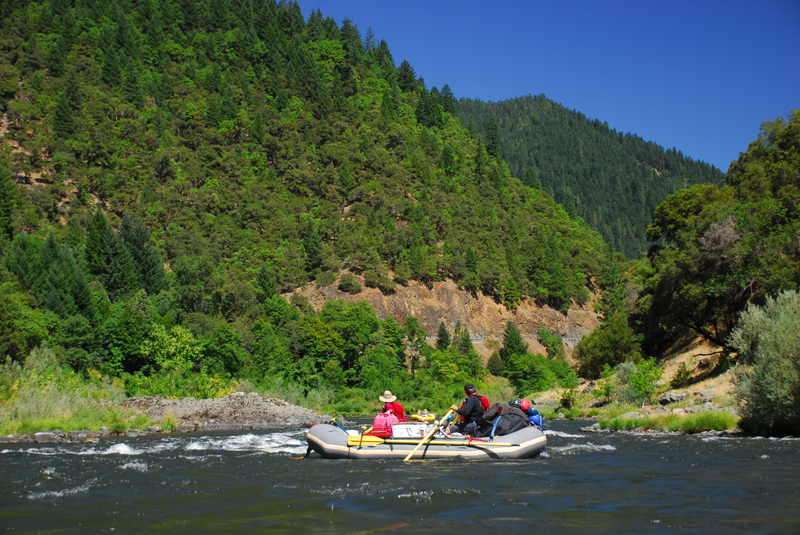
Morrison's Lodge is tucked into the cove on river left at the downstream end of the gorge. An easy rapid forms the exit from this wide spot in the river but then the river enters a mile and a half long stretch of flatwater that feels longer particularly during hot summer days when flows are lower. It's one of the few sections on this run where you really do need to paddle to make progress.
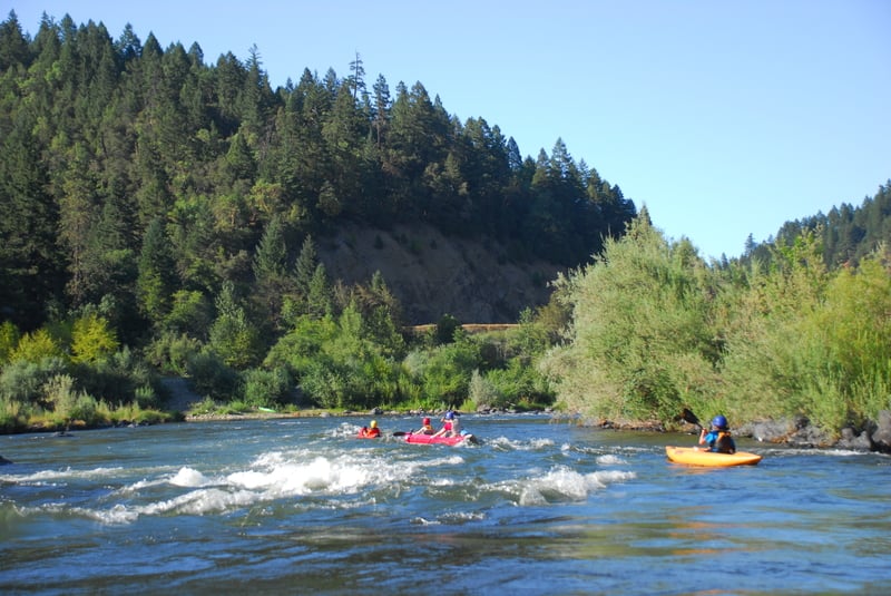
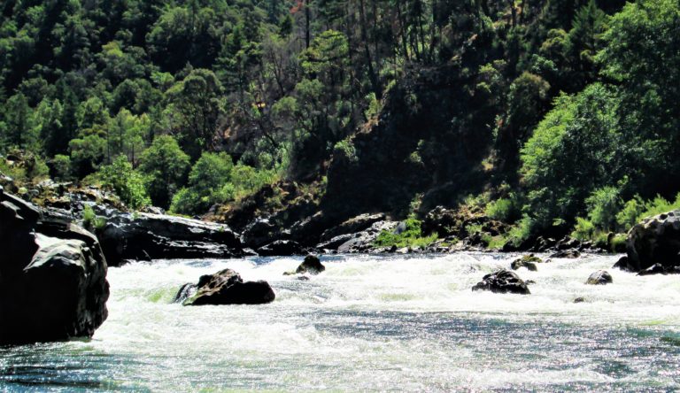
The flatwater finally ends at Ennis Riffle which is an easy class II rapid, but then you start another mile of flatwater. The action finally picks up as you enter the rapid at Carpenter Island which is class II. Coming up in quick succession is Upper Galice which is a class II+ bedrock channel that can be one of the more technical drops on the run. Lower Galice is another class II+ that is just downstream.
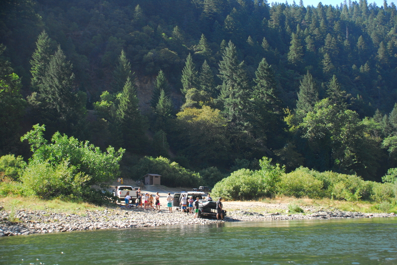
After running this sequence of whitewater, you arrive at Galice Resort. A public boat ramp is available on river left and you can also pull out here (be sure your boats are out of the way) and head up for drinks or a meal out on the deck overlooking the river.
For the next few miles, the rapids of Rocky Riffle, Chair Riffle, and Island Riffle are all easy class II- with stretches of flatwater in between. You will pass the rough boat ramp at Rand and then the nice concrete ramp at Almeda as you boat through this stretch.
Just downstream of Almeda Park, a popular campground used for staging and launching overnight trips, the river the river passes by the Almeda Mine on river right. The mine is evident by the colorful mineralization of the nearby soils, and it is actively discharging acid mine drainage into the Rogue River. The river passes through an easy class II rapid at the mine site. Bailey is another easy rapid about half a mile downstream.
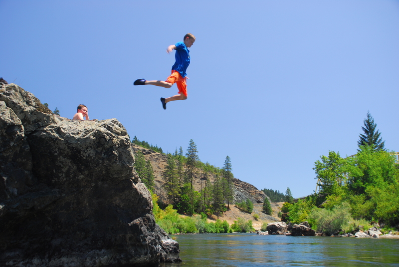
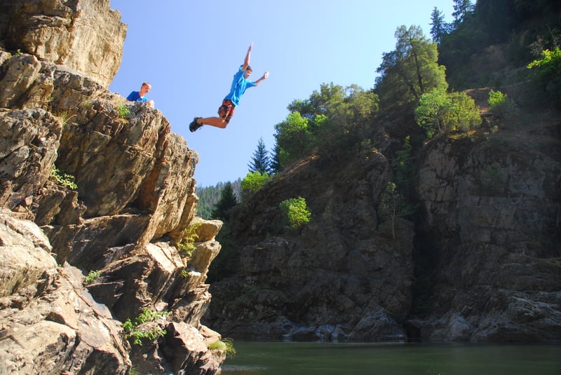
As you enter a short canyon with steep rock walls you will pass by one of the more popular sites for jumping off the rocks into the Rogue River. A couple of platforms on river right provide the launch point for aerial displays as boaters leap into the river below. It constitutes a required stop for nearly all trips who boat this section.
Just downstream lies Argo Rapid, considered by many to be the most difficult one on this section. At high flows the hole at the base can flip rafts but at more moderate flows you will likely have less trouble as long as you don't get hung up on the rocks. The Argo launch site is immediately downstream of this rapid.
The last real rapid on this section is Wooldridge Rapid which you will recognize as the Grave Creek Bridge comes into view. The take-out is located just downstream of the bridge on river right. Permits are required for overnight trips that continue on downstream.
Logistics:
Baker Park Boat Ramp in Grants Pass (river mile 101.9)
This access is on river left downstream of the Highway 199 Bridge in Grants Pass.
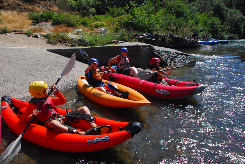
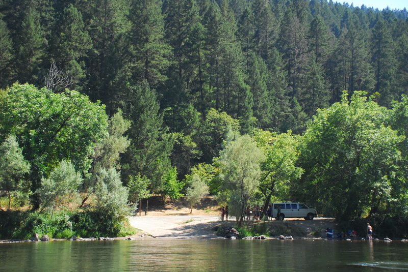
Galice Road mile 4.8, Hog Creek (river mile 83.0)
This is a primary launch point for day trips on the Rogue River and on hot summer weekends this site can be quite a scene. It is just upstream of the scenic Hellgate Canyon. The launch area has two boat ramps at river level and short-term parking for staging. Once you are done rigging, run your car up to the upper parking lot.
Galice Road mile 5.5 Hellgate Overlook
This is a pull-out and overlook high above the river that gives you an overview of Hellgate Canyon. No river access is available from this site.
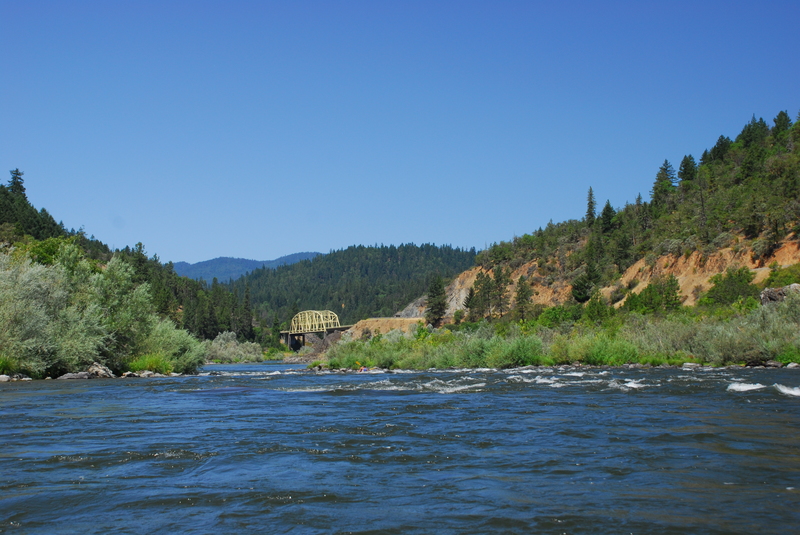
Galice Road mile 6.2 Hellgate Bridge
Where the Galice Road crosses the Rogue River at Hellgate Bridge, there are pull-outs upstream river right and downstream river left and right of the bridge. You will not find formal access for boaters, but the area is popular for day use during the summer as there are several small beaches and some good rocks for jumping into the river.
Galice Road mile 7.0 Indian Mary Park
This is a Josephine County Park that has a boat ramp and is a bit more manicured than other camping areas along the river. It is popular with the RV crowd and the sites are packed in tight.
Galice Road mile 7.7 Rainbow
Rainbow is a day-use area with no formal access for boaters but you can hike down a short trail to a great band of cliffs along the river, Taylor Creek Gorge, that make a popular stop for river trips where you can leap into the river.
Galice Road mile 8.4 Morrison's Lodge
Morrison's is one of the private lodges along the river for those looking for the highest level of comfort for their overnight stay.
Galice Road mile 8.5 USFS road turns off for Briggs Valley
Galice Road mile 9.8 Ennis Riffle
The Ennis Riffle recreation site has a boat ramp and is managed by the BLM as a dispersed recreation site where overnight camping is allowed. There are toilet facilities but no drinking water available. Several simple riverside camps are dispersed along an approximately half mile stretch of river. If you are coming in late at night, you can almost always find a spot to throw down a tent here.
Galice Road mile 10.8 Carpenter's Island
Carpenter's Island is a day-use area with no formal access for boaters but you can hike down a short trail to the river.
Galice Road mile 11.3 Bear Camp Road
The Bear Camp Road is the shortest shuttle route to the coast and the take-out for the multi-day wilderness stretch of the Wild and Scenic Rogue.
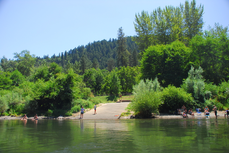
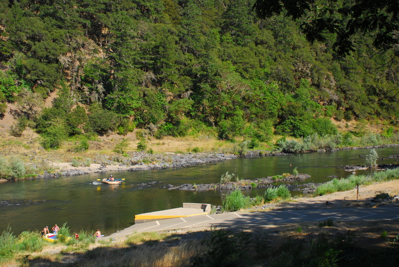
Galice Road mile 11.5 Galice Boat Ramp and Galice Resort
The Galice Resort was a great place to get a burger or ice cream. Prior to the June 2021 fire that destroyed the main building, the outdoor patio was a wonderful summer destination where you could catch live music on weekends. The store had a few basic odds and ends: sunscreen, maps, and cold drinks. Simple cabins were not damaged in the fire and are still available for rent. The boat ramp was the standard take-out for those renting rafts from the Galice Resort so things would get a little crowded during hot summer days.
Galice Road mile 12.5 dispersed site
An unmarked road leads down toward the river and accesses some dispersed camping areas.
Galice Road mile 13.7 Chair
This is not a particularly good river access but if you have a high clearance vehicle you can access some dispersed camping areas along the river.
Galice Road mile 14.0 Rand
This is a river access that is not used as extensively as other areas along the river. It is a good option if you are looking to avoid the crowded ramp at Almeda. It is adjacent to the Smullin Ranger Station, and river access is good via a paved road but the ramp itself is gravel.
Galice Road mile 14.1 Smullin Ranger Station
The ranger station has information and is also the check in point for trips headed on the multi-day wilderness run where permits are required. If you are looking to pick up a last-minute cancellation permit, this is the place to be at 7am.
Galice Road mile 14.8 Almeda County Park
This county park is a popular spot for groups to camp the night before a trip with a paved ramp, long rigging beach, water, and camping. Some groups launch straight from here as an alternate start point for trips on the multi-day wild stretch of the Wild and Scenic Rogue that begins a few miles downstream at Grave Creek. You can rig your boats the night before, camp here, head up to the Smullin Ranger Station first thing in the morning to check in with the ranger, and be on your way right after breakfast. The campground can fill up on summer weekends and is patrolled by a camp host so reservations are recommended.
Galice Road mile 16.8 Argo
This is a dispersed site that is used as an alternate access for the Rogue River. It has good beach access to the river but no formal ramp. It is sometimes used by groups seeking to avoid the Almeda or Grave Creek that tend to be busier.
Galice Road mile 18.7 Graves Creek access (river mile 68.5)
The road along the river ends here (it continues on up Grave Creek) and from this point the river enters the permitted wild stretch. The take-out is on river right immediately downstream of the Galice Road Bridge. There are no facilities for overnight camping at this site but a good paved ramp is available making access to the river easy.
Rapids in this Run (27)
Rapid
Entering Rogue "Wild And Scenic" Area
 Rapid
II
Rapid
II
Whitehorse Riffle
 Rapid
II
Rapid
II
Bedrock Riffle
 Rapid
II
Rapid
II
Brushy Chutes / Everton Riffle
 Rapid
Rapid
Hog Creek River Access
 Rapid
II
Rapid
II
Hellgate Canyon
 Rapid
II
Rapid
II
Dunn Riffle
 Rapid
Rapid
Hellgate Recreation Area
 Rapid
Rapid
Indian Mary County Park Access
 Rapid
II
Rapid
II
Taylor Creek Gorge
 Rapid
II
Rapid
II
Old Man Riffle
 Rapid
Rapid
Ennis Riffle Recreation Site Access
 Rapid
II
Rapid
II
Ennis Riffle
 Rapid
II
Rapid
II
Upper Galice
 Rapid
II
Rapid
II
Lower Galice
 Rapid
Rapid
Galice Boat Ramp
 Rapid
II
Rapid
II
Rocky Riffle
 Rapid
II
Rapid
II
Chair Riffle
Rapid
Rand Access
Rapid
Almeda County Park Access
 Rapid
II
Rapid
II
Almeda Riffle
 Rapid
II
Rapid
II
Bailey
 Rapid
Rapid
Jump Rock
 Rapid
III
Rapid
III
Argo Riffle
 Rapid
II
Rapid
II
Lower Argo
 Rapid
Rapid
Argo Access
 Rapid
II
Rapid
II
Wooldridge Rapid
Difficulty
Class II
Length
34.7 mi
Gradient
8 ft/mi
Rapids
27
Access Points
Difficulty Classes
I Easy
II Novice
III Intermediate
IV Advanced
V Expert/Extreme
VI Unrunnable
Current Conditions
5-Day Forecast
Whitewater data from
American Whitewater
American Whitewater