4 - Log Shoals Rd to West Georgia Rd
Gauge Conditions
Runnable: 4.8 – 12.0 FT
Data from American Whitewater & USGS
Run Map
Run Time Estimate
Select put-in and take-out to estimate time.
Plan This Trip
See wind-adjusted speed maps, forecast planning, and detailed time estimates.
Sign in to generate an AI timing estimate for this run.
Whitewater timing varies with scouting, portages, and group pace. Use as a planning baseline.
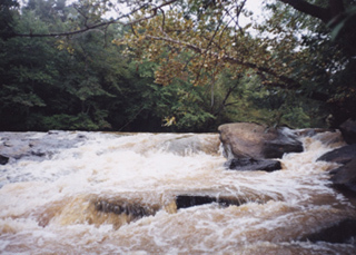
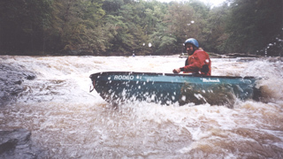
Description
Put in downstream of the Log Shoals bridge on river right. Parking is available on downstream on river right. Please be kind and do not block the private property entrance. DO NOT access the river upstream on river right from the property with the large brick house.
Take out just upstream of the West Georgia Rd bridge on river left. There is a narrow access road but if you don't have 4WD you might be better served to park along the road.
_Shuttle Directions:_ From the put-in, go west on Log Shoals Rd. Turn left (at the blinking yellow light) onto Standing Springs Rd. Continue straight when Standing Springs Rd becomes Holcombe Rd (you probably won't notice this change). The road will end at a stop sign. Turn left onto West Georgia Rd. Parking for the take-out is at the bottom of the hill on the far side of the bridge, right side of the road.
_Water Quality:_ Poor--The Reedy's poor reputation is due to the Colonial Pipeline oil spill many years ago. Despite significant cleanup efforts from this spill, it still suffers as a river which runs through a city just begining to gain an environmental respect for it. During rain, the river will spike with storm water. A sewage line also runs along the river.
Rapids in this Run (2)
Playspots (1)
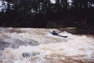
Difficulty
Class II+(III)
Length
2.4 mi
Gradient
19 ft/mi
max 27
Rapids
2
Access Points
Difficulty Classes
I Easy
II Novice
III Intermediate
IV Advanced
V Expert/Extreme
VI Unrunnable
Current Conditions
5-Day Forecast
Whitewater data from
American Whitewater
American Whitewater