4 - Milepost 27 (Maple Falls) to South Fork Nooksack
Gauge Conditions
Runnable: 500.0 – 2,000.0 CFS
Data from American Whitewater & USGS
Run Map
Run Time Estimate
Select put-in and take-out to estimate time.
Plan This Trip
See wind-adjusted speed maps, forecast planning, and detailed time estimates.
Sign in to generate an AI timing estimate for this run.
Whitewater timing varies with scouting, portages, and group pace. Use as a planning baseline.
Description
Class II river trip with sections of braided river channel and wood hazards. Great eagle watching opportunities in the winter. The river flows through a short canyon section as you float by Maple Falls at the start. While the river takes you through a rural landscape, you will find limited evidence of development and have the opportunity to experience a wild river that is rare in the Puget Sound lowlands.
Access: Access continues to be a challenge on the North Fork Nooksack. The put-in for this section is approximately 30 miles from Bellingham, east of the town of Maple Falls on Highway 542. Access points near milepost 27 are all on private property, with the exception of a small parcel of DNR land that could offer some opportunities. At mile 26.4 you will see a drive with a chain across it that opens into a small clearing (you will need to park along the highway but from the clearing it is a short walk to the river). This is the DNR site and is the only public land in the area. At mile 26.8 there is a paved drive (gated) that leads into a good site that outfitters have used with permission of the landowner. At mile 27.0 (upstream side of the milepost marker) there is another site which has also been used by outfitters. Both of these sites are closed off to the public and offer no parking unless you have the key. Some have used the access at mile 27.1 which has space for a car off the highway.
An intermediate access point is available at the Welcome Bridge where Mosquito Lake Road crosses the river. The access point was recently improved by Whatcom County and includes an easy river access and parking on downstream river left.
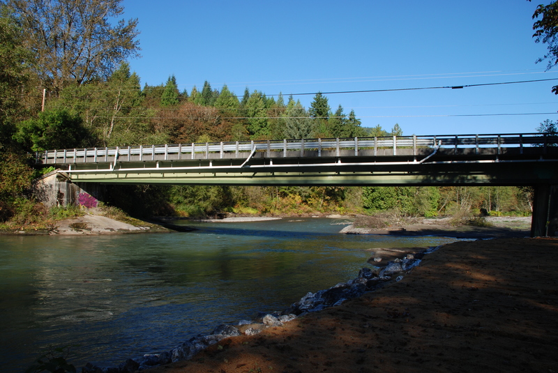
The take-out is at the confluence where the North Fork and South Fork come together. The Highway 9 Bridge crosses the river here.
Rapids in this Run (1)
Difficulty
Class II
Length
13.0 mi
Rapids
1
Access Points
Difficulty Classes
I Easy
II Novice
III Intermediate
IV Advanced
V Expert/Extreme
VI Unrunnable
Current Conditions
5-Day Forecast
Whitewater data from
American Whitewater
American Whitewater