4. Patterson Bend (Kerckhoff Reservoir to Kerchoff #1 PH)
Gauge Conditions
Runnable: ? – ? CFS
Approximate reading: This gauge is 1.5 miles away on San Joaquin. Use as a general reference only.
Data from American Whitewater & USGS
CDEC Flow Data California
Data from California Data Exchange Center (CDEC)
Run Map
Description
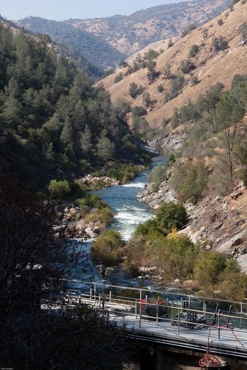
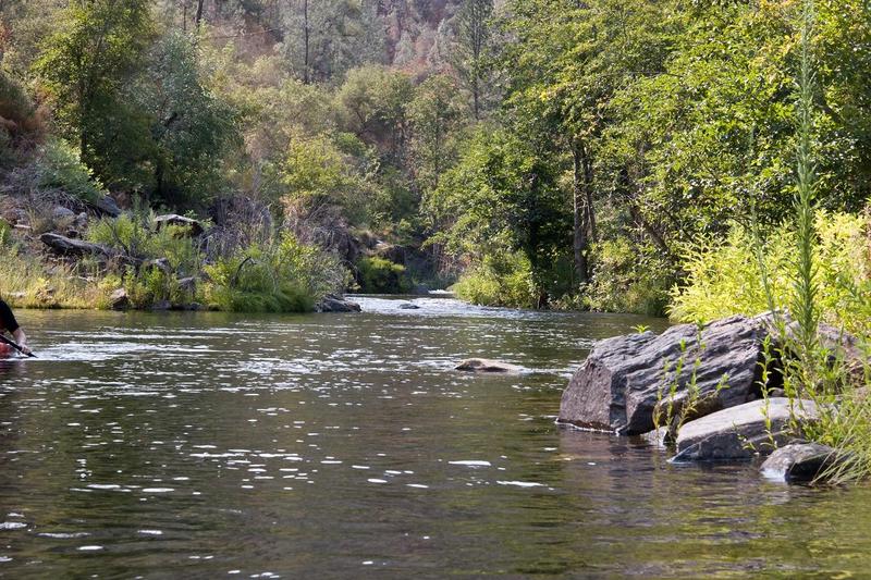
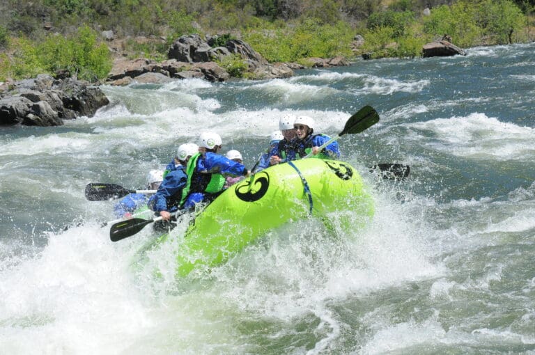
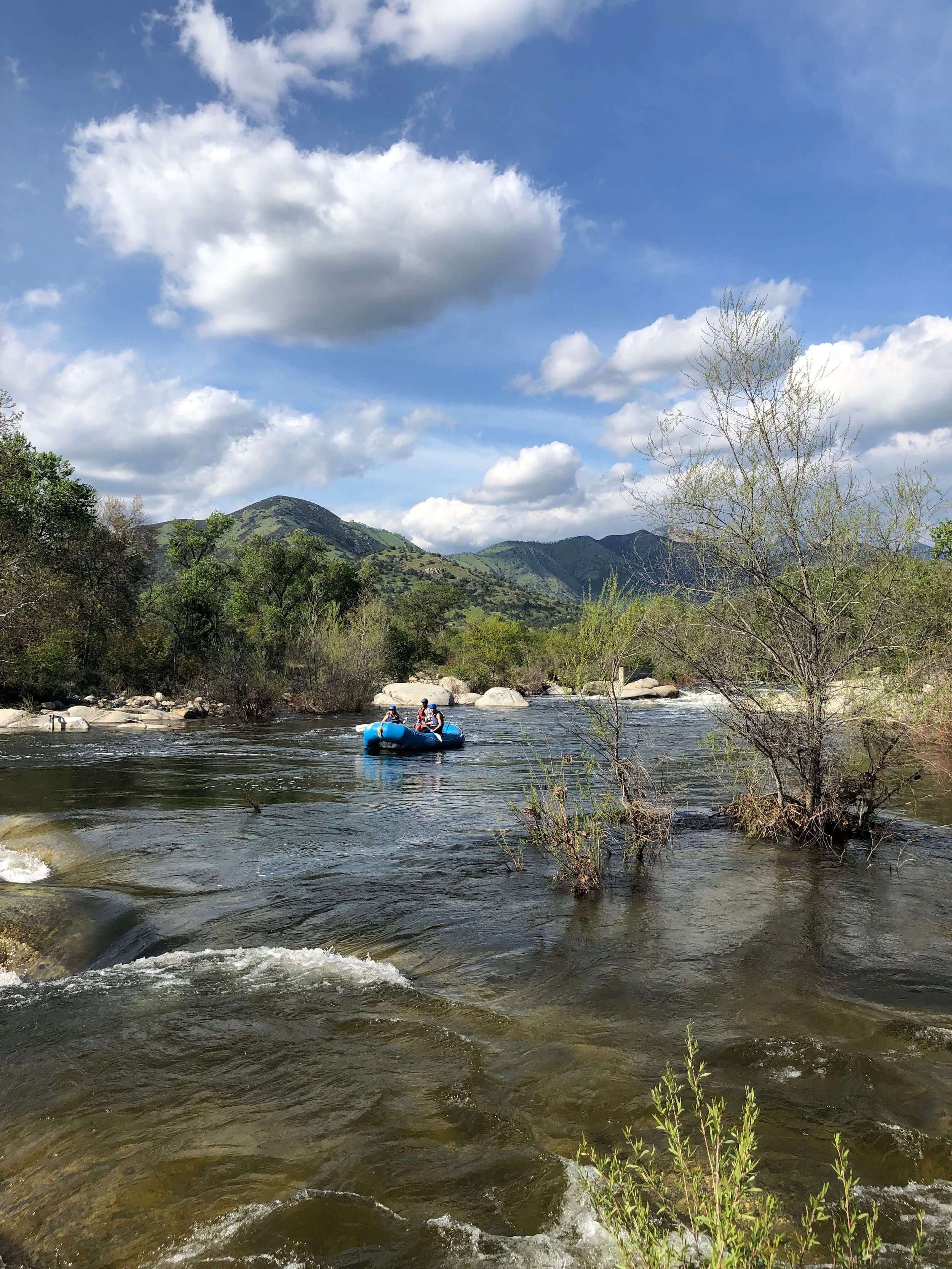
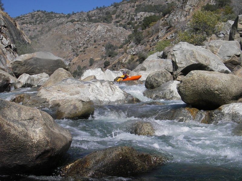
Patterson Bend has a reputation as a hard run because of the old write up in the Holbeck & Stanley guidebook. By modern standards it is a pretty moderate run. Unfortunately, dependable flows are rare enough that boaters don't get a chance to see what it is really like. The scenery is outstanding and most of the rapids are in the class 3 range. There are a number of wonderful class 4 rapids along the run, but only three class 5 rapids in Patterson Bend, plus two more down in the K1 to K2 section. At moderate flows, all rapids are pool drop with long catch pools below.
The first big caveat is that it requires work to do this run. It requires work to paddle two miles across Kerchoff reservoir, then carry around the dam. It is work to hike up to your car at the end. It requires lots of work to get around Binocular Rapid if you choose not to run it. It is easy to spend an hour or more if you portage. It can take quite awhile just to scout.
The second big caveat is that when this run does get spill, the flows are much more often high than moderate. Also flows can fluctuate from moderate to high, quickly and frequently. Most of the run is probably really good at high flows, but the big rapids pose serious issues for scouting, running or portaging.
Prior to 1982 and the construction of the big Kerchoff #2 powerhouse, this section had dependable flows through the summer. The old timers got to boat it a lot. After 1982 flows became rare and it was nearly impossible to know when they occurred. Since 1998 real time flow information has been available on the internet. Now boaters can at least see when there is flow and how weird the patterns are. If you want to boat this section it is best to go with the willingness to boat at whatever flow you get. Fortunately the run is excellent over a wide flow range.
Getting there: From Fresno, take highway 168 into the foothills. Turn left on Auberry Road to the town of Auberry. In Auberry, veer left onto Powerhouse Road at a fork next to the school. BLM Map of Patterson Bend area
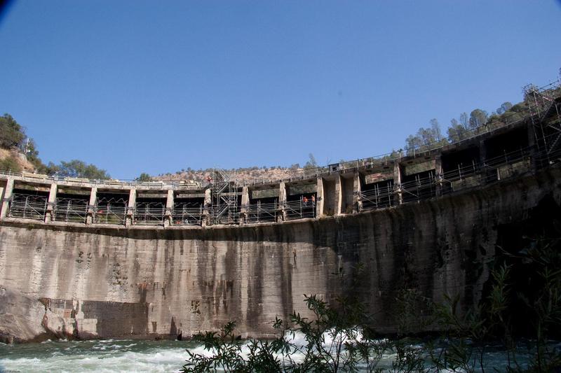
Put-in: Follow Powerhouse Rd. to Kerchoff reservoir. Cross the bridge at the reservoir and go past the powerhouse. Launch at a nice beach. Smalley Cove Campground has toilets and tables, but requires a fee to launch there. Paddle 2 miles across the lake to the dam. At the dam, there used to be easy access around the dam on the left through PG&E facilities. Since about 2020, the left side of the dam has been completely fenced off. There may be a possible route high around the facilities, but it could require severe bushwacking and exploration. Take out at a small dock on the left to explore your options. PG&E does not want the public passing through their facilities. The other option is to portage the dam on river right. It is a shorter distance, but is awkward. The bank is steep on lake right and there is no trail. Below the dam on the right is a cliff. You may be able to scramble down to the river past the cliff, but most likely you will have to rappell.
Take-out: From Auberry, follow Powerhouse Rd. just a few miles to a left turn onto Smalley Rd. There should be signs for the 'San Joaquin River Gorge Recreation Area' which is owned by the BLM. There are two options for the take-out at the recreation area. You can take out at Kerchoff #1 powerhouse or 1.5 miles downstream at Kerchoff #2 powerhouse. For either one you have to park on the road and carry your boats up a few hundred feet from the river. For the #1 powerhouse park near the obvious junction. Kerchoff #2 is further downstream so follow Smalley Rd. to the very end. A gate and some parking areas indicate that you are on top of the underground Kerchoff #2 powerhouse. From the right side (northwest) parking area look for a trail leading down to the river. It ends at the river a short ways upstream of the powerhouse discharge. You can also follow the gated road up from the river at the powerhouse outlet, but it will be less direct than the trail.
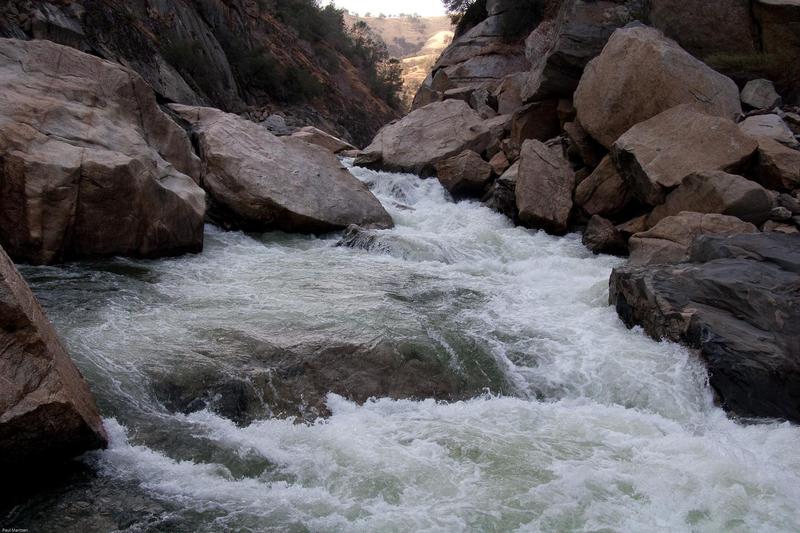
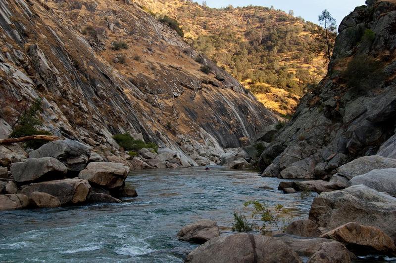
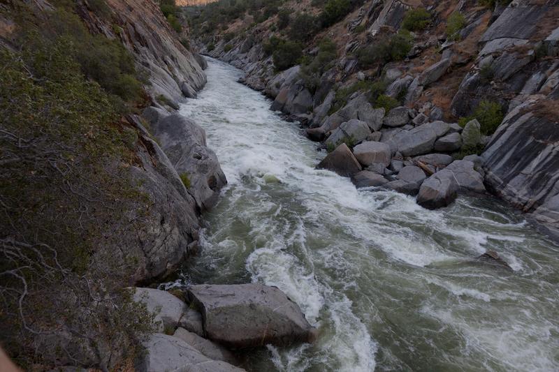
General Description: The first half of the run contains many long class 2, 3 and 4ish rapids seperated by long scenic pools. The scenery and geology are very interesting with types of rock not seen on other sections of the main San Joaquin. With decent access and dependable flows these few miles would be a classic and popular class 3 commercial float trip. Typical rapids through out the run tend to have distinct horizon lines that hide any view of the rapid until you you are speeding into it. At the halfway point, the gradient increases and the rapids get much bigger. Pools remain long, so rapids tend to be steep. There is a particularly ugly rapid near the halfway point that will be a portage for some and for most boaters at lower flows. It will be pretty obvious. Just past that, a beautiful section has 100 foot smooth, vertical cliffs on both sides of the river.
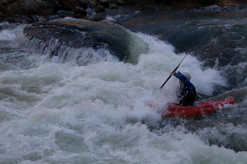
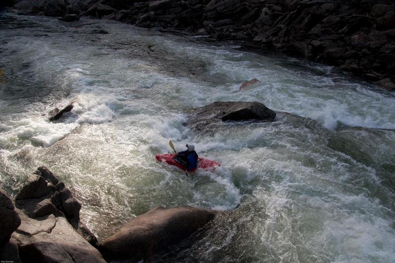
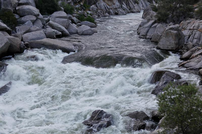
Binocular Rapid is the biggest rapid in the section and is visable from a few spots along the take-out road. On the river, it is difficult to get a good view of the whole rapid, so boaters must climb high above the rapid to get a good overview. One excellent overview is available by climbing high on river right. Some boaters have reported getting a good overview by climbing high on the left. Scouting near river level on the left means scrambling amongst monster boulders to get views of small sections at a time. At some medium flows the rapid is relatively straight forward, but at lower flows you may have to portage a portion or all of the rapid. At flows around 7,000 cfs there appears be a river wide hole at the bottom. Portage on left: through boulders (uhg!) to portage sections, or high on the hillside to portage the whole thing (uhg! uhg! uhg!). Scout it thoroughly and paddle as much as possible.
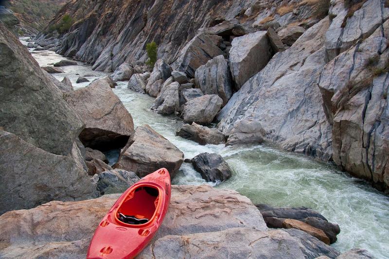
The first two rapids past Binocular are big and steep class 4 rapids. Approaching the old powerhouse, the river enters a gorge of low, but vertical cliffs. There are a bunch of rapids in this section but they tend to be short, steep, pool drops. The most busy and fun boating is probably from below Binocular Rapid to the powerhouse. The powerhouse can add up to 1735 cfs or so if it is running (much lower in recent years). Three more rapids lead to the K1 to K2 Upper & Lower Falls, which are actually two separate class 5 drops. The first is scouted and/or portaged on river right with high flows (on the left with flows of 1800 or less). A huge boulder blocks the channel forming huge holes on both sides. Ski jump the boulder to miss the holes at some flows. (At lower Autumn release of 1700 cfs one can run the very tight right side.) The next rapid is scouted on the right at all flows, but is very difficult to scout at spring spill flows because it is very hard to get out of your boat. Portage is extremely difficult at high spring flows and very difficult at low fall release flows. At high flows, run the left wall all the way down. (At fall release flows of 1700 cfs, ski jump or run the center falls, then get to the left channel and charge. A big hole at the bottom occupies 3/4's of the left chute. Punch it or swim.)
The final rapids ease off to the new powerhouse or into Millerton Lake.
Other Information Sources:
Kerchoff Project Relicensing Website
For more information about the SJRGRA see: SJGRA
Education program
The San Joaquin River Trail: Effort to complete a 73 mile trail from Fresno to the Pacific Crest.
Information about Millerton Reservoir State Rec Area is available at Millerton SRA
# Temperance Flat Dam Proposal:
March 2014: Bureu of Reclamation has issued a Draft Feasibility Report for a Temperance Flat Dam. Please read and comment by October 27, 2014.
November 2014 Water Bond: The California senate and legislatures have approved a bill which includes 3 billion dollars in bonds for construction of new water storage facilities. Voters must approve the bond in the November 4 election. Temperance Flat is not named in the bond measure, but it is one of several potential projects that will compete for the bond funding. Other potential projects include Sites Reservoir and groundwater storage projects.
Concurrently the Upper San Joaquin Basin Storage Investigation is now settling on the mile 274 dam proposal as being the most beneficial and feasible. This dam site is slightly upstream of Sky Harbor and Finegold Creek. The reservoir could hold 1.26 million acre feet of water and would extend back to the top of Kerchoff dam.
Background: This area of the San Joaquin is under study for several potential large dam and reservoir sites. See: Upper San Joaquin Basin Storage Investigation Three sites are under serious investigation. One site is about one mile upstream of the confluence with Finegold Creek and could have a maximum size of around 2.1 million ac/ft. One site is downstream of Temperance flat and could be as big as 2.7 million ac/ft. The third site is upstream of K1 to K2 about halfway through the Patterson Bend section. This would only contain 1.4 million ac/ft. Despite their huge sizes, the maximum annual yield from the biggest of these reservoirs is only 200,000 ac/ft. All of these reservoirs will bury the Patterson Bend section and depending on size, might also bury some or all of the Horseshoe Bend section. Maps from the study showing the sizes of the proposed reservoirs are available at the study website. A speech by Gary Bobker of the Bay Institute, gives some arguements against building new dams at these locations. Further information and links are at:
Friends of the River where you can write a letter to the governor.
California Water Myths: Virtual Tour by UC Davis Center for Watershed Sciences.
This research paper describes and discusses the astounding California flood of 1862. This flood was so big that the entire central valley was flooded and became a lake/river 300 miles long by 40 to 60 miles wide. Part of the problem was caused by hydraulic mining which released so much debri that the river beds in the valley were raised abnormally high. But the main cause was simply the incredible amount of rain and snow; such as 72 inches of rain in two months at Sonora. It seems possible that such volumes of water could exceed the capacity of any additional reservoirs that we could reasonably build.
FERC information:
Federal Energy Regulatory Commission ( FERC) links related to the Kerchoff Project, FERC project No. 96 This project was relicensed on Nov. 8, 1979. The license expires on Nov. 30, 2022. The relicensing process typically starts about 6 to 8 years before the license expires. To develop scheduled releases for this reach will require coordination with the upstream SCE Big Creek #4 project. Scheduled releases could potentially occur in the fall during scheduled maintanence as well as in spring or summer.
The generators at the two powerhouses have a rated maximum capacity of 174,075 KiloWatts.
Search for FERC documents related to Kerchoff at http://elibrary.ferc.gov/idmws/search/fercgensearch.asp
In the Docket Number box, write P-96-\* to do a wild card search for any documents related to Project 0096.
Minimum Instream Flows: are 25 cfs year round, but somewhat higher flows must be released in order to keep water temperature below 27 degrees.
Paul Martzen, 2003
A GUIDE TO THE BEST WHITEWATER IN THE STATE OF CALIFORNIA, HOLBEK & STANLEY, 1988
Rapids in this Run (17)
 Rapid
III+
Rapid
III+
Launch point
 Rapid
II
Rapid
II
Island
 Rapid
III
Rapid
III
Rapid
 Rapid
Rapid
Mike Walker Canyon
 Rapid
Rapid
No Name
Rapid
III
Grapevine Canyon & Rapid
 Rapid
Rapid
Southwest
 Rapid
IV
Rapid
IV
Rapid
 Rapid
Rapid
No Name
Rapid
V
First Five
 Rapid
V
Rapid
V
El Limpo
 Rapid
IV
Rapid
IV
#3
 Rapid
IV
Rapid
IV
Below Binoc
Rapid
Kerchoff #1 powerhouse
 Rapid
V
Rapid
V
Upper Falls
 Rapid
V
Rapid
V
Lower Falls
Rapid
Kerchoff #2 Powerhouse
Hazards & Portages (2)
Caution: The following locations may require scouting or portaging. Always check current conditions.
Difficulty
Class III-V
Length
11.6 mi
Gradient
33 ft/mi
max 70
Rapids
17
1 Hazard
1 Portage
Access Points
Shuttle Info

Difficulty Classes
I Easy
II Novice
III Intermediate
IV Advanced
V Expert/Extreme
VI Unrunnable
Permit Required
No permits are needed to run the river. Parking permits are required by BLM at the take out.
Current Conditions
5-Day Forecast
Whitewater data from
American Whitewater
American Whitewater