4 - Road 28 Bridge to Scanewa Reservoir (The Lower)
Gauge Conditions
Runnable: 800.0 – 4,000.0 CFS
Data from American Whitewater & USGS
Run Map
Interactive run map
Loads as you approach this section.
Run Time Estimate
Select put-in and take-out to estimate time.
Plan This Trip
See wind-adjusted speed maps, forecast planning, and detailed time estimates.
Sign in to generate an AI timing estimate for this run.
Whitewater timing varies with scouting, portages, and group pace. Use as a planning baseline.
Description
Description
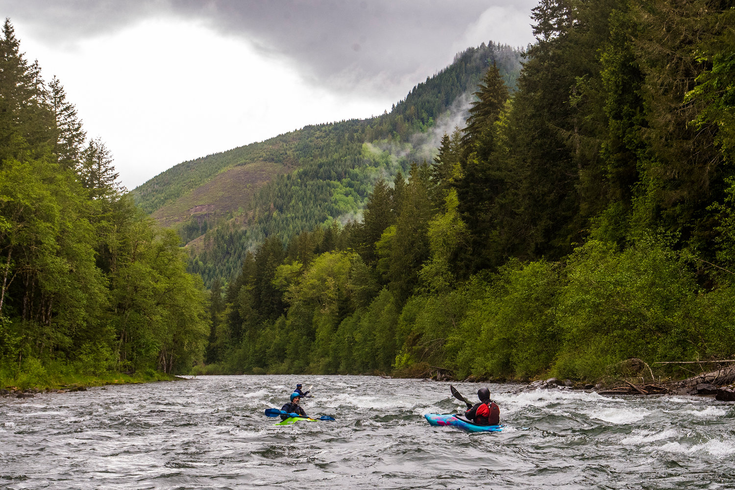
With nearly 30 miles of continuous intermediate whitewater, the Cispus provides opportunities for one of the longest whitewater trips in the state. By combining this section with the Upper Cispus you'll find opportunities for overnight excursions through the Gifford Pinchot National Forest. Braided channels with wood hazards near the FR 28 bridge however keep most from embarking on such an adventure. Paddlers typically divide the lower run which starts at the FR 28 Bridge into two sections separated by the Twin Cedars access point located just upstream of the confluence with Iron Creek.
_FR 28 to Twin Cedars_
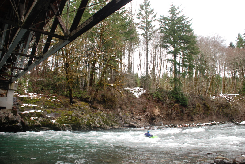
Starting from the FR 28 bridge (river mile 17.5), the river cuts through braided channels and shifting gravel bars. Most of the whitewater in this section is class II, but beware of wood hazards. You will encounter some private property along this first half which passes under the shadow of Tower Rock.
_Twin Cedars to Scanwea Reservoir_
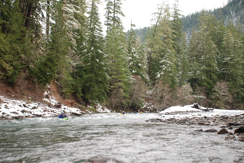
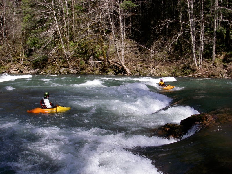
The second half of the run contains the interesting rapids, several of which rate class III, and starts about a mile upstream of the Iron Creek Campground. You can put-in here at the Twin Cedars access (river mile 9.2), a small pull-out with a twin pair of majestic cedar trees along the river bank and a couple larger pull-outs immediately upstream. The great thing about this section is all the rapids have relatively easy lines that make it a great training stretch for those just learning the sport.
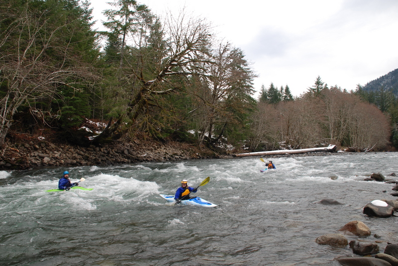
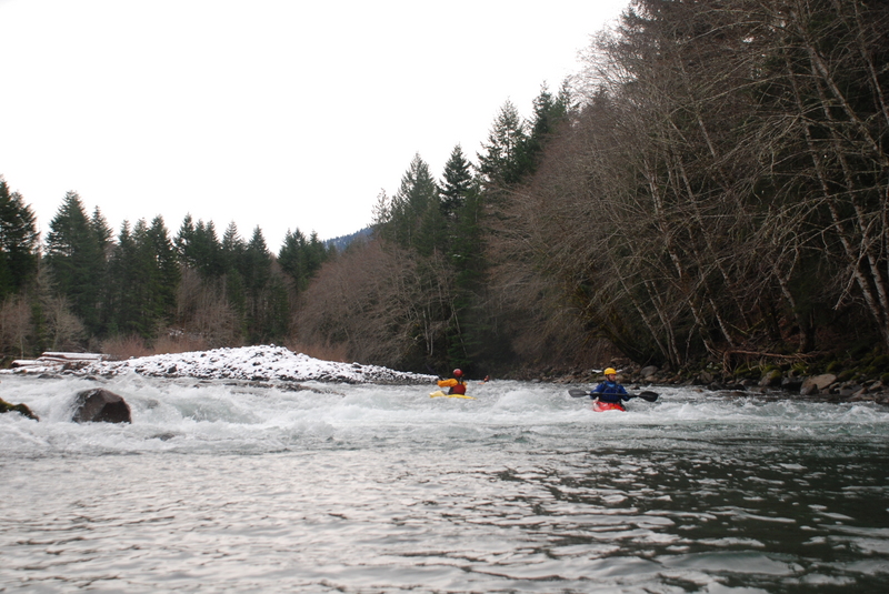
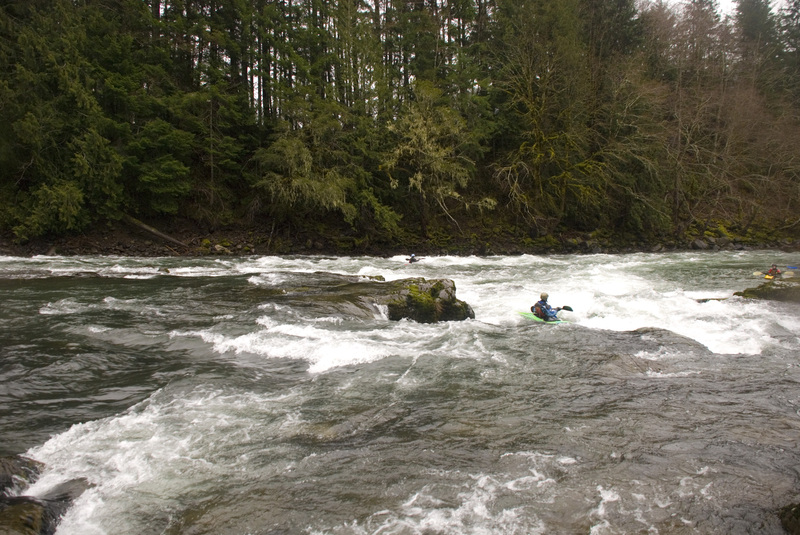
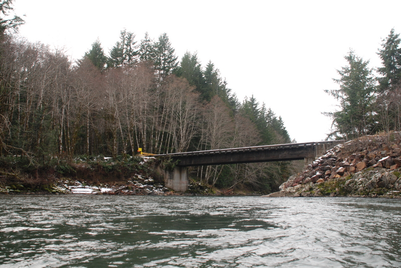
The action starts right away with First Iron Creek Rapid (river mile 8.8) and Second Iron Creek Rapid (river mile 8.6) both of which contain some fun play spots. Let's Make a Deal (river mile 7.6) comes next followed by Rollercoaster (river mile 7.2) where the river bounces down to the Huffaker Bridge (river mile 7.1) forming fun waves along the way. From this point on the river enters private commercial forest but the trees along the river are in good shape and the remote setting is a good place to see wildlife and birds.
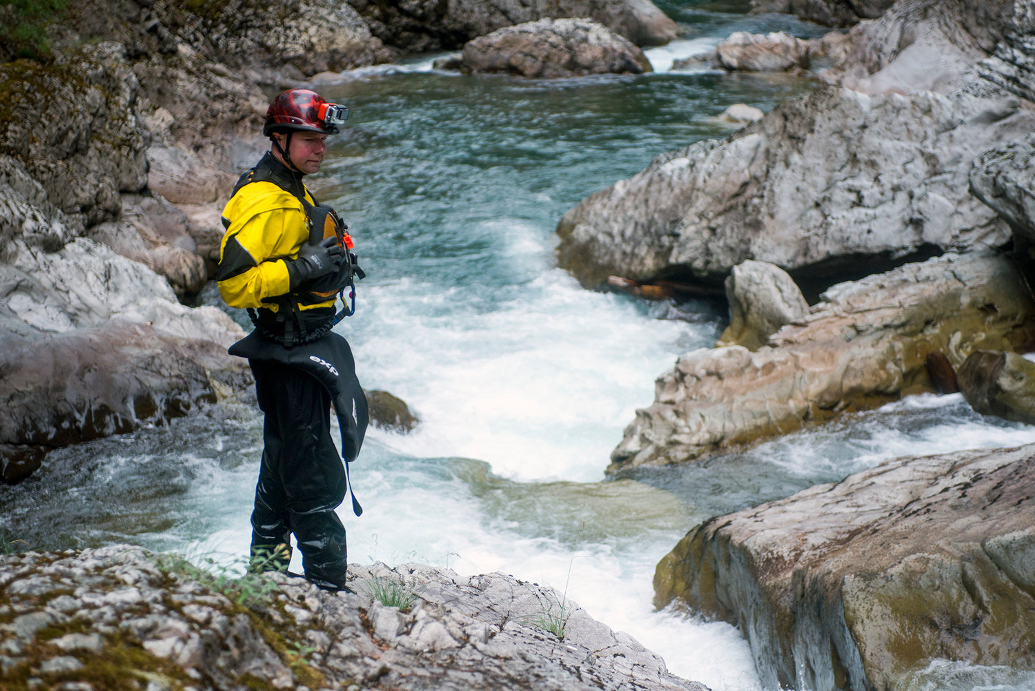
Below the bridge there are some fun rapids (river mile 6.6) and still within site of the bridge you come upon one of the best playspots on the run at Paul's Play Pen (river mile 6.4). Here a playful hole forms at the center and a ledge to the river right side forms a nice wave. Good eddy service makes this a great place to hang out for a few minutes or even an hour or more.
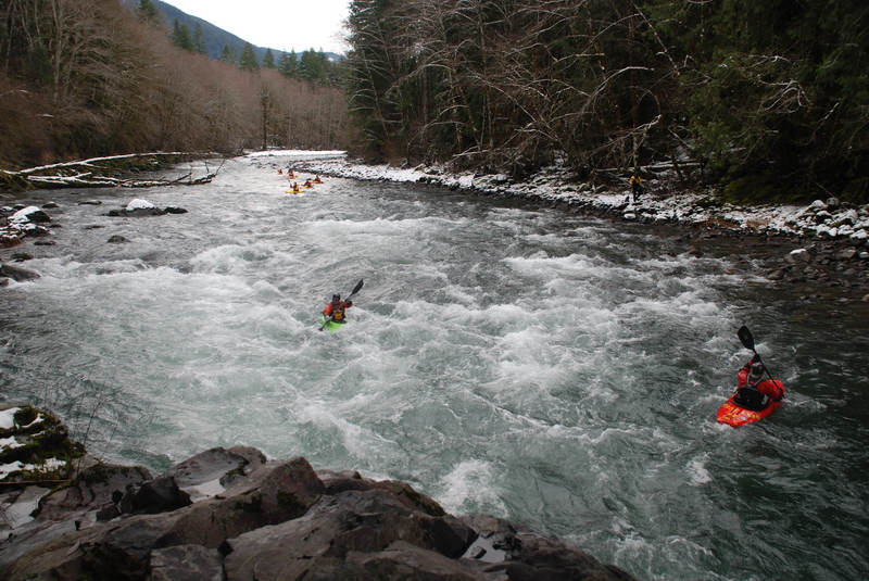
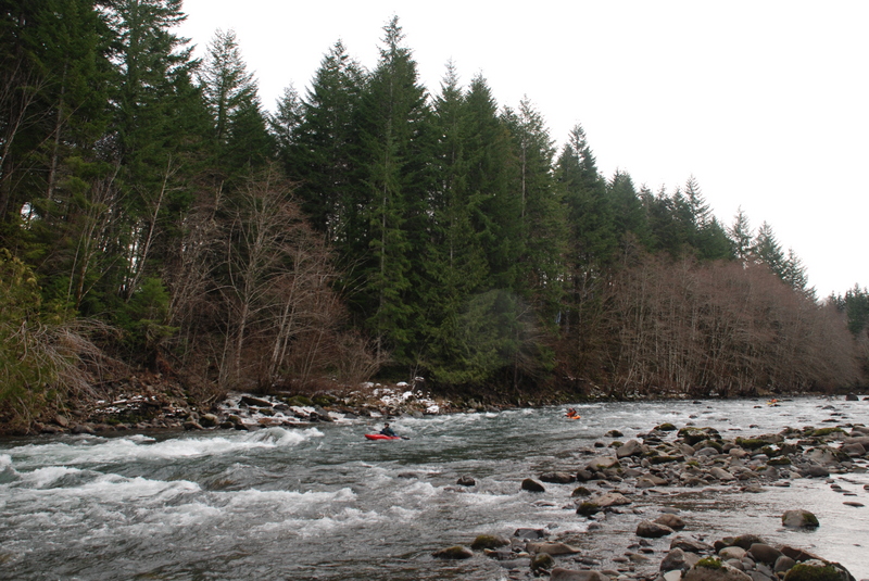
Immediately downstream the river slams into a bedrock wall on river left at Whirpool Corner (river mile 6.3). This was to be the site of the Cispus 4 hydropower dam which was fought by paddlers and others who helped successfully kill the project. It would have created a 0.7 mile reservoir flooding the rapids between this point and the Huffaker Bridge and dewatering the great whitewater that continues on below.
Just around the the corner the river flows through Agitator (river mile 6.2) which forms a nice wave and then Elk Rapid at river mile 5.9. Lion's Jaw comes up at river mile 5.6 which has a significant hole at the bottom. The final significant rapid on the run is Bobcat Rapid (river mile 5.4) which has a straightforward route down the left or a more exciting line to the right with a bedrock ledge dividing the two channels. You will encounter another class II rapid with some fun waves (river mile 4.6) before you reach the Crystal Creek Bridge (river mile 4.5). The river remains fun past the bridge but the action begins to slow down a bit as you pass Quartz Creek on your left (river mile 4.1). Most of the rapids are class II from this point on but there is one last distinct rapid called Double Trouble which comes as you pass the old take-out on river right. As you pass around a final bend in the river you're at the slackwater of the reservoir and the take-out located on river left at river mile 1.0.
In recent years the gates on private forest roads have generally been open during paddling season (they may be closed during fire season which corresponds to periods of low flow in the river). If the private timber roads are gated and you can't get to this access your only other option is to slog your way across the reservoir. At one time paddlers could continue on to the bigwater rapids of the Cowlitz, but now those rapids and the confluence itself are flooded by the waters of Scanwea Reservoir.
Logistics
When construction was completed on the Cowlitz Falls hydro project in 1994, we lost our historic public access along with 1.7 miles of whitewater on the Cispus (and even more on the Cowltiz). The result was that the project has made it very difficult for paddlers, and particularly rafters, to make use of the last few miles of the remaining free-flowing stretch of river. Some older maps do not show this reservoir, but it's where the Cispus historically entered the Cowlitz with the dam itself at the site of Cowlitz Falls ( map showing the approximate reservoir boundary).
Starting from the town of Randle which makes a good place to rendevous for breakfast at the Blue Stone Cafe (Previously Mt. Adams Cafe) at Highway 12 mile 115, take Cispus Road south across the Cowltiz River and continue for one mile to the fork of FR 25 and FR 23. Take the right fork on FR 25 and head 7.8 miles to Huffaker Bridge which crosses the Cispus River. Downstream of this point the river flows through private forest land. Continue across the bridge and immediately take a right turn down the forest road that parallels river left (this is a private forest road known as the 300 road). The first take-out option is reached by heading 1.6 miles down this road and then taking the right fork to the Crystal Creek Bridge (the access is steep but OK for kayaks). For the full run head 4.7 miles down the forest road on river left to a pull-out just past a small creek (this is Copper Canyon Creek). Here you will find a spur road (the 340 road) that leads to the river providing boater access to the reservoir. The utility has provided a formal access site and generally has it open except during periods of high fire danger which typically corresponds to low water. Details on current status of this access can be obtained from Lewis County PUD ( Copper Creek Cayon Creek take-out site web page). If you encounter any problems with access or otherwise have thoughts it is very helpful to register comments directly with FERC where they are placed on the public record. You can write to Secretary, Federal Energy Regulatory Commission, 888 First Street, NE Washington, DC 20426, RE: Cowlitz Falls Hydroelectric Project 2833.
To reach the put-in head back the way you came along river left. Once you reach FR 25 at Huffaker Bridge continue upstream along river left. Take the left turn onto FR 76 to stay along the river following it for 0.8 mile to a site just past Iron Creek where the river comes close to the road; this site is known as Twin Cedars. For a longer run you can continue up FR 76 to the FR 23 bridge which crosses the river and is considered the traditional dividing point between the upper and lower run. Between Twin Cedars and FR 23 you can also access the river at Tower Rock Campground.
Additional Information
- Bennett, J. 1997. A Guide to the Whitewater Rivers of Washington, second edition. Swiftwater Publishing Co. Portland, OR.
- FERC eLibrary: Cispus 4 Project under docket 10567; Cowlitz Falls Project whitewater recreation issues under dockets 2833-049, 2833-055, 2833-092
- Gifford Pinchot National Forest website
- North, D.A. 1999. Washington Whitewater. The Mountaineers. Seattle, WA.
- McNulty, T. 1990. Washington's Rivers: The Unfinished Work. The Mountaineers. Seattle. WA.
Rapids in this Run (15)
 Rapid
II+
Rapid
II+
First Iron Creek Rapid
 Rapid
II+
Rapid
II+
Second Iron Creek Rapid
 Rapid
III
Rapid
III
Let's Make a Deal
 Rapid
III
Rapid
III
Rollercoaster
 Rapid
Rapid
Huffacker Bridge
 Rapid
II
Rapid
II
Unnamed Rapid
 Rapid
III
Rapid
III
Paul's Play Pen
 Rapid
II
Rapid
II
Whirlpool Corner
 Rapid
III
Rapid
III
Agitator
 Rapid
II
Rapid
II
Elk Rapid
 Rapid
III
Rapid
III
Lion's Jaw
 Rapid
III
Rapid
III
Bobcat Rapid
Rapid
II
Unnamed Rapid
 Rapid
Rapid
Crystal Creek Bridge
 Rapid
III
Rapid
III
Double Trouble
Difficulty
Class III
Length
15.6 mi
Gradient
24 ft/mi
Rapids
15
Access Points
Difficulty Classes
I Easy
II Novice
III Intermediate
IV Advanced
V Expert/Extreme
VI Unrunnable
Current Conditions
5-Day Forecast
Whitewater data from
American Whitewater
American Whitewater