4. Sandy Beach/O-Deck to Anglers Inn
Gauge Conditions
Data from American Whitewater & USGS
Run Map
Run Time Estimate
Select put-in and take-out to estimate time.
Plan This Trip
See wind-adjusted speed maps, forecast planning, and detailed time estimates.
Sign in to generate an AI timing estimate for this run.
Whitewater timing varies with scouting, portages, and group pace. Use as a planning baseline.
Description
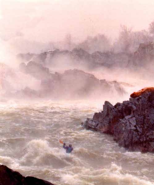
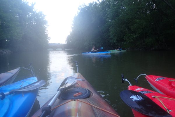
The Potomac River below Great Falls is literally in the back yard of Washington, D.C. This fact contributes to the strong boating community in the metropolitan region. Mather Gorge, where this section begins, is a stunning cliff-lined gorge. Further down, the river maintains it's wild and remote feeling, except for at choice spots where Virginia has allowed sloppy development to mar the shore.
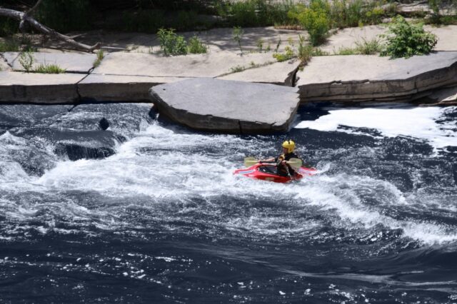
The river offers play and practice for beginners to experts and numerous sections can be run. This description will deal with the rapids and access points and doesn't provide details on the numerous play spots.
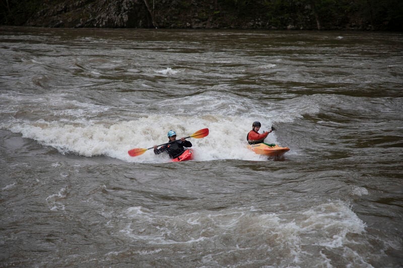
It should be noted that the stretch of river from O-Deck just below Great Falls thru Wet Bottom offers some of the best big water paddling in Maryland. 10,000 cfs thru a 100 foot wide gorge makes for some large waves, surging eddies and boiling eddylines. Below Mather gorge the rapids get considerably easier. See Surf the Potomac for good playspot info. Older playspot pages are the Potomac Playspot Project, Potomac Paddlers, as well as another popular playspot guide developed by David Mackintosh.
Playspot List & Levels:
2.5' - 4.2' Wet Bottom (Class 3)
2.6' - 2.8' Horseshoe (Snodgrass) Wave (Class 3+)
2.7' - 2.9' Fishladder Wave
2.7' - 2.9' Portage Waves (Class 2)
2.7' - 3.0' Annie's
2.7' - 3.0' O-Deck 3 (Class 3)
2.7' - 4.0' Maryland Chute (Class 2+)
2.7' - 4.2' Virginia Chute Wave (Class 2)
2.8' - 3.3' Bloody Good
3.3' - 3.6' O-Deck 2 (Class 3)
3.6' - 3.8' O-Deck 1 (Class 3)
3.6' - 3.7' S-Turn (Class 3)
3.7' - 3.9' S-Turn
3.7' - 4.1' Showcase (Class 3)
3.9' - 4.1' Simon Says
3.9' - 4.8' Rocky Island Waves (Class 3)
4.1' - 5.4' Center Chute Ledge (Main Hole) (Class 3+)
4.2' - 4.7' Upper Center Chute Ledge (Class 3)
4.2' - 4.4' Fish Counter
4.5' - 6.0' Tight Quarters
4.8' - 5.2' Gil's Hole (Lower) (Class 3)
4.9' - 5.4' Gil's Hole (Upper) (Class 4)
5.3' - 6.4' Rodeo Zone
5.4' - 6.5' Center Chute Wave (Class 3)
6.0' - 6.7' Rocha Motel
6.0' - 7.6' Skull Island Wave (Class 2+)
6.2' - 6.6' Dave's Wave (Class 3+)
6.4' - 8.0' Showcase
6.7' - 6.9' Super Dave
6.7' - 7.0' Shoulder Snapper (Sweetie-pie) Wave
6.8' - 7.5' Corner Hole (Fudgepacker) (Class 4)
7.0' - ?.?' Sweetie-pie Wave
7.2' - 8.2' Last Supper
7.3' - 8.0' Elbow Wave
7.3' - 8.8' Dead Cow Hole (Class 3+)
7.9' - 8.8' Bud (also called Butt) Hole
8.0' - 9.5' Pencil Sharpener
8.0' - ?.?' Zambezi Wave
8.5' - 9.5' Eraser
9.0' - 9.5' Round the Corner
From Potomac Paddlers website, added May 2004
National Park Service Great Falls Page
NPS Great Falls Map
These guide books provide good references for this section: Sehlinger, Bob, et. al.; Appalachian Whitewater, the Southern States. Gertler, Ed; Maryland and Delaware Canoe Trails.
Rapids in this Run (4)
Playspots (30)
 Playspot
Sandy Beach/O-Deck
 Playspot
Annies
 Playspot
Thunderdome Wave
 Playspot
The Pimp Hand
 Playspot
Zambezi Wave
 Playspot
Rodeo Zone
 Playspot
Portage
 Playspot
S-Turn
 Playspot
Super Dave
 Playspot
Dave's Wave
 Playspot
Small Green Wave
Playspot
Gil's Hole
 Playspot
Shoulder Snapper / Sweetie Pie
Playspot
Wet Bottom
 Playspot
Around the Corner
 Playspot
Butt Hole
 Playspot
Point 59
 Playspot
Dead Cow
 Playspot
Upper Center Chute Ledge
 Playspot
VA Chute
 Playspot
Center Chute ledge
Playspot
Chuck's Wave
 Playspot
MD Chute
 Playspot
Center Hole
Playspot
Island Wave
 Playspot
Corner Hole
 Playspot
Madiera Wall Wave
Playspot
Difficult Run Rapids
 Playspot
Barrel Wave
 Playspot
Skull Island
Difficulty
Class II-III(IV)
Length
2.2 mi
Gradient
8 ft/mi
Rapids
4
Access Points
Difficulty Classes
I Easy
II Novice
III Intermediate
IV Advanced
V Expert/Extreme
VI Unrunnable
Current Conditions
5-Day Forecast
Whitewater data from
American Whitewater
American Whitewater