4. Yankee Jims Road Bridge to Lake Clementine Wild
Gauge Conditions
Runnable: 500.0 – 5,000.0 CFS
Data from American Whitewater & USGS
CDEC Flow Data California
Data from California Data Exchange Center (CDEC)
Run Map
Put-in
Take-out
Rapids/Hazards
Wild
Run Time Estimate
Select put-in and take-out to estimate time.
Plan This Trip
See wind-adjusted speed maps, forecast planning, and detailed time estimates.
Sign in to generate an AI timing estimate for this run.
Whitewater timing varies with scouting, portages, and group pace. Use as a planning baseline.
Description
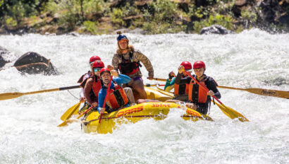
This section goes by several names - Ponderosa, Shirttail, and sometimes just 'The North Fork from Yankee Jim down'. A couple of takeout options allow you to choose between about 5 miles on the water to Ponderosa Road Bridge and a longer 9 miles or so to Upper Lake Clementine River Access. It is excellent on a warm, sunny spring day on snowmelt and also often runs in the winter. Upper Clementine is typically subject to seasonal closure so taking out is preferred in the winter/early spring. Rapids are generally Class II between about 800 and 1600cfs. At these flows the most significant features appear in the longer braided rapid visible from Yankee Jim's Road and an excellent and short first-time-boating run can be had between Ponderosa Bridge and Upper Clementine. Above 1500cfs, a few rapids can become a little bit more chaotic. Around 3,000cfs a few holes appear on the run that deserve prudent caution with one notable one appearing about 3 bends below Ponderosa Bridge.
In 2022 the Ponderosa Road Bridge replacement project necesitated road grading and the takeout road was considerably improved and smooth as of May 2024.
Put-in: Colfax-Foresthill Rd.
Take-out: Ponderosa Way Bridge (4.5mi) or Upper Lake Clementine Road (9mi)
CAMPING: As of 2015, camping is allowed only from 2000’ downstream of Ponderosa Bridge to 1 mile downstream of Codfish Creek. A campfire permit and/or a camp stove permit will be required too. Also, while they transition into this new policy it would be best to contact and pick up your permits at the Auburn State Recreation Area office.
Other information sources:
- Cassady & Calhoun
- Holbek & Stanley
- Martin
- California Creeks
Rapids in this Run (1)
Difficulty
Class II-III
Length
9.0 mi
Rapids
1
Access Points
Difficulty Classes
I Easy
II Novice
III Intermediate
IV Advanced
V Expert/Extreme
VI Unrunnable
Current Conditions
5-Day Forecast
Whitewater data from
American Whitewater
American Whitewater