5) Ayers Island Dam (Bristol) to Coolidge
Gauge Conditions
Runnable: 400.0 – 12,000.0 CFS
Usual release level. Good play, fluid, not too shallow.
Data from American Whitewater & USGS
Run Map
Description
River description.
There is a small parking area at the put-in near Ayers Island dam. There is a porta poty located here along with trash cans. Additional parking can be found at the top of the dam where a hiking trail leads down to the put-in parking lot.
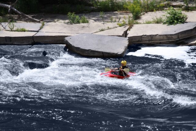
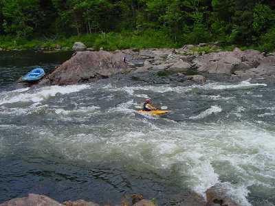
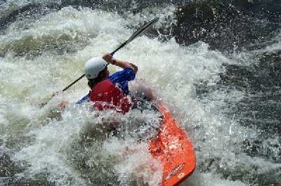
The river is about 1-1/2 miles long with three distinct play spots. The first big drop is about 1/4 mile downstream with a medium size sidesurfing hole (Rodeo Hole)it is not for novices to play in. Run right at this point. Downstream 100 yards there is a good surfing wave depending on level. The river from this point to the take out is mostly small rapids with a few oppertunities for surfing a sidesurfing. The last rapid is a series of reactionary waves and holes caused by protruding ledges on a long sweeping right turn. The last ledge at the take out is probably one of the best summer time play spots in NH with a great sunning and spectating rock to go with it. Depending on level it is either a sidesurfing hole, surfing wave, and or ender spot.
You can takeout at the Pemi Park & Play or just slightly downstream at a ledge. This take-out is easier for canoes and rafts. It also leads up to a small parking area on Coolidge Woods road which has new porta poties maintained by Public Service company of NH.
### Technical info
```
Put in elevation........370'
Take out elevation......331'
Total drop..............39'
Average drop/mile.......25'
Distance................1.6 miles
River width average.....120'
River geology...........small boulders and granite ledge
River water quality.....fair to good, clarity fair, sewage treatment dumps in
below rodeo wave.
Scenery.................Good forest scenery. Not many signs of civilization
except for dam and bridge.
Wildlife................Occasional deer, hawks, osprey, fishermen. Good trout
fishing.
```
## Mapquest Directions From Concord, NH
## Directions from southern NH.
Interstate 93 north to exit 23.
Left on state rt. 104 (west) towards Bristol.
Approximately 4.5 miles, look for a baseball field on the left.
There will be a yellow playground sign just before you get there.
Take a left here and go around the ball field towards the recycling
center.
Drive past the entrance to the town garage, sewage treatment
facility, and recycling center. The road at this point turns to a
rough dirt road descending steeply to the small parking area at the
base of the dam. Note new handicap accessible outhouse.
Directions to the take out:
As of the Fall of 2009 a new bridge opened to replace the metal truss bridge that used to cross the river from Bristol to New Hampton. This cuts the shuttle down to 2 miles from the 8 miles we had to endure over the last couple years.
Head back out to NH rt 104 and take a left toward Bristol.
In the center of town at the intersection of rt 3a take a left then another immediate left in the town square.
Take the right (downhill) at the fork.
Follow the road down over the bridge then take a right on Coolidge Woods road (dirt).
Approximately 1/3 mile to take out. Look for vehicles parked at the
play spot. Or take out a little further down stream where the river
flattens out.
## New put in access
In the summer of 2006 a new river access path was put in by PSNH. It is accessed from the same parking area. The path leads a short distance downstream from the old put in. The path is made up of crushed stone and has an even grade all the way to river level. This is a great improvement over the continually shifting rock jumble we used to put in at.
## Osprey Webcam
In 2003 Public Service Company of New Hampshire installed an artificial osprey nest at their Ayers Island hydro facility. Since that time a nesting pair of Ospreys have taken up residents to raise their chicks for the last few years. This Nest is visable from the putin. Look to the river left side of the dam to view the telephone pole platform with a large nest on top. In the summer of 2006 PSNH installed a webcam so we can view the nest at anytime.
Flow Info:
This entire section is regulated by Ayers island hydro dam at the put-in. The USGS gauge referred to above is located upstream of the dam in Plymouth NH. When this gauge exceeds 1300cfs, water is just about guaranteed in Bristol. Water is available at other times when this guage is below 1300cfs but Ayers Island Hydro regulates releases below the dam. This is a peaking power station so levels sometimes rise and fall without warning. To get the latest best guess level information call after 7pm the day before (603) 624-0779 for a recorded phone message. You can call the dispatcher for specific info 603-669-4000.
To find out if the Pemi has been releasing recently go to the Army Corps of Engineers Franklin Falls flood control dam webpage and look at the last reading under the "inflow cfs" heading. Unfortunately there is a several hour delay between the release at Ayers Island and the reading on this webpage. Use it only to get a recent release history.
There are four Summer releases of at least 900 cfs that were negotiated during dam relicencing a few years ago. Usually one weekend in July and another weekend in August.
400 cfs ......minimum scratchy level
600 cfs.......very low
800 cfs.......low
1100 cfs......low to medium
1500 cfs......medium
2000 cfs......medium high
2700 cfs......high
3400 cfs......very high
>6800 cfs.....Pemibec
2019 Pemigewasset Bristol releases (Ayers Island dam)
Date
Time
Flow
Notes
Sat. July 20th
10:00am to 2:00 pm
1000 cfs
Recreational release
Sun. July 21st
10:00am to 2:00 pm
1000 cfsif water is available
Sat. Aug. 24th (to be confirmed)
10:00am to 2:00 pm
1000 cfs
Recreational release
Sun. Aug. 25th (to be confirmed)
10:00am to 2:00 pm
1000 cfsif water is available
Note: The 20th annual and last MVP Pig roast was held in August of 2008. The Brunning farm has been sold so there is no longer an open invitation to camp at the farm as we have been able for the last quarter century.
Rapids in this Run (2)
Playspots (3)
Difficulty
Class II(III)
Length
1.7 mi
Gradient
25 ft/mi
max 35
Rapids
2
Access Points
Shuttle Info
Mapquest Directions
[From Concord, NH](http://tinyurl.com/y76t2j)
## Directions from southern NH.
Interstate 93 north to exit 23.
Left on state rt. 104 (west) towards Bristol.
Approximately 4.5 miles, look for a baseball field on the left.
There will be a yellow playground sign just before you get there.
Take a left here and go around the ball field towards the recycling
center.
Drive past the entrance to the town garage, sewage treatment
facility, and recycling center. The road at this point turns to a
rough dirt road descending steeply to the small parking area at the
base of the dam. Note new handicap accessible outhouse.
Directions to the take out:
As of the Fall of 2009 a new bridge opened to replace the metal truss bridge that used to cross the river from Bristol to New Hampton. This cuts the shuttle down to 2 miles from the 8 miles we had to endure over the last couple years.
Head back out to NH rt 104 and take a left toward Bristol.
In the center of town at the intersection of rt 3a take a left then another immediate left in the town square.
Take the right (downhill) at the fork.
Follow the road down over the bridge then take a right on Coolidge Woods road (dirt).
Approximately 1/3 mile to take out. Look for vehicles parked at the
play spot. Or take out a little further down stream where the river
flattens out.
Difficulty Classes
I Easy
II Novice
III Intermediate
IV Advanced
V Expert/Extreme
VI Unrunnable
Current Conditions
5-Day Forecast
Whitewater data from
American Whitewater
American Whitewater