5. Bloomington, MD to Black Oak (Gary Yoder River Access) Nr. Rawlings, MD
Gauge Conditions
Runnable: 400.0 – 3,000.0 CFS
Data from American Whitewater & USGS
Run Map
Run Time Estimate
Select put-in and take-out to estimate time.
Plan This Trip
See wind-adjusted speed maps, forecast planning, and detailed time estimates.
Sign in to generate an AI timing estimate for this run.
Whitewater timing varies with scouting, portages, and group pace. Use as a planning baseline.
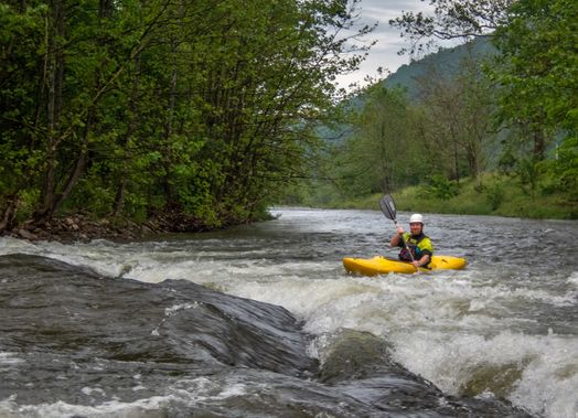
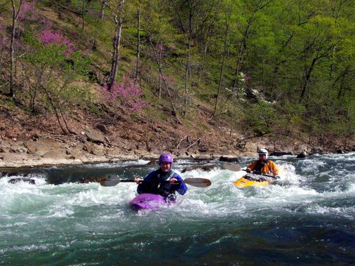
Description
Ed Evangelidi: This stretch (which starts at the Bloomington MD take-out for the Barnum to Bloomington section) is a nice Class 2 section that is rarely paddled since early in the run, you have to portage the Paper Mill dam on river right, then paddle by the huge monstrosity that is the paper mill. But the river entertainment continues all the way to Keyser
Portage the dam at the paper mill in Luke, MD on river right.
The Dam portage and the ugly stretch of river around the abandoned paper mill can be avoided by putting in 2.1 miles downstream at Westernport, MD or 2.0 miles downstream at Piedmont, WV. This run can also be shorted at the bottom by approximately 4 miles by taking out under the bridge on Potomac Dr. at Keyser, WV.
The shuttle from Westernport MD is to take MD 135 east 5 miles to US 220 north for 3.5 miles to the Gary Yoder (Black Oak) river access for a total shuttle distance of 8.5 miles one way. One weirdness on the reverse shuttle is that the signs on US 220 south towards MD 135 west to Westernport direct a left turn onto an older road that goes under US 220 and joins MD 135 west without approaching the bridge over the Potomac to Keyser, WV. You should take this turn, but if you miss it, there is another opportunity to turn (right this time) onto MD 135 after the Chat and Chew restaurant and a gas station but before the bridge. Total shuttle distance is the same.
Lat/longitude coords are approximate, from TopoZone.
Rapids in this Run (7)
Hazards & Portages (1)
Caution: The following locations may require scouting or portaging. Always check current conditions.
Difficulty
Class II
Length
12.0 mi
Gradient
20 ft/mi
Rapids
7
1 Hazard
Access Points
Difficulty Classes
I Easy
II Novice
III Intermediate
IV Advanced
V Expert/Extreme
VI Unrunnable
Current Conditions
5-Day Forecast
Whitewater data from
American Whitewater
American Whitewater