5. Pierce bridge to NH 116
Gauge Conditions
Runnable: 3.1 – 6.0 FT
Data from American Whitewater & USGS
Run Map
Run Time Estimate
Select put-in and take-out to estimate time.
Plan This Trip
See wind-adjusted speed maps, forecast planning, and detailed time estimates.
Sign in to generate an AI timing estimate for this run.
Whitewater timing varies with scouting, portages, and group pace. Use as a planning baseline.
Description
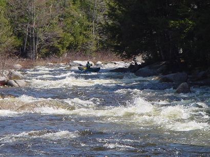
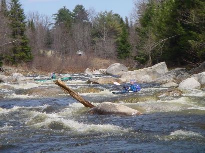
Pierce Bridge Put-In: Access the large gravel lot on River Rd just behind the large bridge on Rt 302. There is a 300 ft walking trail down to the river. This is the take-out for the upper section and a great spot for lunch if doing the Class II upper section in the morning and the Class III lower section in the afternoon. This section contains LONG lengths of flatwater and quickwater -- nearly half the run, so plan to engage in a good shoulder work out! There is also a significant river-left portage around Powerhouse Dam. At 3 ft and below, all rapids are Class III and under and the river is slow-going on the flats. At 3.5 ft, the river is more lively and the big rapids increase in difficulty. At 4 ft and above,the major rapids approach Class IV character.
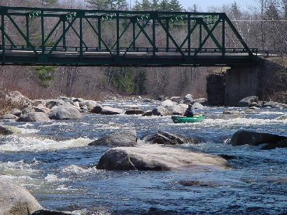
Maplewood Put-in: At the end of River Rd there is a bridge over the river with a small parking area (only 2 cars). This is a good take-out for any paddler who wants to push through Powerhouse Rapid, but avoid Alder Brook and Railroad Rapids at the end of the run.
Powerline Put-in: To bypass the LONG flats after Powerhouse Rapid, put in at the powerlines on NH Rt 116 (44.323311, -71.678313). This gives you a 2-mile short run and puts you in about a half-mile above the beginning of Alder Brook Rapid.
### Technical info
```
Put in elevation........1167'Take out elevation......875'Total drop..............292'1st mile................32'2nd mile................7'3rd mile................79'4th mile................46'5th mile................26'6th mile................33'7th mile................46'7.3 mile................23' (77 average)Average drop/mile.......40'Distance................7.3 milesRiver width average.....70'River geology...........Small to medium granite bouldersRiver water quality.....good to excellent, clarity good.Scenery.................Nice Mountain scenery, river parallels road most of the wayWildlife................Deer, hawks, moose, beavers.
```
Rapids in this Run (4)
Hazards & Portages (1)
Caution: The following locations may require scouting or portaging. Always check current conditions.
Difficulty
Class II-IV
Length
7.4 mi
Gradient
40 ft/mi
max 79
Rapids
4
1 Portage
Access Points
Difficulty Classes
I Easy
II Novice
III Intermediate
IV Advanced
V Expert/Extreme
VI Unrunnable
Current Conditions
5-Day Forecast
Whitewater data from
American Whitewater
American Whitewater