5. Sherman Island to Feeder Dam
Gauge Conditions
Runnable: 0.0 – 20,000.0 CFS
The gauge limits are a rough guess, based on historical streamflows. If you have good beta on runnable levels, please add a comment.
Data from American Whitewater & USGS
Run Map
Run Time Estimate
Select put-in and take-out to estimate time.
Plan This Trip
See wind-adjusted speed maps, forecast planning, and detailed time estimates.
Sign in to generate an AI timing estimate for this run.
Whitewater timing varies with scouting, portages, and group pace. Use as a planning baseline.
Description
General Description: This section starts with a challenging section (which is difficult to access) followed by a mile of of Class 1-2 ripples followed by flatwater.
Directions from I-87 (Northway): Take exit 18. Head West on Corinth Road for 3 miles until the river comes into view to get to put-in.
Put-in: The GPS coordinates for the put-in refer to a turn-off on river left above the river. The land is fenced and posted elsewhere, but not here. There is small gully just to the east side of the turn-off that makes an easy walk down to the shore. The put-in is above the Sherman Island Project. To get downstream of the dam, paddle across the impoundment to river right, adjacent to the horseshoe-shaped dam.
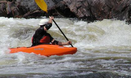
Dam: Portage the dam on river right. Use caution approaching the dam. A dirt road leads downstream to make it easy to portage. It might be possible to paddle some of the spillway, but the access would be difficult as is. The rapids in the spillway are very serious at the levels when this section was researched. Wide, terminal hydraulics overlap any obvious lines through the spillway. (See photo)
Access at HPNP: There is access on river left at the Hudson Point Nature Preserve, but the climb out to the parking lot would be long and steep. Instead, use the nature preserve as a quick stop to explore. The preserve can be located on river left by some steps leading down to the water where the river narrows again. (43.279352N,73.697501W) This would be about 1 1/4 miles downstream of the spillway.
Access at Hudson River Park: The trip can be shortened by taking out at the park seen on river left downstream from the I-87 Northway bridge over the Hudson. To access the park, head east from Exit 18 on Main Street and take the immediate right onto Boom Road. Follow Boom Road until it terminates at the boat launch on the river (43.263970N,73.674647W).
Take-out: The GPS coordinates for the take-out refer to just above the Feeder Dam on river left. To get to the parking area at the Feeder Dam, head east from Exit 18 on Main Street. Take a right at the light on Richardson Street. Take Richardson to the parking area at the Feeder Dam.
Rapids in this Run (1)
Difficulty
Class I(V)
Length
7.0 mi
Gradient
5 ft/mi
max 100
Rapids
1
Access Points
Difficulty Classes
I Easy
II Novice
III Intermediate
IV Advanced
V Expert/Extreme
VI Unrunnable
Current Conditions
5-Day Forecast
Whitewater data from
American Whitewater
American Whitewater