6 - Metro Hooch - Powers Ferry to West Pallisades/Paces Mill
Gauge Conditions
Runnable: 850.0 – 20,000.0 CFS
Data from American Whitewater & USGS
Run Map
Run Time Estimate
Select put-in and take-out to estimate time.
Plan This Trip
See wind-adjusted speed maps, forecast planning, and detailed time estimates.
Sign in to generate an AI timing estimate for this run.
Whitewater timing varies with scouting, portages, and group pace. Use as a planning baseline.
Description
Gauge Description:
There are three gauges of note for this run. The main one listed is USGS 32336000 CHATTAHOOCHEE RIVER AT ATLANTA, GA. This is located a little under a mile below the main Paces Mill takeout at Paces Ferry Rd. This is also the gauge the levels referenced below are from. They correlate closely with the put-in gauge, USGS 02335880 CHATT R AT POWERS FY & I-285 NR ATLANTA, GA. These gauges are typically within around 100 CFS of each other, but it takes about 1 to 1.5 hours for the water to travel from Powers Ferry to Paces Ferry. Personally, I use the Powers Ferry gauge since it is actually located in the run, but either one will work.
Additionally, you can check the USGS 02335815 CHATTAHOOCHEE RIVER BELOW MORGAN FALLS, DAM, GA gauge. This gauge is located about 6 miles up river from the put-in. It takes about 2 hours for the water to travel from Morgan Falls to Powers Ferry. It's a good idea to check this gauge as it will show you if the dam is currently releasing. Georgia Power also has real-time data for this site which also includes the dam resevoir level. When this level approaches 866.0 feet, Morgan Falls will release.
Powers Ferry Gauge\- USGS 03235880 (Powers Ferry)
Morgan Falls Gauge \- USGS 02335815 (Morgan Falls)
Georgia Power Morgan Falls
Optimal Levels: 2500 cfs and up.
Optimal Playboating Levels: 5,500 to 7,500 CFS
At the upper end of this range the eddies disappear but the holes get deeper, at the lower end of this range, some of the holes get shallow but the eddies are good.
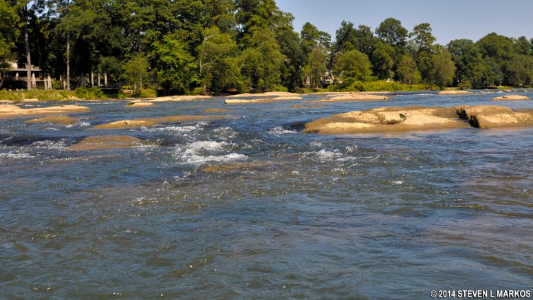
The cement and wood stairs in the main channel at the put-in are a good gauge. If all the stairs are out of the water the river can be considered low. This usually corresponds to about 900 cfs.
If you see exposed dirt below the stairs, then the river is too low.
At 2000 cfs the bottom cement step is underwater. This would be a low, but not scrapy level. Rafts would not be getting hung up on rocks at this level.
3 stairs underwater is about optimal. This is about 3500 cfs. At this level there is some good surfing to be found.
At 5000 cfs most of the rocks in the river are underwater. Lots of good sidesurfing holes. Short boats can get vertical. The only eddies are in the backwash of holes.
Bankful is around 9,000 cfs. If the takeout parking lot is underwater, then consider the river high. This occurs around 12,000 cfs.
Morgan Falls Dam is the primary feeder for this stretch. Release info for Morgan Falls Dam: 404-329-1455. When Morgan Falls is releasing the water can get very cold, very quickly. Don't be suprised if the river becomes blanketed in a thick fog.
Buford Dam at Lake Lanier is 40 or so miles upstream. Normal releases from Buford do not directly affect paddling levels on this section; CONTINUAL releases do.
Buford Dam info number: 770-945-1466
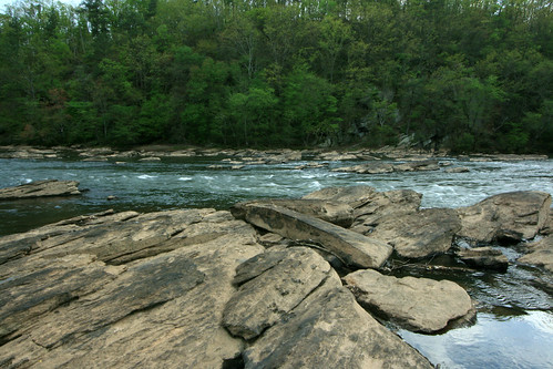
RIVER DESCRIPTION:
At the river left put-in you have two options. Closest to the parking lot is a channel with some flatwater slalom gates. A variety of olympic calibre paddlers have practiced at these gates. The drain at the lower end of the channel is under the interstate bridge and sometimes gets temporarily jammed up with wood. As of summer 2008 this channel is impassable.
On the other side of Powers Island is the main channel of the Hooch. There is usually a mild current here which is good for warmup.
Just below the put-in is the Interstate 285 bridge over the river. On river right there is a very small wave hole under the bridge which is a good place for novices to practice surfing. After this is a long stretch of flatwater.
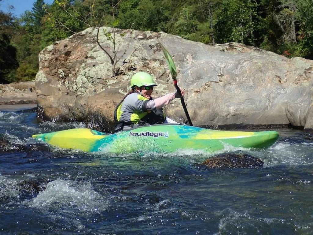
Next up is a riverwide series of small ledges. At flows over 1500 cfs the best surfing is on river left. Most of the flow goes far right through a class II chute with good eddies on both sides. Far left there is a short but good wavetrain at flows of 2000-4000 cfs.
A few hundred yards beyond, the second set of ledges is rocky with a fast chute down the middle and a number of good eddies to the sides. Known locally as the 'Devil's Racecourse', this is a very good place for novices to practice swiftwater ferrys and eddys. At higher flows most of the rocks disappear underwater; follow the flow left of center but know most of the holes/rocks are on the left side of the chute flow. The pool on river left at the bottom of the chute is great for roll practice.
Below the pool the river is divided by an island. Most of the water goes down the left side of the island and forms a nice wavetrain with a couple of surfable holes. Eddy behind the island and ferry far right across some more small islands and ledges to get to a park service picnic area, with restrooms. This is a very scenic spot that gets very crowded on the weekends and probably the best choice of lunch stop on this section; also is a good place to hike out if necessary - follow the downriver trail uphill to get back to civilization. On river left across the pool is the diving rock, obvious in the summer by the presence of locals diving into the river from the higher of the two cliffs. The lower cliff makes a fun seal launch for kayakers.
After this the river bends to the left and goes over the third series of ledges. This set is similar to the first; most of the flow going far right, then across to the far left, but there are plenty of alternate routes down. The abundant rocks create many small playspots. About this time the odor of sewage sometimes drifts over the river. That lovely odor comes from a vent pipe about 50 feet back in the woods on river right. There is an underground sewage line that runs next to the last half of the run on river right.
As the river takes a right bend and the I-75 bridge comes into view there will be a strong eddy with a clean eddy line on river right at medium flows. This is a great playspot for the local squirt boaters, and a great place to learn mystery moves.
On river left is Whitewater Creek of the East Palisades Unit of the park. This can be used as an alternative take out, but be aware that there is very little parking and it tends to get very crowded as this is the most scenic unit of the park. There are no restrooms here. At lower flows this becomes a popular dog beach, and also the last decent spot to stop. You must manuever through Long Island Shoals to get to the unit.
At Whitewater Creek, the river splits around Long Island. The island is about .7 miles long. The main flow runs to the right. At flows of 3000 or more, the left channels can be taken. Anything lower this is very boney and no fun. If you do go this route, stay in the main flow and don't take any of the offshoots as most are filled with channel wide strainers and are impassable. Also, to get to the takeout you must ferry across river immediately after clearing the island to make the main Paces Mill take out. This can be difficult at higher flows, but if you miss it, there is another boat ramp just past the US-41 Bridge, still within the park.
River left of Long Island, just above the I-75 bridge there is a large obvious rock 30 feet off the right bank of the river. I don't recommend splatting the upstream side of the rock, but it does have a great eddyline for stern squirts. Class III-IV Rottenwood Creek (see AW reach # 497) enters the river just below this point.
On river right just below the bridge is a little drop running right to left that may have some wood in it but is otherwise fun to run. From this point down to the takeout, look for many more small surfing ledges at normal water. The river starts fording out, getting more shallow and gravelly.
The takeout is on the right about a half mile past the I-75 bridge. You can spot the end of the concrete boat launch from a few hundred yards upriver, sticking out of the trees. If it is extremely busy, there is another boat ramp in the park located just past the US-41 bridge. Note, there is a tree that fell just in front of the boat ramp in 2021, so this take out can be tricky/dangerous at higher flows.
Map of the put-in: Powers Island.
Map of the takeout: West Palisades and Paces Mill.
East Palisades.
Map of the Chattahoochee River National Recreation Area.
Upper Chattahoochee Riverkeeper.
How Polluted is the River??
Rapids in this Run (3)
Playspots (8)

Hazards & Portages (1)
Caution: The following locations may require scouting or portaging. Always check current conditions.

Difficulty
Class I-II+(III)
Length
2.6 mi
Rapids
3
1 Hazard
Access Points
Difficulty Classes
I Easy
II Novice
III Intermediate
IV Advanced
V Expert/Extreme
VI Unrunnable
Current Conditions
5-Day Forecast
Whitewater data from
American Whitewater
American Whitewater