7. Watertown to Brownville
Gauge Conditions
Runnable: 1,000.0 – 6,000.0 CFS
The True Path keeps getting tighter and tighter as the water rises above 2500; at the higher end, most boaters will sneak Knife's Edge.
Data from American Whitewater & USGS
Run Map
Run Time Estimate
Select put-in and take-out to estimate time.
Plan This Trip
See wind-adjusted speed maps, forecast planning, and detailed time estimates.
Sign in to generate an AI timing estimate for this run.
Whitewater timing varies with scouting, portages, and group pace. Use as a planning baseline.
Description
# Video River Guide
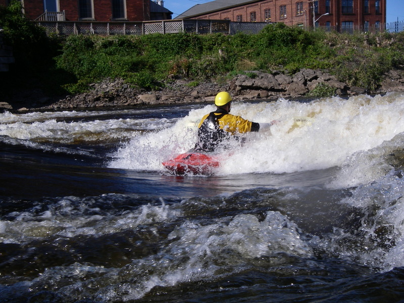
The classic summer run for New York that has play spots almost every day!
Driving Directions: To the Put-in:
Take Interstate 81 North. Exit on Rte. 12-F, heading East toward Watertown.
Near the center of the town, take a Left at the lights onto City Center Drive.
Soon after that, turn left onto Whitewater Way.
Park at the parking lot there and play at Hole Brothers.
(Or you can walk up to the rafting shop, head through the gate, put in there, and get one more rapid with a couple of play waves...and then play at Hole Bros.)
To the Take-out:
Head out to Rte. 12-F, heading Right (back toward Rte. 81).
After about three miles or so, turn right onto Rte. 12-E toward Brownville.
Cross the bridge and grab the first Left. Park on the street. From the river, you'll see the takeout as a flatwater spot just after a large industrial plant on River Right.
Lat / Longitude data are verified by GPS.
Safety Warning and description of Knife's Edge Rapid
by Bridog, posted to the Northeast Paddlers' Message Board
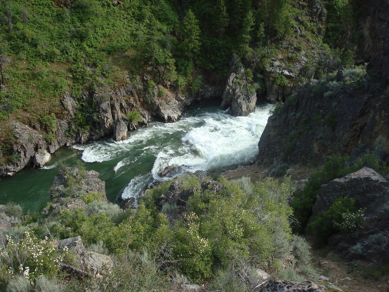
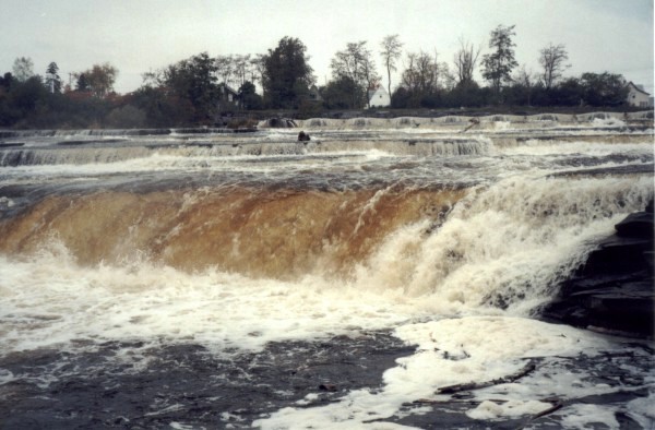
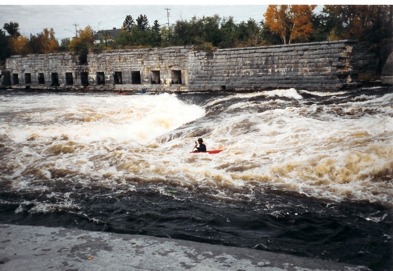
Knife's Edge is the first significant rapid that you encounter as you paddle downriver from Hole Brothers. You will find it approximately 200 yards downstream from the Interstate-81 bridge. There are numerous eddies on both river left and river right, including a "last chance" eddy on river left right at the top of the drop.
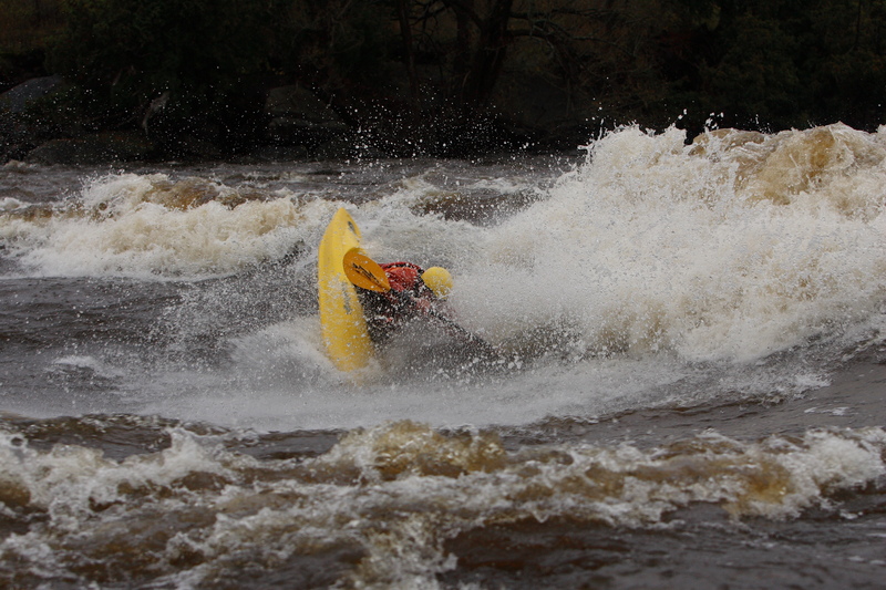
The rapid is basically a shallow fast section with a bit of gradient and 3 "ledges". Depending on water level, boaters will choose different lines.
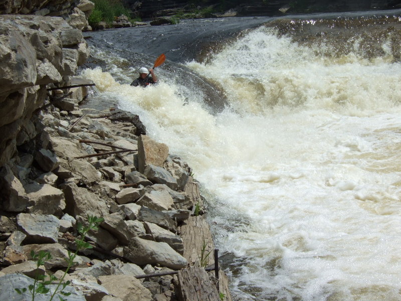
High Water (>5000 cfs): You can run "Right-right-right" (river right side, all 3 drops. The last drop will have a large/powerful hole (Mary's Hole). Just hug the stone wall on river right and you'll have no problem. For more excitement start in the center and work right.
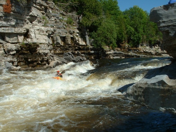
Medium Water (2000-5000 cfs): You can run "True Path" or "B-line Skate". Both routes start the same: Run the 1st drop either all the way left or at the "point" formed by the two diagonal ledges, or anywhere in between. At low levels, the point may be best because it won't be as scrapey. The 2nd ledge forms a wave/hole in river center. You'll want to sneak by it on the river-left side. Once past it, you can make a choice: Ferry over to the river right side and run the 3rd drop river-right of Mary's Hole (B line skate), or run True Path. To run True Path, you are essentially "threading the needle" between 2 hydraulics: The diagonal extending out from river left, and Mary's Hole in river center. It will look like there is a wide and easy pathway between the two, but that is where this pinning hazard is located. So you'll want to clip the corner (right side) of that diagonal coming out from the left (known as the Heater), or just miss it. Get too far river-right, and you potentially could get hurt.
You won't want to run all the way right (Right-right-right) at these medium levels - very scrapey over there.
Low water (
Rapids in this Run (5)
Waterfalls (1)
Playspots (2)
Hazards & Portages (4)
Caution: The following locations may require scouting or portaging. Always check current conditions.
Difficulty
Class III-V
Length
4.0 mi
Rapids
5
4 Hazards
Access Points
Shuttle Info
**Driving Directions**
**To putin:** Take Interstate 81 North. Exit on Rte. 12-F, heading East toward Watertown.
Near the center of the town, take a Left at the lights onto City Center Drive.
Soon after that, hang a Left onto Whitewater Way.
Park at the parking lot there, and play at Hole Brothers.
(Or you can walk up to the rafting shop, head through the gate, put in there, and get one more rapid with a couple of play waves...and then play at Hole Bros.)
**To takeout:** Head out to Rte. 12-F, heading Right (back toward Rte. 81).
After about three miles or so, bang a Right onto Rte. 12-E, toward Brownville.
Cross the bridge, and grab the first Left. Park on the street. From the river, you'll see the takeout as a flatwater spot just after a large industrial plant on River Right.
_Note: this reach used to be described as "Watertown to Dexter." Rafters might paddle all the way to Dexter, butt kayakers always take out at Brownville._
Lat / Longitude data are verified by GPS.
Difficulty Classes
I Easy
II Novice
III Intermediate
IV Advanced
V Expert/Extreme
VI Unrunnable
Current Conditions
5-Day Forecast
Whitewater data from
American Whitewater
American Whitewater