8. Greenwood Creek to Folsom Reservoir
Gauge Conditions
Runnable: ? – ? CFS
Approximate reading: This gauge is 5.4 miles away on American. Use as a general reference only.
Data from American Whitewater & USGS
CDEC Flow Data California
Data from California Data Exchange Center (CDEC)
Run Map
Run Time Estimate
Select put-in and take-out to estimate time.
Plan This Trip
See wind-adjusted speed maps, forecast planning, and detailed time estimates.
Sign in to generate an AI timing estimate for this run.
Whitewater timing varies with scouting, portages, and group pace. Use as a planning baseline.
Description
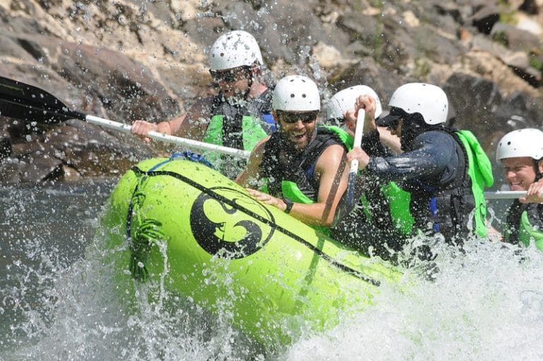
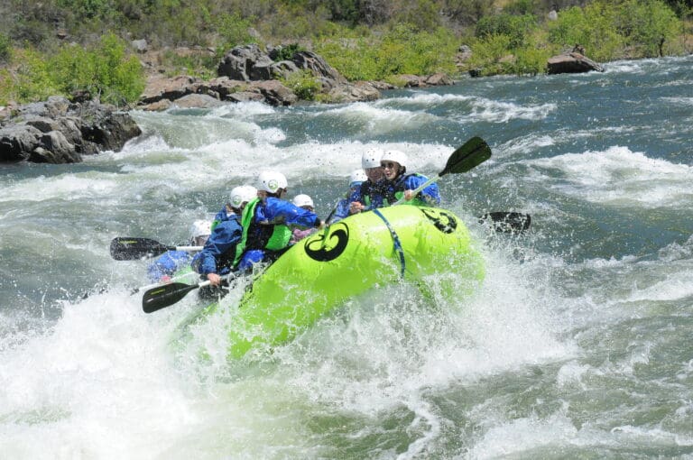
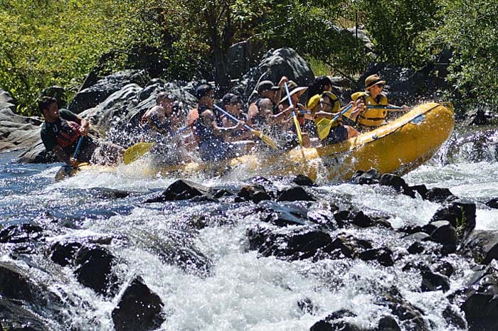
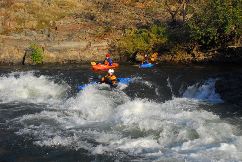
From the put in, class 2 rapids start off immediately, but then long stretches of slow, flat water separate the few rapids. The scenery is pleasant oak woodlands, grassy hillsides, or brushy chapparal. There are a few islands with interesting side channels for those with small enough boats and exploratory spirits. Once into the Gorge, the scenery is beautiful with wild cliffs and rocks channeling the river. The Gorge is distinctly different than the Chili Bar section rapids. Rapids in the gorge tend to be narrow, deep and turbulent. In the Haystack canyons, the wave trains seem to go on forever.
The Gorge is often the first Class III run for Sacramento and San Francisco area boaters. It is somewhat easier than Chili Bar and has a much more gradual warm up with many class 2 and easier rapids before boaters reach the actual gorge. On the other hand more advanced boaters may complain about these long stretches of flat water and mild rapids on the approach to the bigger rapids in the gorge.
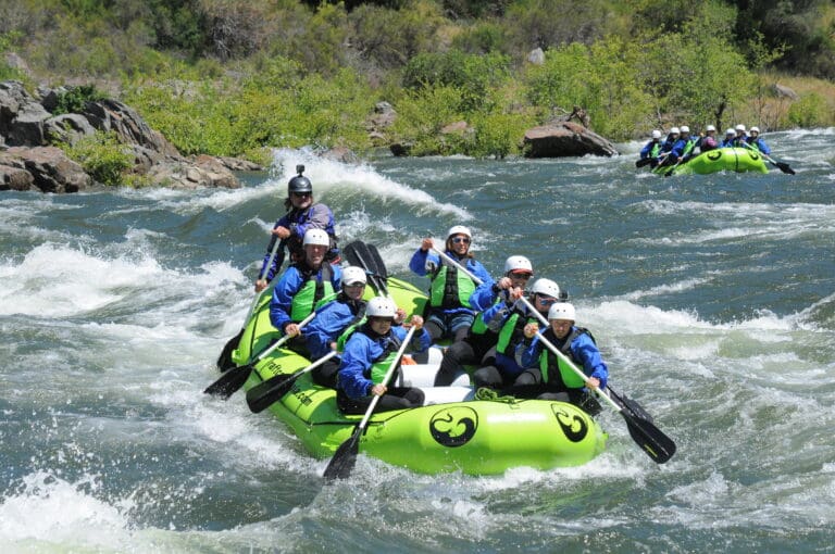
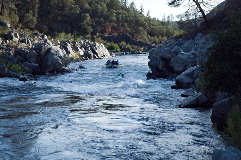
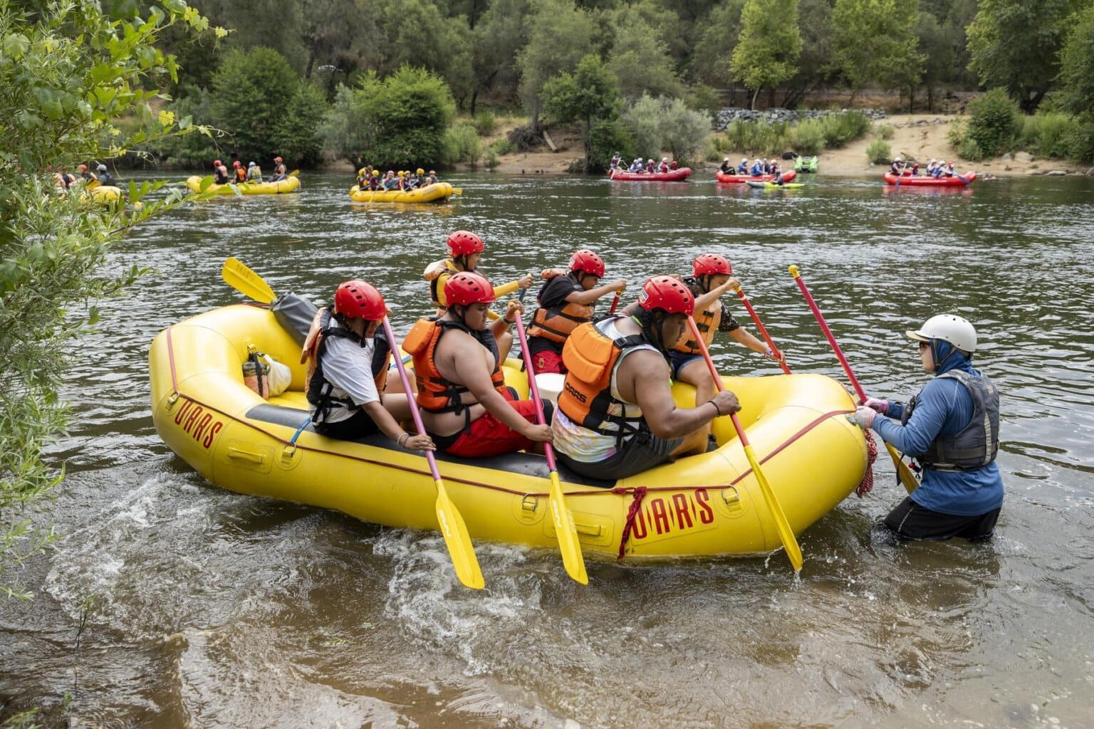
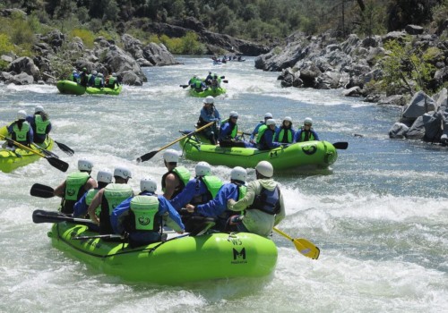
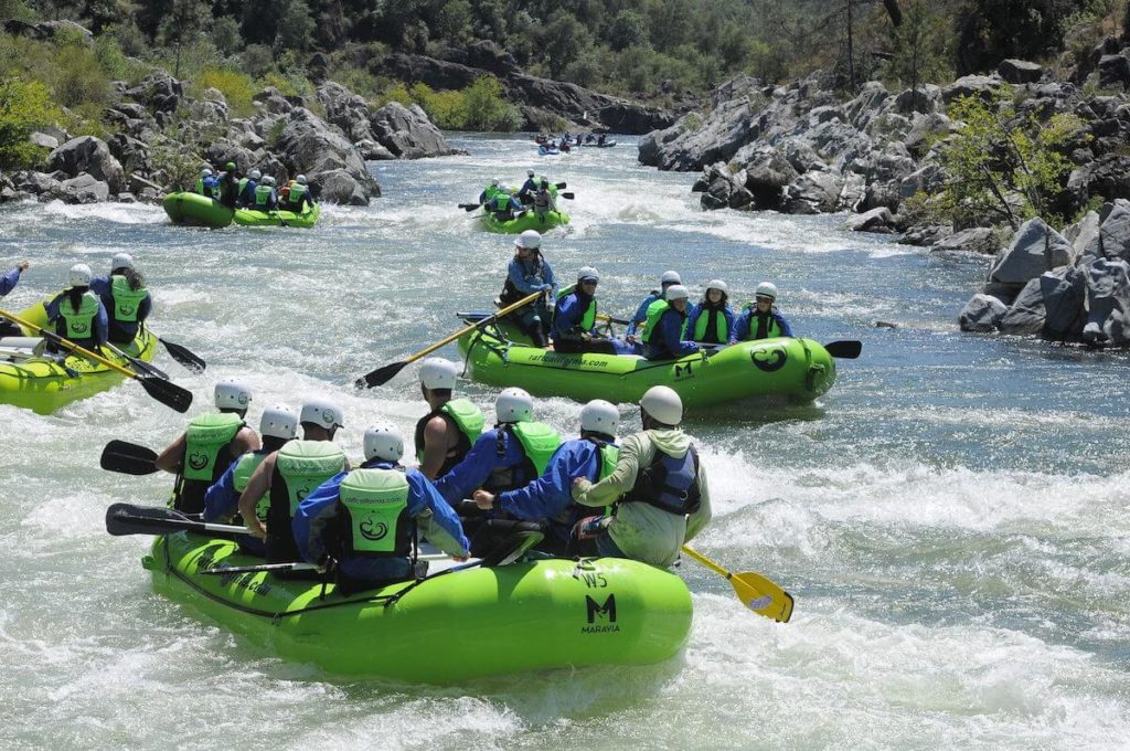
Following Chili Bar, The Gorge is the most popular commercial run in the state. There will be lots of other rafts and kayaks on the river and each boat must show consideration for others. Kayakers will have to weave their way through rafts at times. Raft guides need to acknowledge each other and give enough space so that others can maneuver.
Thanks to the Sacramento Municipal Utility District (SMUD) hydropower operations, the river has dependable flows through much of the year, with releases from the Chili Bar Powerhouse providing boating flows in the afternoon most days during spring and summer, and on most weekends for the rest of the year.
Difficulty by flow:
@ Standard flows ~ II-III (2 @ III+)
At typical summer flows of around 1200-1500 cfs, rafting is generally easy. However, some rapids pose a higher risk of flips and swims. The most challenging sections include:
\\* Satan's: A steep, turbulent chute in the left channel just after Lost Hat (Class III). It has offset holes that can be difficult to navigate. You can choose to take the easier right channel, or scout, hike, and run it again from the left.
\\* Bouncing Rock: This rapid features a strong, flippy pourover/hole that most of the river's flow is directed into. Despite its tendency to flip rafts, it’s fairly forgiving.
\\* Hospital Bar: Known for its 'S-Turn' shape, this rapid has the largest wave on the river. Rafts can avoid it by skillfully maneuvering to the far left.
Almost half of the run is Class II, but the main gorge (which starts after the 'lollipop tree' is sighted for a third time) is continuous III.
~3500-7000 CFS ~ II+-III+ (3 @ IV)
At these high flows, nearly everything becomes more challenging, and many rapids take on a completely different character. The warmup miles feel notably larger than usual, though not significantly harder. (Some waves in this stretch reach the size of Barking Dog but are generally easy to avoid.) Once the Gorge officially begins, expect rapids to be at least Class III+, similar to lower flows but with a pushier, beefier feel and much higher consequences (swims are serious and often long, as the rapids run together or the flatwater moves quickly).
During spring high flows (>3500 cfs), both Fowler’s Rock and Satan’s Cesspool can flip rafts easily. Fowler’s Rock might be the most challenging rapid at these flows; the river-right sneak route in Satan’s Cesspool feels like Class III (and can throw you into a backender) and flows almost immediately into Son of Satan (solid Class III). Further downstream, Scissors and Haystack combine to form Lower Haystack Canyon (Class IV), which includes Cornholio—a wide, infamous hole near the end that’s hard to spot until you’re right on top of it
Put-in: Greenwood Creek River Access area on Highway 49 at mile post 27, west of Coloma. Bureau of Land Management developed this area in 2005 by paving a large parking area with 40 slots. There are toilets but no potable water. Boaters must carry their equipment down a 300 yard trail to the river. google map. The next public put ins upstream are at Camp Lotus and at Henningson-Lotus park, where boats can be unloaded from cars close to the river. Parking fees are required at both locations.
Take-out: Skunk Hollow at Salmon Falls Road bridge at Folsom reservoir. A large parking area is located on river right on the upstream side of the bridge. Two pit toilets are available but there is no potable water. Some overflow parking is available uphill and on the other side of the bridge. The high water mark of the reservoir extends several miles upstream of the bridge, so depending on the lake level, the paddle out can range from a few hundred yards to a few miles. google map.
Shuttle Service: The Coloma Shuttle provides transportation for people and their boats from the take-out at Skunk Hollow on Folsom Reservoir to the put-in at Greenwood Creek at mid-day or in the late afternoon. The shuttle continues upstream to Henningsen-Lotus Park of Marshall Gold Discovery State Historic Park. Using the shuttle reduces air pollution and traffic congestion. As of 2024, the shuttle fleet includes two 14-passenger vans with kayak trailers. Rides cost $10, or a 12-ride pass is available for $100. Reservations are typically required on weekends or for alternative pick-up locations. To reserve, call 530-303-2404 or book online. The Coloma Shuttle is operated by the non-profit South Fork Arts and Recreation.
Rafter's Toe 530-622-9655, in Coloma, can tow rafts from the end of the river across Folsom Lake to the Salmon Falls take out. Call ahead for prices and schedule.
Local Clubs:
There are a number of active paddling clubs that frequent this river. Listed below are just a few of our American Whitewater affiliates:
Gold Country Paddlers
Chico Paddleheads
Sierra Club: Loma Prieta Chapter.
Online Information:
American River Page
SF American at cacreeks.com
The River Store is in Lotus.
BLM Mother Lode Office manages much of the public land along this river. Phone: (916) 941-3101
River Conservancies:
Protect American River Canyons works to protect the North and Middle forks of the American River, along with The American River Conservancy.
Rapids in this Run (14)
 Rapid
II
Rapid
II
Swimmer's Rapid
 Rapid
II
Rapid
II
Cable Car Rapid
 Rapid
III
Rapid
III
Fowler's Rock
 Rapid
II+
Rapid
II+
Upper Haystack
 Rapid
III+
Rapid
III+
Satan's Cesspool
 Rapid
II+
Rapid
II+
Son of Satan's
 Rapid
III
Rapid
III
Scissors
 Rapid
II+
Rapid
II+
Lower Haystack
 Rapid
III
Rapid
III
Bouncing Rock
 Rapid
III
Rapid
III
Pre-Op
 Rapid
III+
Rapid
III+
Hospital Bar
 Rapid
III
Rapid
III
Recovery Room
 Rapid
III
Rapid
III
Surprise
 Rapid
II+
Rapid
II+
Salmon Falls
Difficulty
Class III
Length
8.9 mi
Gradient
23 ft/mi
max 30
Rapids
14
Access Points
Shuttle Info

Figure about 20 minutes driving time each way between Greenwood and Salmon Falls bridge.
Difficulty Classes
I Easy
II Novice
III Intermediate
IV Advanced
V Expert/Extreme
VI Unrunnable
Current Conditions
5-Day Forecast
Whitewater data from
American Whitewater
American Whitewater