9 - Hammer Creek to Snake River confluence
Gauge Conditions
Runnable: 3,000.0 – 30,000.0 CFS
Data from American Whitewater & USGS
Run Map
Run Time Estimate
Select put-in and take-out to estimate time.
Plan This Trip
See wind-adjusted speed maps, forecast planning, and detailed time estimates.
Sign in to generate an AI timing estimate for this run.
Whitewater timing varies with scouting, portages, and group pace. Use as a planning baseline.
Description
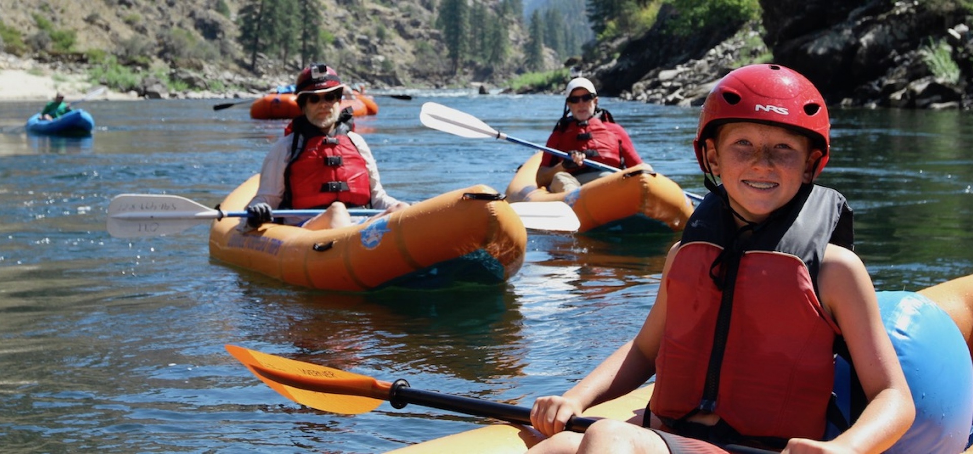
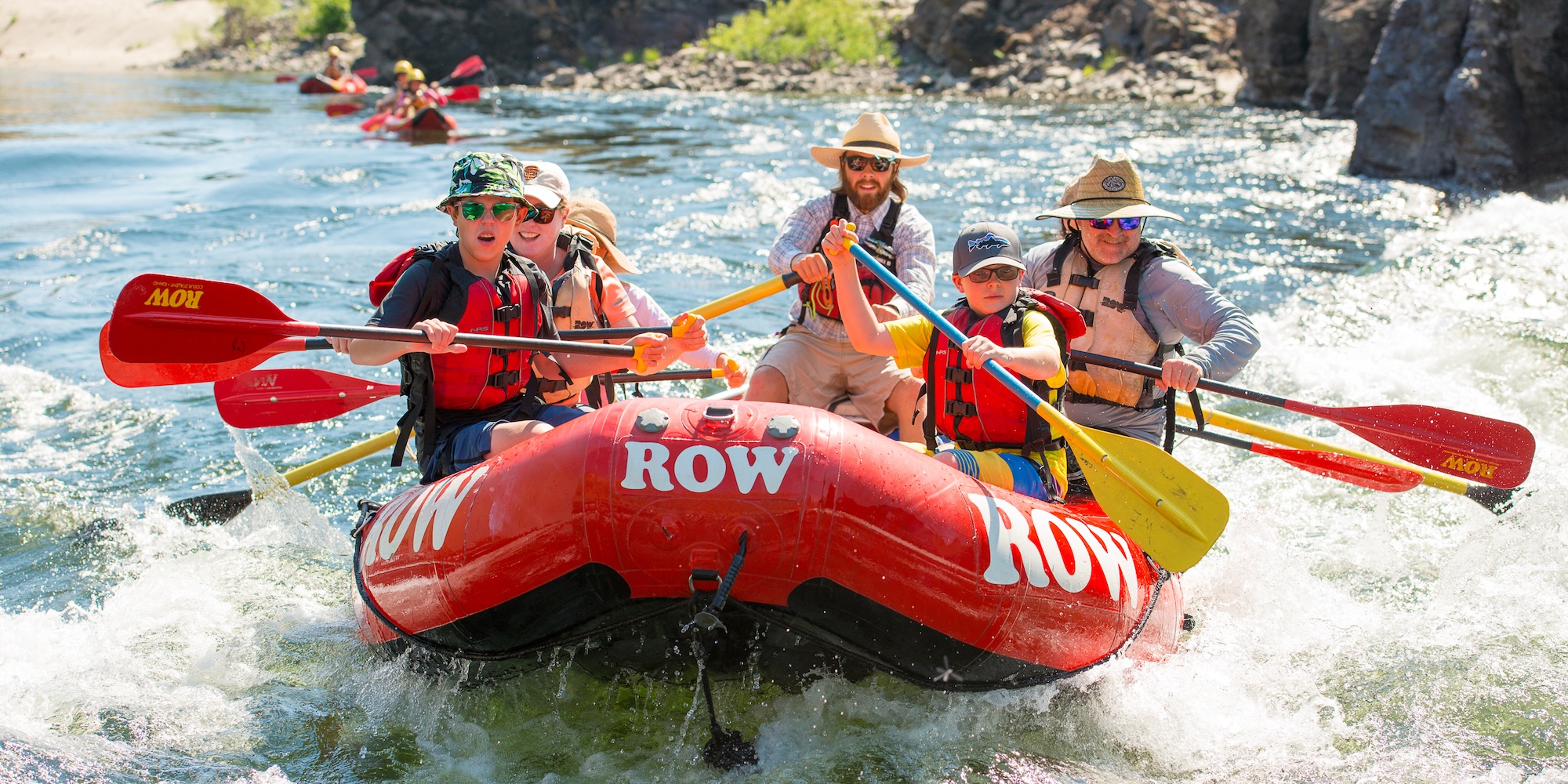
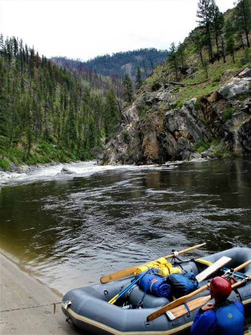
There are a few options for a Lower Salmon trip which typically lasts 4 to 5 days. This trip is a great summer outing with fun pool-drop rapids through beautiful canyon scenery and wonderful river beach camping. Rattlesnakes are very abundant along this river and one needs to be extremely careful.
The Hammer Creek Launch Site is located at river mile 52.5. The next 10 miles are often run as a day trip ending with the 2.5 Green Canyon. This canyon includes a few class III drops: Wright Way Drop, Demon's Drop, and ending with Pine Creek Rapid.
Pine Creek Launch is located immediately below Pine Creek Rapid (river mile 42.5). This access is a take-out for the shorter day run and a put-in for the multi-day trip that continues down to the Snake River.
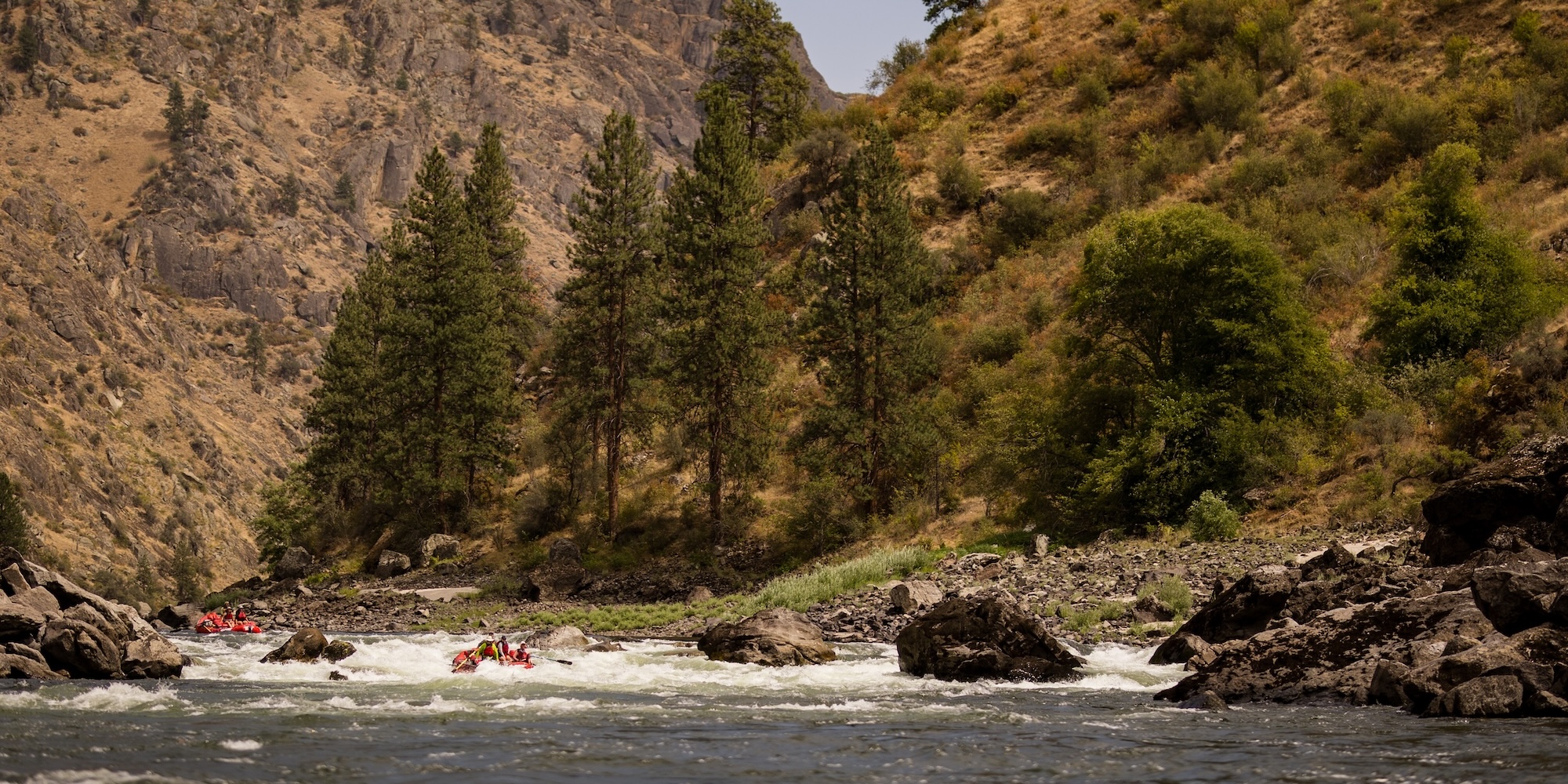
From this access a road continues for a few miles along the river as you pass through agricultural land. The scenery is beautiful though and the 15 miles down to Snow Canyon contains several class II pool-drop rapids and nice sandy beaches.
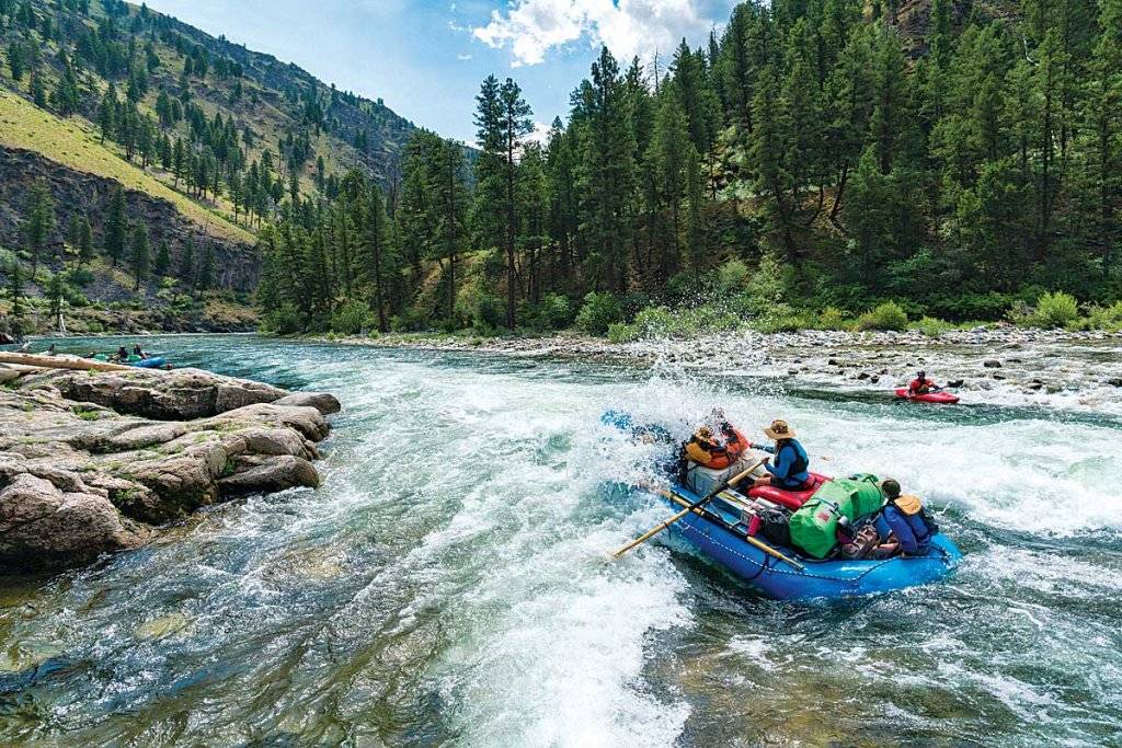
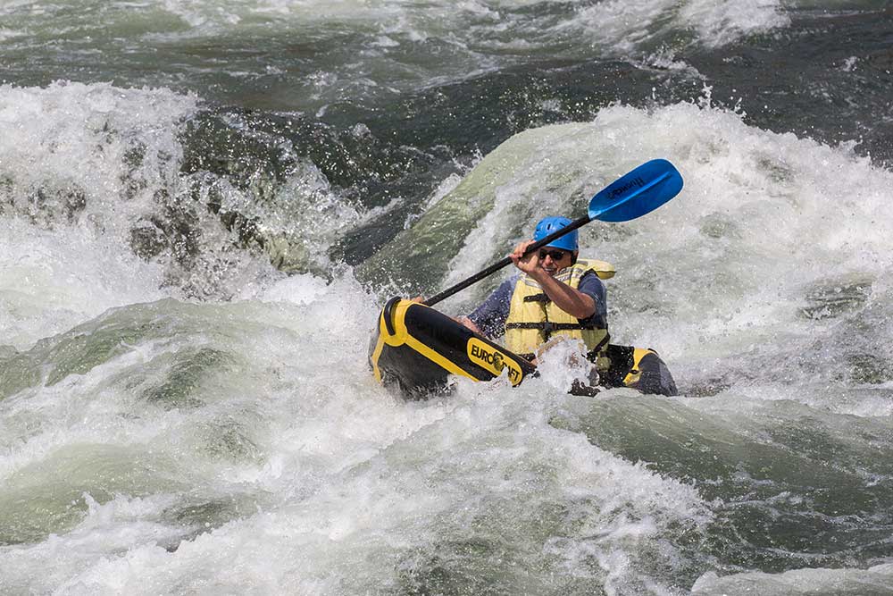
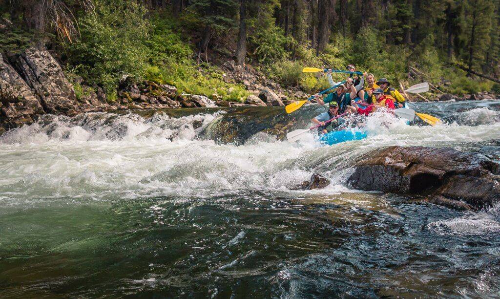
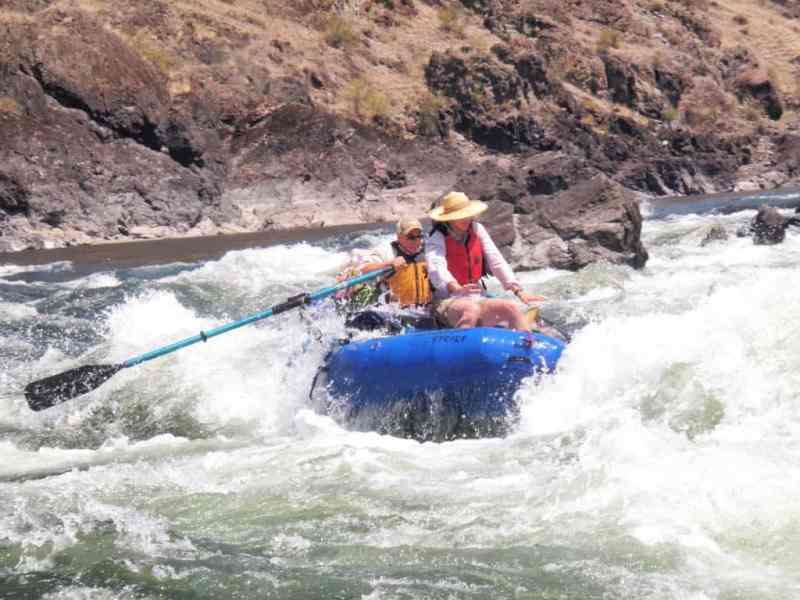
The last big camp is at White House Beach before you enter Snow Hole Canyon (starting at river mile 27.5). Snow Hole Canyon is 10 miles long and contains the most challenging rapids on the trip. The major rapids include Bodacious Bounce (class III), Half and Half (class III), Snow Hole (class IV), and China Rapids (class III). Experienced boaters will be able to boat-scout these rapids but getting out for a look from shore is always possible. There are also a number of class II rapids in this section and plenty of fun playspots.
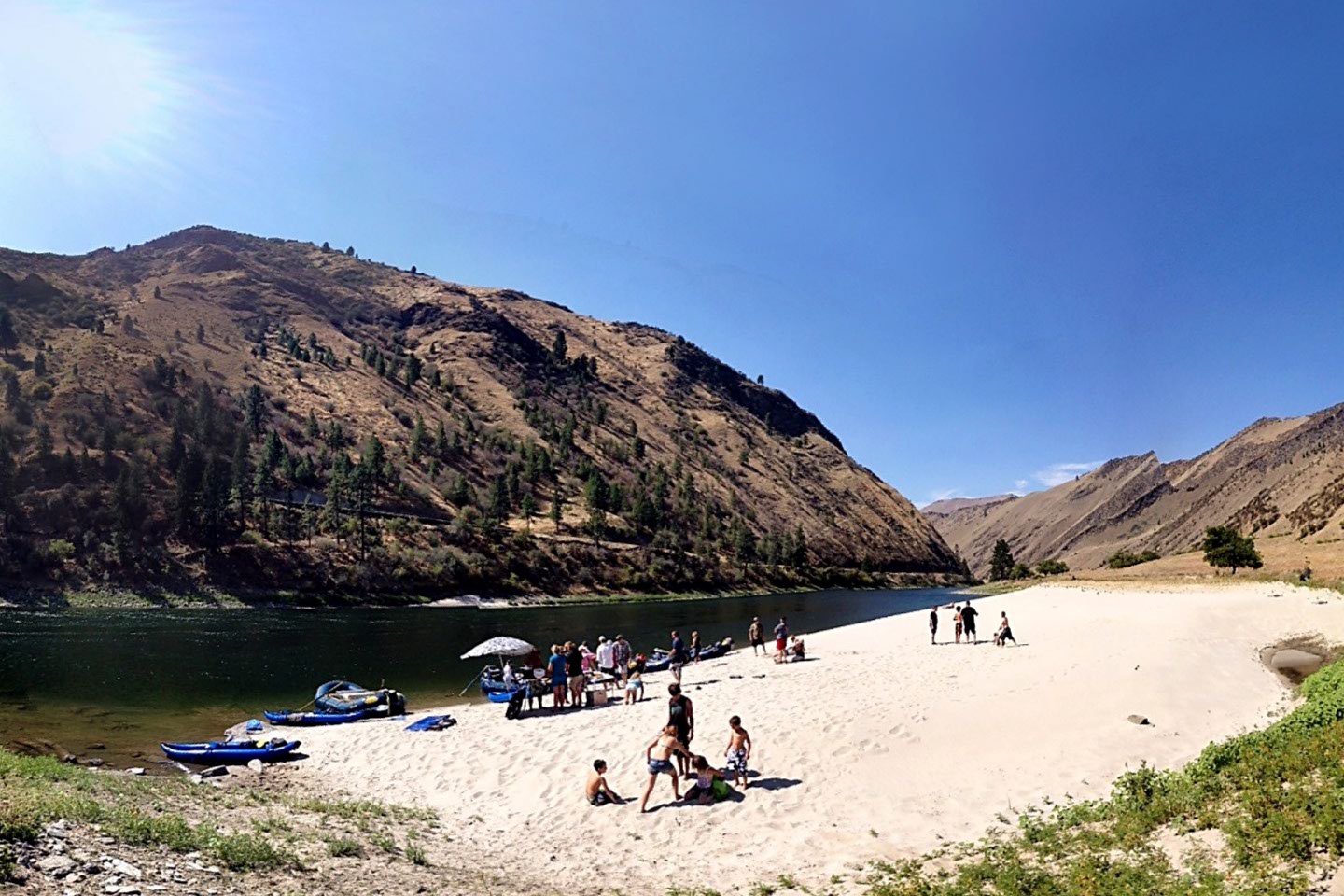
Shortly after China Rapids the canyon opens up with great beach camp sites. There is some private land and a few cabins in this 12.5 mile section. You will also begin to encounter jet boat traffic during the summer season. There are several fun class II rapids and one class III at Eagle Creek (river mile 13.5).
The river constricts again at river mile 5 with the start of Blue Canyon. This is a beautiful narrow canyon and a good place to see sheep. This section alternates between big bouncy rapids and short sections of calm water that allow one to gaze up at the vertical canyon walls that tower overhead. One rapid to be aware of is Slide Rapids (river mile 3.9). Here a massive rock slide from river left has further constricted the already narrow river. At lower flows there is not much of a feature at this site but as flows increase to 10,000 cfs and above this becomes the most dangerous hazard on the run. As water backs up at the narrow constriction, a huge standing wave forms that is a guaranteed raft flipper. Portaging this drop with a raft is all but impossible.
The last major rapid on the Salmon is Eye of the Needle (river mile 0.5), a class III rapid with a fun bouncy wave train.
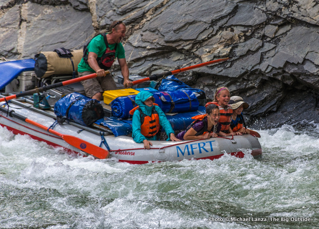
Soon the Salmon comes to an end as it pours out into the Snake River. It's another 20 miles on the Snake to the confluence with the Grande Ronde and Heller Bar river access which is just past this on river left. The section on the Snake has some beautiful canyon scenery, fun class II rapids, and good beach campsites. The downside is significant jet boat traffic. On summer weekends you will likely have jet boats in sight the throughout the day although use tends to taper off in the evenings and early mornings.
Logistics: Unlike other nearby multiday trips, there is no lottery for permits to run this section of the Salmon but campsite competion can be an issue particularly if you are on a trip timed to hit weekends. Permits are available on a self issue basis at launch sites. It's a good idea to bring along a copy of the BLM river guide to the Lower Salmon. It provides lots of useful information on individual rapids and camping areas.
The river has gotten quite busy in recent years given the excess demand for nearby lottery-based runs. The busiest period is July 10 through August 20, essentially when school is out, water is warm, and flows subside a bit. Avoiding these times will make for a much less crowded trip. Because of the recent increases in use, it is more important than ever to visit in a way that reduces your effects on the land, water, and other visitors. Here are some tips from the river's manager:
\- Groups should camp at a beach appropriate to their group size. Small groups on smaller beaches leaving the large beaches for bigger groups. Alternately (and less preferably), be willing to share the big beaches between two or more smaller groups.
\- All beaches below the high water line are public land. Groups do NOT have to camp at a beach that is labeled or named on the guide books. Some years new small beaches are formed where camping is allowed.
\- Disperse rocks used as tie downs off of the beaches, and disperse and scatter unburned piles of driftwood collected for firewood. Pack out all ash and partially burned wood. Leave a clean 'undisturbed' beach for the next group.
\- Use only toilet paper in groovers, as laundry detergent, kitty litter, straw, feminine hygiene products, etc. clog and damage the SCAT machine.
\- Do not inflate or deflate rafts on the boat ramps. Unload gear from your vehicle as quickly as possible, clear the ramp, then come back and load your boat with the gear. Unloading/loading your vehicle at the same time of loading or unloading your boat greatly increases a group's time on the already crowded launch and take out sites. Unload/load vehicles separately from loading/unloading boats.
Please follow this good guidance, and strive to leave no trace.
Rapids in this Run (37)
Rapid
Hammer Creek Recreation Site, Access
 Rapid
II
Rapid
II
Rollercoaster Rapid
 Rapid
III
Rapid
III
Big Foot Island Rapid
Rapid
II
Shorts Bar Pictographs - start of Green Canyon
Rapid
II
Green Canyon Rapid
 Rapid
III
Rapid
III
Wright Way Rapid
 Rapid
II
Rapid
II
Unnamed Rapid
Rapid
III
Demons Drop Rapid
Rapid
III
Pine Bar Rapid
Rapid
Pine Bar Recreation Site, Access
 Rapid
II
Rapid
II
The Maze Rapid
 Rapid
II
Rapid
II
Long Class II Rapid
 Rapid
Rapid
Taylor Beach Access
 Rapid
II
Rapid
II
Cougar Canyon Rapid
 Rapid
II
Rapid
II
Cliff Rapid
 Rapid
II
Rapid
II
Pipeline Rapid
 Rapid
II
Rapid
II
Lomas Luma Rapid
 Rapid
II
Rapid
II
Bunghole Rapid
 Rapid
II
Rapid
II
Lower Bunghole Rapid
Rapid
II
Harms Hole Rapid - Start of Snowhole Canyon
 Rapid
III
Rapid
III
Bodacious Bounce Rapid
 Rapid
III
Rapid
III
Half and Half Rapid
 Rapid
II
Rapid
II
The Gobbler Rapid
Rapid
IV
Snowhole Rapid
Rapid
III
China Rapid
Rapid
II
Billy Creek Rapid
 Rapid
III
Rapid
III
Eagle Creek Rapid
 Rapid
II
Rapid
II
China Creek Rapid
 Rapid
II
Rapid
II
Skeleton Creek Rapid
 Rapid
II
Rapid
II
Wapshilla Rapid
 Rapid
II
Rapid
II
S Turn Rapid
Rapid
V
Slide Rapid
 Rapid
II
Rapid
II
H-hole Rapid
 Rapid
II
Rapid
II
Sluicebox Rapid
 Rapid
II
Rapid
II
Checkerboard Rapid
 Rapid
III
Rapid
III
Eye of the Needle Rapid
Rapid
Snake River Confluence
Difficulty
Class II-IV
Length
55.0 mi
Rapids
37
Access Points
Difficulty Classes
I Easy
II Novice
III Intermediate
IV Advanced
V Expert/Extreme
VI Unrunnable
Current Conditions
5-Day Forecast
Whitewater data from
American Whitewater
American Whitewater