A) Piers Gorge: Niagara to Hwy.8 (0.5-2.9 miles) *Fee Area*
Gauge Conditions
Runnable: 800.0 – 3,000.0 CFS
Normal 'usual' boatable range.
Data from American Whitewater & USGS
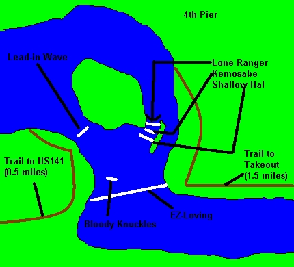
Run Map
Run Time Estimate
Select put-in and take-out to estimate time.
Plan This Trip
See wind-adjusted speed maps, forecast planning, and detailed time estimates.
Sign in to generate an AI timing estimate for this run.
Whitewater timing varies with scouting, portages, and group pace. Use as a planning baseline.
Description
In summer, 2012, the areas surrounding Piers Gorge, Quiver Falls, and Pemene Falls were incorporated into a State Recreation Area cooperatively operated by Michigan DNR and Wisconsin DNR. As a result, parking and access for each of these areas now requires either a daily or annual State Park sticker.
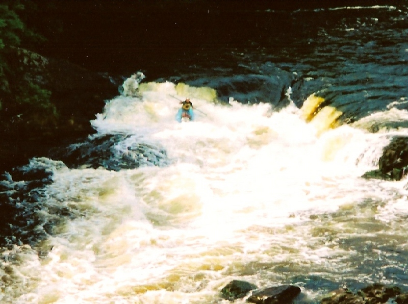
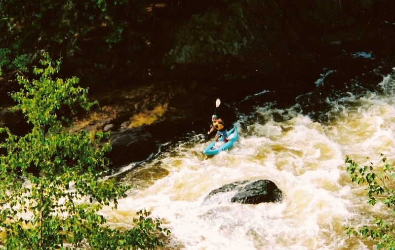
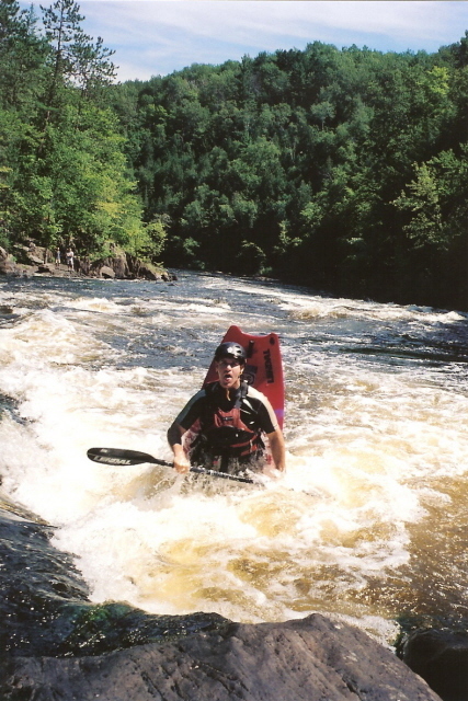
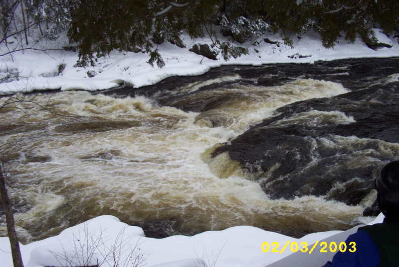
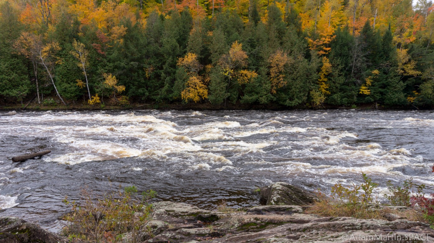
Piers Gorge (final 0.5mi., skipping the shuttle and foregoing Sand Portage) is often done as a big-water, carry-up park-and-play. The gorge often stays open well into winter. (Please scout for any ice-shelves which may overhang critical eddies or areas of shoreline where current may be likely to push you! Some years back, a local paddler who pushed the season had a near-death experience being stuffed into an ice-shelf, struggling to abandon boat and paddle, and did manage to free himself before having to attempt to breathe like a fish.)
Click the following link to watch a video (with a mix of rear-of-the-kayak mounted camera and aerial photography via helicopter-drone) for a good feel for Piers Gorge proper: https://youtu.be/WbSfbn-dCpY
Rapids in this Run (4)
Difficulty
Class II-IV
Length
2.7 mi
Gradient
15 ft/mi
max 21
Rapids
4
Access Points
Shuttle Info
You have a few different options here:
1) Carry up: Misicot Falls is located within 0.5 mile of the parking lot, and Sand Portage Falls is a 1.5 mile carry from the parking lot. The trail from the parking lot to both of these places is wide and well worn, and a fairly easy carry (no grueling hills).
2) You can drive toward Niagara on US141. Not far north of the US 8/US141 junction, you will see a road side park. You can park here, change in the restrooms and follow trail on the other side of US141 to Sand Portage. This is an easy carry of about a quarter-mile. While it is not well marked, if you just head due-East along the edge of a woods, you will hit the river at Sand Portage. Note: This wayside may be closed (chained/gated).
3) Continue into Niagara, where there is a boat launch with changing rooms just a block to the right off the main highway. The rafters start here. This adds about a mile-and-a-quarter of very scenic, but totally flat/flowing water before Sand Portage.
Shuttle as shown is for the full run.
Use the input field below to get routing from any other location to the put-in. (You can use that info in concert with the shuttle info to get you directly to the take-out instead.)
Difficulty Classes
I Easy
II Novice
III Intermediate
IV Advanced
V Expert/Extreme
VI Unrunnable
Current Conditions
5-Day Forecast
Whitewater data from
American Whitewater
American Whitewater