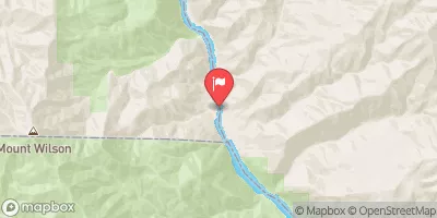
A) Unnamed Road to Black Creek Road (7.8 miles)
Gauge Conditions
Runnable: ? – ? CFS
Approximate reading: This gauge is 10.5 miles away on Huron. Use as a general reference only.
Data from American Whitewater & USGS
Run Map
Run Time Estimate
Select put-in and take-out to estimate time.
Plan This Trip
See wind-adjusted speed maps, forecast planning, and detailed time estimates.
Sign in to generate an AI timing estimate for this run.
Whitewater timing varies with scouting, portages, and group pace. Use as a planning baseline.
Description
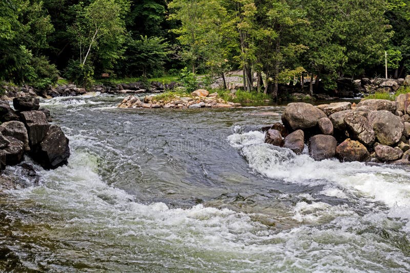
OK, it's tough enough finding the lower runs on the branches of the Huron at runnable flows. However, in the odd event that there is high water, you may wish to try for the upper reach, which contains Leatherby Falls.
A fine photo essay can be found at: Waterfalls of the Keweenaw. Click on the smaller photos to pull up a viewer to click-through the various photos enlarged, and then make certain to hit the links midway down the page in the right column to also see Upper and Lower Leatherby Falls.


Difficulty
Class II-III(IV)
Length
5.9 mi
Gradient
66 ft/mi
max 113
Rapids
9
Access Points
Shuttle Info
As shown by GoogleMaps, this shuttle is near a half-hour (each way)! If attempting full run, we highly recommend meeting at take-out, gearing up, swapping boats and boaters to as few vehicles as possible (to leave 'drop vehicles' there), then driving to put-in to run river. This gets you on water without the delay which would result from meeting at put-in, having to run shuttle down and back up (while some boaters wait nearly a full hour) before putting on river!
Difficulty Classes
I Easy
II Novice
III Intermediate
IV Advanced
V Expert/Extreme
VI Unrunnable
Current Conditions
5-Day Forecast
Whitewater data from
American Whitewater
American Whitewater