Above Powerlines to Lower Ashuelot
Gauge Conditions
Runnable: 6.0 – 9.0 FT
Data from American Whitewater & USGS
Run Map
Run Time Estimate
Select put-in and take-out to estimate time.
Plan This Trip
See wind-adjusted speed maps, forecast planning, and detailed time estimates.
Sign in to generate an AI timing estimate for this run.
Whitewater timing varies with scouting, portages, and group pace. Use as a planning baseline.
Description
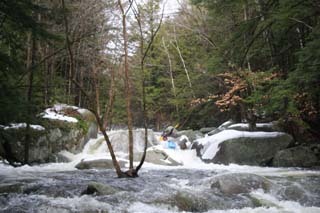
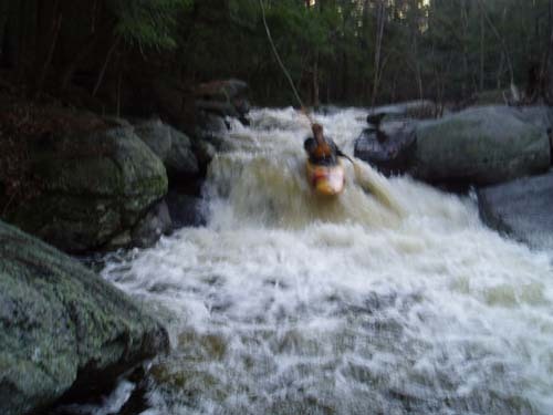
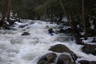
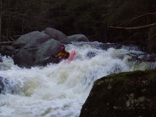
This is the hidden gem of southern NH. Although it is a very short run, the quality of rapids and natural scenery are comparable to that of the boulder-strewn White Mountain creeks. When arriving at the put-in you will be immediately confronted with what this creek has to offer, looking up at the Fungi Express rapid while getting changed and ready to hike-in will get you excited for what's in store. This run could be considered an intro to creeking run but also has one rapid that most people walk. Three out of the four rapids have multiple lines to run depending on the level, where the difficulty can be significantly increased.
Directions:
Use the directions on AW to get yourself to the Lower Ashuelot putin on 119. From the covered bridge putin for the Lower Ash, drive towards Hinsdale about 1-2 miles, see Broad Brook Road on your right side and go up Broad Brook road for about 1/2 mile. Park on the river-left side in small pull-off out of the way of the dumpster. Hike from here upstream on the river-left side for about 20 minutes to just above the power lines and cut in just above Percolator. (There is a trail that goes up the river right side which is much easier, but to access it you walk up someone's driveway. The locals here have always been nice to me but I would certainly ask if it's ok to cross their land to get to the trail.)
To get to the takeout, drive out Broad Brook Road to 119, take a right, go to the bottom of the hill, see Broad Brook coming in on your right and take the next left across the bridge that goes to the dam. Park in the far back parking lot as far out of the way as you can. You can also park at the takeout for the lower Ash and continue on down and run the dams in your creek boat if you want.
The easiest walk is to take the old Broad Brook Road across the pictured bridge, up 100 yards to the power line easement, then turn right and take the trail that winds beneath the power lines to the riverside. I enjoy walking up to do Percolator; another not-hard 100 yards towards the beaver dam and old dam to get all the whitewater in as a warm-up and scout.
Rapids in this Run (4)
Difficulty
Class IV+
Length
1.5 mi
Gradient
200 ft/mi
Rapids
4
Access Points
Difficulty Classes
I Easy
II Novice
III Intermediate
IV Advanced
V Expert/Extreme
VI Unrunnable
Current Conditions
5-Day Forecast
Whitewater data from
American Whitewater
American Whitewater